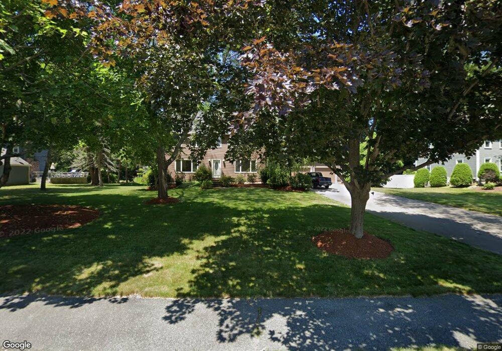
21 Kings Row Ln Framingham, MA 01701
Estimated Value: $870,000 - $979,000
About This Home
This home is located at 21 Kings Row Ln, Framingham, MA 01701 and is currently estimated at $930,976, approximately $362 per square foot. 21 Kings Row Ln is a home located in Middlesex County with nearby schools including Framingham High School, Summit Montessori School, and Saint Bridget School.
Ownership History
We collect this data history from publicly available records. To have your information removed, we recommend requesting removal directly through your county’s website.
Purchase Details
Purchase Details
Home Values in the Area
Average Home Value in this Area
Purchase History
We collect this data history from publicly available records. To have your information removed, we recommend requesting removal directly through your county’s website.
| Date | Buyer | Sale Price | Title Company |
|---|---|---|---|
| -- | -- | ||
| -- | -- | ||
| $174,900 | -- |
Mortgage History
We collect this data history from publicly available records. To have your information removed, we recommend requesting removal directly through your county’s website.
| Date | Status | Borrower | Loan Amount |
|---|---|---|---|
| Previous Owner | $150,000 | ||
| Previous Owner | $150,000 | ||
| Previous Owner | $75,000 |
Tax History
We collect this data history from publicly available records. To have your information removed, we recommend requesting removal directly through your county’s website.
| Year | Tax Paid | Tax Assessment Tax Assessment Total Assessment is a certain percentage of the fair market value that is determined by local assessors to be the total taxable value of land and additions on the property. | Land | Improvement |
|---|---|---|---|---|
| 2025 | $9,927 | $831,400 | $288,400 | $543,000 |
| 2024 | $9,729 | $780,800 | $257,100 | $523,700 |
| 2023 | $9,372 | $716,000 | $229,400 | $486,600 |
| 2022 | $8,990 | $654,300 | $208,500 | $445,800 |
| 2021 | $8,736 | $621,800 | $200,400 | $421,400 |
| 2020 | $8,930 | $596,100 | $182,400 | $413,700 |
| 2019 | $8,911 | $579,400 | $182,400 | $397,000 |
| 2018 | $8,948 | $548,300 | $178,800 | $369,500 |
| 2017 | $8,830 | $528,400 | $173,500 | $354,900 |
| 2016 | $8,591 | $494,300 | $175,100 | $319,200 |
| 2015 | $9,031 | $506,800 | $175,500 | $331,300 |
Map
- 35 Westgate Rd
- 27 Clearview Dr
- 92 Flanagan Dr
- 17 Old Wood Rd
- 4 Old Wood Rd
- 14 Clearview Dr
- 15 Major Hale Dr
- 15 Bosworth Rd
- 1500 Worcester Rd Unit 405
- 1500 Worcester Rd Unit 308
- 1500 Worcester Rd Unit 612
- 11 Foxhill Rd
- 29 Little Tree Ln
- 947 Pleasant St Unit 947
- 1323 Worcester Rd Unit F2
- 1321 Worcester Rd Unit 610
- 69 Gates St
- 2 Millwood Cir
- 3 Grattan St
- 987 Pleasant St
Ask me questions while you tour the home.