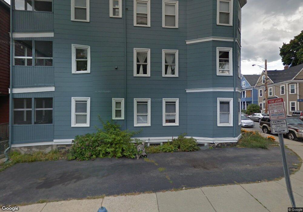
21 Kingston St Unit 1 Somerville, MA 02144
Davis Square NeighborhoodEstimated Value: $700,936 - $914,000
2
Beds
1
Bath
952
Sq Ft
$811/Sq Ft
Est. Value
About This Home
This home is located at 21 Kingston St Unit 1, Somerville, MA 02144 and is currently estimated at $772,234, approximately $811 per square foot. 21 Kingston St Unit 1 is a home located in Middlesex County with nearby schools including Somerville High School, Benjamin Banneker Charter Public School, and St. Clement Elementary School.
Ownership History
Date
Name
Owned For
Owner Type
Purchase Details
Closed on
Oct 4, 2013
Sold by
Haas Andrea L
Bought by
Haas Christopher and Haas Andrea L
Current Estimated Value
Home Financials for this Owner
Home Financials are based on the most recent Mortgage that was taken out on this home.
Original Mortgage
$307,500
Outstanding Balance
$232,046
Interest Rate
4.61%
Mortgage Type
New Conventional
Estimated Equity
$540,188
Purchase Details
Closed on
Apr 22, 2004
Sold by
Reamer Marianne and Reamer Michael B
Bought by
Blackwell Andrea L
Home Financials for this Owner
Home Financials are based on the most recent Mortgage that was taken out on this home.
Original Mortgage
$274,000
Interest Rate
5.4%
Mortgage Type
Purchase Money Mortgage
Create a Home Valuation Report for This Property
The Home Valuation Report is an in-depth analysis detailing your home's value as well as a comparison with similar homes in the area
Home Values in the Area
Average Home Value in this Area
Purchase History
| Date | Buyer | Sale Price | Title Company |
|---|---|---|---|
| Haas Christopher | -- | -- | |
| Blackwell Andrea L | $342,500 | -- |
Source: Public Records
Mortgage History
| Date | Status | Borrower | Loan Amount |
|---|---|---|---|
| Open | Haas Christopher | $307,500 | |
| Previous Owner | Blackwell Andrea L | $274,000 |
Source: Public Records
Tax History Compared to Growth
Tax History
| Year | Tax Paid | Tax Assessment Tax Assessment Total Assessment is a certain percentage of the fair market value that is determined by local assessors to be the total taxable value of land and additions on the property. | Land | Improvement |
|---|---|---|---|---|
| 2025 | $6,304 | $577,800 | $0 | $577,800 |
| 2024 | $5,919 | $562,600 | $0 | $562,600 |
| 2023 | $6,039 | $584,000 | $0 | $584,000 |
| 2022 | $5,837 | $573,400 | $0 | $573,400 |
| 2021 | $5,724 | $561,700 | $0 | $561,700 |
| 2020 | $5,551 | $550,100 | $0 | $550,100 |
| 2019 | $5,667 | $526,700 | $0 | $526,700 |
| 2018 | $5,617 | $496,600 | $0 | $496,600 |
| 2017 | $5,229 | $448,100 | $0 | $448,100 |
| 2016 | $4,728 | $377,300 | $0 | $377,300 |
| 2015 | $4,751 | $376,800 | $0 | $376,800 |
Source: Public Records
Map
Nearby Homes
- 19 Woodbridge St
- 34 Day St
- 32 Gorham St
- 32 Cameron Ave
- 5 Haskell St Unit 1
- 30 Chester St Unit 16
- 12-14 Hollis St
- 67 Cameron Ave
- 51 Dudley St Unit 2
- 39 Seven Pines Ave
- 2456 Massachusetts Ave Unit 402
- 110 Reed St
- 97 Elmwood St Unit 110
- 97 Elmwood St Unit 312
- 199 Elm St
- 69 Harvey St Unit 1
- 53 Paulina St
- 179 Rindge Ave Unit 1
- 18 Windom St
- 183 Rindge Ave Unit 1
- 19 Kingston St Unit 3
- 19 Kingston St Unit 2
- 19 Kingston St
- 17 Kingston St
- 40 Thorndike St
- 40 Thorndike St Unit 1
- 38 Thorndike St
- 11 Kingston St
- 41 Thorndike St
- 43 Thorndike St
- 43 Thorndike St Unit 2
- 16 Kingston St
- 23 Kingston St
- 18 Kingston St
- 10 Lester Terrace
- 20 Kingston St
- 7 Kingston St
- 12 Kingston St
- 25 Kingston St
- 36 Thorndike St Unit 36