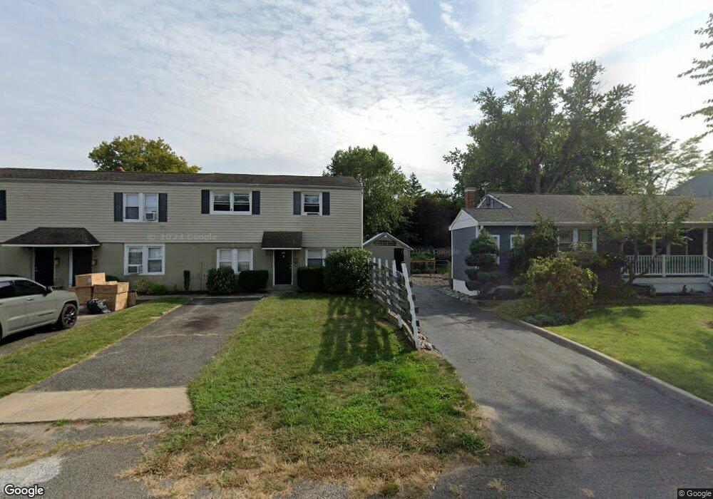
21 Lancaster Ave Unit 25 Keansburg, NJ 07734
Estimated Value: $456,000 - $862,000
7
Beds
3
Baths
3,458
Sq Ft
$192/Sq Ft
Est. Value
About This Home
This home is located at 21 Lancaster Ave Unit 25, Keansburg, NJ 07734 and is currently estimated at $664,967, approximately $192 per square foot. 21 Lancaster Ave Unit 25 is a home located in Monmouth County with nearby schools including Joseph C. Caruso School, Joseph R. Bolger Middle School, and Keansburg High School.
Ownership History
Date
Name
Owned For
Owner Type
Purchase Details
Closed on
Mar 13, 2013
Sold by
Megas Gregory J
Bought by
Megas Gregory J and Megas Patrizia
Current Estimated Value
Purchase Details
Closed on
Jan 20, 2011
Sold by
Megas Sharon
Bought by
Megas Gregory J
Home Financials for this Owner
Home Financials are based on the most recent Mortgage that was taken out on this home.
Original Mortgage
$188,500
Outstanding Balance
$5,811
Interest Rate
4.76%
Mortgage Type
Commercial
Estimated Equity
$659,156
Purchase Details
Closed on
Apr 25, 2006
Sold by
Administrat Gregory J Megas
Bought by
Megas Gregory J and Megas Sharon
Purchase Details
Closed on
Jan 6, 1994
Sold by
First Fedl Sav
Bought by
Dultz Albert
Home Financials for this Owner
Home Financials are based on the most recent Mortgage that was taken out on this home.
Original Mortgage
$55,000
Interest Rate
7.23%
Mortgage Type
Commercial
Create a Home Valuation Report for This Property
The Home Valuation Report is an in-depth analysis detailing your home's value as well as a comparison with similar homes in the area
Home Values in the Area
Average Home Value in this Area
Purchase History
| Date | Buyer | Sale Price | Title Company |
|---|---|---|---|
| Megas Gregory J | -- | None Available | |
| Megas Gregory J | -- | Cb Title Group Llc | |
| Megas Gregory J | -- | -- | |
| Dultz Albert | $60,770 | -- |
Source: Public Records
Mortgage History
| Date | Status | Borrower | Loan Amount |
|---|---|---|---|
| Open | Megas Gregory J | $188,500 | |
| Previous Owner | Dultz Albert | $55,000 |
Source: Public Records
Tax History Compared to Growth
Tax History
| Year | Tax Paid | Tax Assessment Tax Assessment Total Assessment is a certain percentage of the fair market value that is determined by local assessors to be the total taxable value of land and additions on the property. | Land | Improvement |
|---|---|---|---|---|
| 2025 | $10,855 | $540,300 | $214,300 | $326,000 |
| 2024 | $12,347 | $493,400 | $173,400 | $320,000 |
| 2023 | $12,347 | $476,700 | $140,200 | $336,500 |
| 2022 | $11,021 | $436,800 | $109,500 | $327,300 |
| 2021 | $11,021 | $358,300 | $93,600 | $264,700 |
| 2020 | $13,696 | $341,800 | $54,800 | $287,000 |
| 2019 | $13,374 | $337,800 | $52,800 | $285,000 |
| 2018 | $12,970 | $331,800 | $52,800 | $279,000 |
| 2017 | $12,630 | $332,800 | $51,800 | $281,000 |
| 2016 | $13,049 | $357,900 | $46,800 | $311,100 |
| 2015 | $12,429 | $354,800 | $51,800 | $303,000 |
| 2014 | $11,424 | $335,700 | $66,800 | $268,900 |
Source: Public Records
Map
Nearby Homes
- 33 Harding Ave
- 19 Lancaster Ave
- 19 Harding Ave
- 37 Harding Ave
- 31 Lancaster Ave
- 15 Lancaster Ave
- 36 Harding Ave
- 26 Harding Ave
- 15 Harding Ave
- 40 Harding Ave
- 20 Harding Ave
- 27 Snyder Ave
- 11 Harding Ave
- 33 Snyder Ave
- 14 E Church St
- 46 Harding Ave
- 16 Harding Ave
- 35 Snyder Ave
- 270 Main St Unit 10
- 270 Main St Unit 1