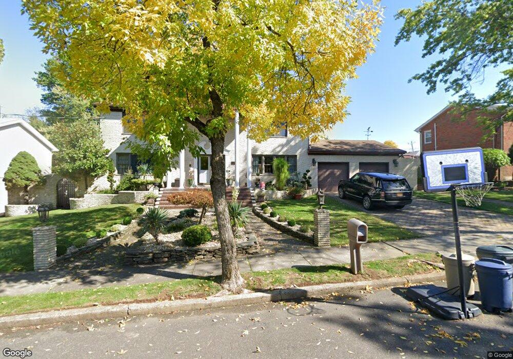
21 Latham Place Staten Island, NY 10309
Rossville NeighborhoodEstimated Value: $1,094,000 - $1,531,000
4
Beds
3
Baths
3,008
Sq Ft
$412/Sq Ft
Est. Value
About This Home
This home is located at 21 Latham Place, Staten Island, NY 10309 and is currently estimated at $1,239,384, approximately $412 per square foot. 21 Latham Place is a home located in Richmond County with nearby schools including P.S. 56 - The Louis Desario School, Is 34 Tottenville, and Tottenville High School.
Ownership History
Date
Name
Owned For
Owner Type
Purchase Details
Closed on
Aug 3, 2006
Sold by
Zaplin Robert and Zaplin Veronica
Bought by
Dicostanzo Paul and Dicostanzo Kim
Current Estimated Value
Home Financials for this Owner
Home Financials are based on the most recent Mortgage that was taken out on this home.
Original Mortgage
$410,000
Outstanding Balance
$247,758
Interest Rate
6.88%
Mortgage Type
Purchase Money Mortgage
Estimated Equity
$991,626
Create a Home Valuation Report for This Property
The Home Valuation Report is an in-depth analysis detailing your home's value as well as a comparison with similar homes in the area
Home Values in the Area
Average Home Value in this Area
Purchase History
| Date | Buyer | Sale Price | Title Company |
|---|---|---|---|
| Dicostanzo Paul | $825,430 | First Amer Title Ins Co Ny |
Source: Public Records
Mortgage History
| Date | Status | Borrower | Loan Amount |
|---|---|---|---|
| Open | Dicostanzo Paul | $410,000 |
Source: Public Records
Tax History Compared to Growth
Tax History
| Year | Tax Paid | Tax Assessment Tax Assessment Total Assessment is a certain percentage of the fair market value that is determined by local assessors to be the total taxable value of land and additions on the property. | Land | Improvement |
|---|---|---|---|---|
| 2025 | $10,600 | $69,840 | $14,997 | $54,843 |
| 2024 | $10,612 | $64,260 | $15,377 | $48,883 |
| 2023 | $10,560 | $53,395 | $14,251 | $39,144 |
| 2022 | $10,372 | $61,260 | $18,240 | $43,020 |
| 2021 | $10,372 | $54,240 | $18,240 | $36,000 |
| 2020 | $9,833 | $59,280 | $18,240 | $41,040 |
| 2019 | $9,151 | $60,720 | $18,240 | $42,480 |
| 2018 | $8,773 | $44,496 | $14,120 | $30,376 |
| 2017 | $8,771 | $44,496 | $16,866 | $27,630 |
| 2016 | $8,140 | $42,269 | $18,175 | $24,094 |
| 2015 | $6,915 | $39,877 | $14,270 | $25,607 |
| 2014 | $6,915 | $37,620 | $15,180 | $22,440 |
Source: Public Records
Map
Nearby Homes
- 0 Woodrow Rd
- 1272 Woodrow Rd
- 108 Wieland Ave
- 106 Wieland Ave
- 104 Wieland Ave
- 142 Wieland Ave
- 9 Mallow St
- 559 Alverson Ave
- 265 Ramapo Ave
- 47 Hemlock St
- 234 Gervil St
- 735 Maguire Ave
- 230 Gervil St
- 728 Maguire Ave
- 30 Alverson Loop
- 91 Bombay St
- 739 Maguire Ave
- 87 Bombay St
- 732 Maguire Ave
- 218 McBaine Ave
- 11 Latham Place
- 31 Latham Place
- 658 Rossville Ave
- 20 Latham Place
- 648 Rossville Ave
- 30 Latham Place
- 41 Latham Place
- 668 Rossville Ave
- 40 Latham Place
- 638 Rossville Ave
- 10 Latham Place
- 21 Helios Place
- 31 Helios Place
- 41 Helios Place
- 1312 Woodrow Rd
- 1326 Woodrow Rd
- 1318 Woodrow Rd
- 1304 Woodrow Rd
- 1308 Woodrow Rd
- 1298 Woodrow Rd