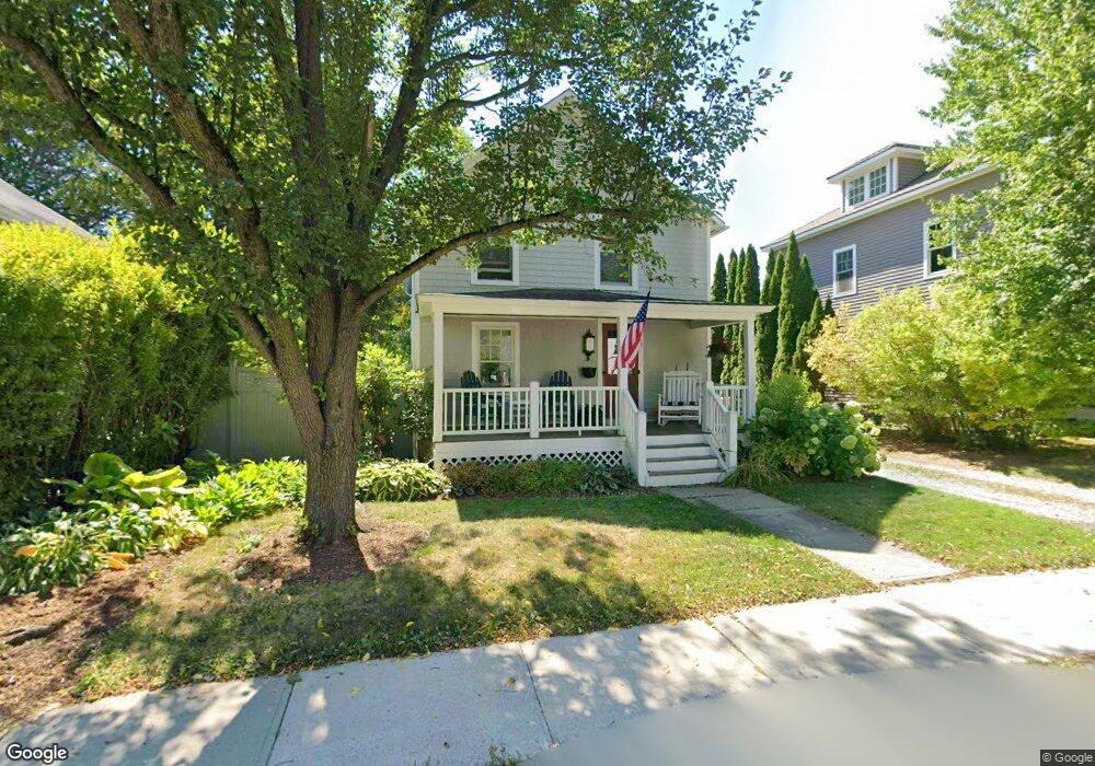
21 Latham St Williamstown, MA 01267
Estimated Value: $370,000 - $591,000
3
Beds
1
Bath
1,360
Sq Ft
$340/Sq Ft
Est. Value
About This Home
This home is located at 21 Latham St, Williamstown, MA 01267 and is currently estimated at $462,396, approximately $339 per square foot. 21 Latham St is a home located in Berkshire County with nearby schools including Lanesborough Elementary School, Mt. Greylock Regional High School, and Pine Cobble School.
Ownership History
Date
Name
Owned For
Owner Type
Purchase Details
Closed on
Mar 29, 2023
Sold by
Umlauf John N
Bought by
John N Umlauf 2010 Ret
Current Estimated Value
Purchase Details
Closed on
Jul 8, 2009
Sold by
Sap Nt and Ware Robert C
Bought by
Umlauf John N
Home Financials for this Owner
Home Financials are based on the most recent Mortgage that was taken out on this home.
Original Mortgage
$173,000
Interest Rate
5.31%
Purchase Details
Closed on
Nov 1, 2006
Sold by
Marks Joan Marie
Bought by
Sap Nt and Ware Robert C
Purchase Details
Closed on
Oct 11, 2000
Sold by
Madden William C and Madden Sarah J B
Bought by
Makrs Joan Marie and Kim Gwang Ho
Create a Home Valuation Report for This Property
The Home Valuation Report is an in-depth analysis detailing your home's value as well as a comparison with similar homes in the area
Home Values in the Area
Average Home Value in this Area
Purchase History
| Date | Buyer | Sale Price | Title Company |
|---|---|---|---|
| John N Umlauf 2010 Ret | -- | None Available | |
| Umlauf John N | -- | -- | |
| Sap Nt | $145,000 | -- | |
| Makrs Joan Marie | $134,500 | -- |
Source: Public Records
Mortgage History
| Date | Status | Borrower | Loan Amount |
|---|---|---|---|
| Previous Owner | Makrs Joan Marie | $173,000 | |
| Previous Owner | Makrs Joan Marie | $60,000 | |
| Previous Owner | Makrs Joan Marie | $10,000 |
Source: Public Records
Tax History Compared to Growth
Tax History
| Year | Tax Paid | Tax Assessment Tax Assessment Total Assessment is a certain percentage of the fair market value that is determined by local assessors to be the total taxable value of land and additions on the property. | Land | Improvement |
|---|---|---|---|---|
| 2025 | $5,346 | $387,400 | $126,200 | $261,200 |
| 2024 | $5,352 | $353,300 | $118,200 | $235,100 |
| 2023 | $5,192 | $321,100 | $107,500 | $213,600 |
| 2022 | $4,839 | $286,000 | $103,300 | $182,700 |
| 2021 | $4,477 | $258,800 | $103,300 | $155,500 |
| 2020 | $3,840 | $218,200 | $71,200 | $147,000 |
| 2019 | $3,415 | $189,200 | $58,800 | $130,400 |
| 2018 | $3,394 | $189,200 | $58,800 | $130,400 |
| 2017 | $3,224 | $189,200 | $58,800 | $130,400 |
| 2016 | $2,987 | $189,200 | $58,800 | $130,400 |
| 2015 | $2,953 | $189,200 | $58,800 | $130,400 |
| 2014 | $2,983 | $195,200 | $63,800 | $131,400 |
Source: Public Records
Map
Nearby Homes
- 1 River Run Unit 1
- 2 River Run
- 2 River Run Rd
- 160 Water St Unit 102
- 160 Water St Unit 407
- 160 Water St Unit 112
- 160 Water St Unit 23
- 160 Water St Unit 103
- 160 Water St Unit 209
- 160 Water St Unit 309
- 12 River Run
- 0 Water St
- 196 South St
- 51 Colonial Ave
- 111 Park St
- 15 Orchard Ln
- 108 Berkshire Dr
- 14 Orchard Ln
- 111 North St
- 189 Stratton Rd Unit E2
- 15 Latham St
- 25 Latham St
- 7 Latham St
- 22 Latham St
- 115 & 7 Water & Latham St
- 14 Latham St
- 110 Meacham St
- 104 Meacham St
- 407 Meacham St
- 144 Meacham St
- 23 Meadow St
- 11 Meadow St Unit 13
- 131 Water St
- 137 Water St
- 118 Water St
- 87 Water St
- 128 Water St
- 106 Water St
- 154 Meacham St Unit C
- 154 Meacham St Unit B