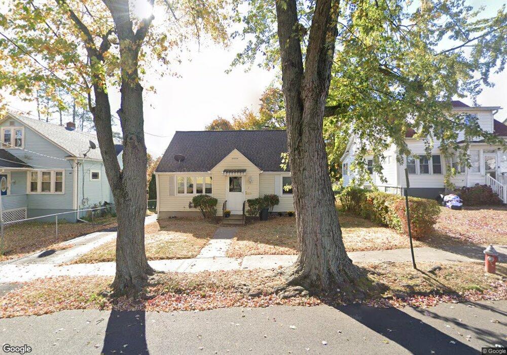
21 Leo St New Britain, CT 06053
Estimated Value: $247,000 - $301,000
4
Beds
1
Bath
1,224
Sq Ft
$219/Sq Ft
Est. Value
About This Home
This home is located at 21 Leo St, New Britain, CT 06053 and is currently estimated at $267,526, approximately $218 per square foot. 21 Leo St is a home located in Hartford County with nearby schools including Gaffney School, Slade Middle School, and St Paul School.
Ownership History
Date
Name
Owned For
Owner Type
Purchase Details
Closed on
Apr 1, 2005
Sold by
Minery Jennifer A and Minery Sorek O
Bought by
Ardrey Marguerite W
Current Estimated Value
Home Financials for this Owner
Home Financials are based on the most recent Mortgage that was taken out on this home.
Original Mortgage
$139,000
Outstanding Balance
$70,937
Interest Rate
5.61%
Estimated Equity
$196,589
Purchase Details
Closed on
Dec 30, 1999
Sold by
Sweetman Daniel
Bought by
Minery Sorek O and Minery Jennifer A
Home Financials for this Owner
Home Financials are based on the most recent Mortgage that was taken out on this home.
Original Mortgage
$77,800
Interest Rate
7.71%
Purchase Details
Closed on
Oct 18, 1999
Sold by
Est Matuszak Sophie and Matuszak Michael
Bought by
Sweetman Daniel
Create a Home Valuation Report for This Property
The Home Valuation Report is an in-depth analysis detailing your home's value as well as a comparison with similar homes in the area
Home Values in the Area
Average Home Value in this Area
Purchase History
| Date | Buyer | Sale Price | Title Company |
|---|---|---|---|
| Ardrey Marguerite W | $139,000 | -- | |
| Minery Sorek O | $78,900 | -- | |
| Sweetman Daniel | $62,000 | -- |
Source: Public Records
Mortgage History
| Date | Status | Borrower | Loan Amount |
|---|---|---|---|
| Open | Sweetman Daniel | $139,000 | |
| Previous Owner | Sweetman Daniel | $40,000 | |
| Previous Owner | Sweetman Daniel | $85,000 | |
| Previous Owner | Sweetman Daniel | $77,800 |
Source: Public Records
Tax History Compared to Growth
Tax History
| Year | Tax Paid | Tax Assessment Tax Assessment Total Assessment is a certain percentage of the fair market value that is determined by local assessors to be the total taxable value of land and additions on the property. | Land | Improvement |
|---|---|---|---|---|
| 2025 | $4,454 | $113,680 | $43,750 | $69,930 |
| 2024 | $4,501 | $113,680 | $43,750 | $69,930 |
| 2023 | $4,352 | $113,680 | $43,750 | $69,930 |
| 2022 | $3,687 | $74,480 | $14,490 | $59,990 |
| 2021 | $3,687 | $74,480 | $14,490 | $59,990 |
| 2020 | $3,761 | $74,480 | $14,490 | $59,990 |
| 2019 | $3,761 | $74,480 | $14,490 | $59,990 |
| 2018 | $3,761 | $74,480 | $14,490 | $59,990 |
| 2017 | $3,450 | $68,320 | $15,120 | $53,200 |
| 2016 | $3,450 | $68,320 | $15,120 | $53,200 |
| 2015 | $3,348 | $68,320 | $15,120 | $53,200 |
| 2014 | $3,348 | $68,320 | $15,120 | $53,200 |
Source: Public Records
Map
Nearby Homes
- 1467 Corbin Ave
- 1485 Corbin Ave
- 108 Overhill Ave
- 43 Westerly St
- 30 Westerly St
- 8 Albany Ave
- 23 Ledyard Rd
- 25 Clinton St
- 335 Broad St
- 817 W Main St
- 42 Fairlane Dr
- 87 Pinehurst Ave
- 115 Beechwood Dr
- 230 Hillhurst Ave
- 19 Maplehurst Ave
- 179 Broad St
- 96 Garden St
- 66 Lincoln St
- 71 Pennsylvania Ave
- 149 Pennsylvania Ave Unit 151
- 15 Leo St
- 25 Leo St
- 32 Richard St
- 35 Leo St
- 1407 Corbin Ave
- 34 Richard St
- 1403 Corbin Ave Unit 2
- 1403 Corbin Ave Unit 1
- 1403 Corbin Ave
- 1403 Corbin Ave Unit 3FL
- 1417 Corbin Ave
- 1397 Corbin Ave
- 1397 Corbin Ave Unit 2
- 20 Leo St
- 42 Richard St
- 32 Leo St
- 1391 Corbin Ave
- 1391 Corbin Ave Unit 1
- 1391 Corbin Ave Unit 3