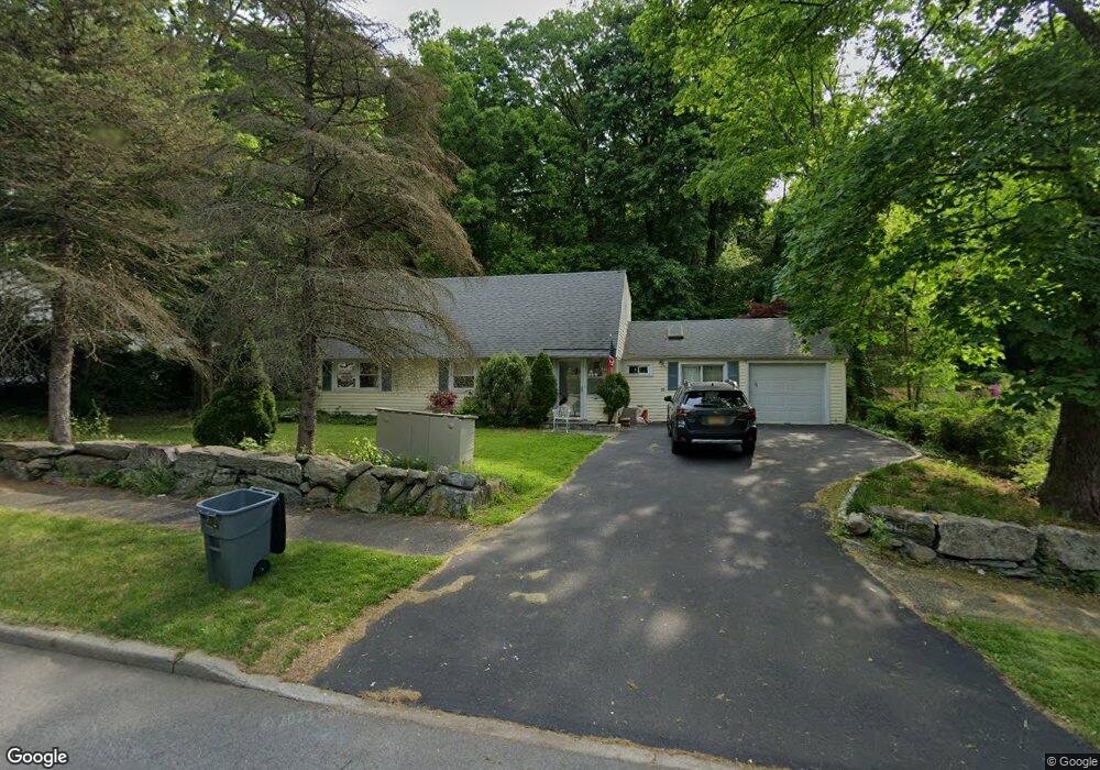
21 Lincoln Ave Rye Brook, NY 10573
Estimated Value: $858,000 - $992,000
3
Beds
2
Baths
2,326
Sq Ft
$394/Sq Ft
Est. Value
About This Home
This home is located at 21 Lincoln Ave, Rye Brook, NY 10573 and is currently estimated at $915,563, approximately $393 per square foot. 21 Lincoln Ave is a home located in Westchester County with nearby schools including Port Chester Senior High School, Corpus Christi Holy Rosary School, and School of the Holy Child.
Ownership History
Date
Name
Owned For
Owner Type
Purchase Details
Closed on
Sep 19, 2014
Sold by
Naughton Thomas
Bought by
Naughton Thomas
Current Estimated Value
Purchase Details
Closed on
Dec 30, 1999
Sold by
Dicostanzo Vincent and Dicostanzo Virginia Lee
Bought by
Naughton Thomas and Naughton Sheila
Home Financials for this Owner
Home Financials are based on the most recent Mortgage that was taken out on this home.
Original Mortgage
$160,000
Interest Rate
8.21%
Mortgage Type
Unknown
Create a Home Valuation Report for This Property
The Home Valuation Report is an in-depth analysis detailing your home's value as well as a comparison with similar homes in the area
Home Values in the Area
Average Home Value in this Area
Purchase History
| Date | Buyer | Sale Price | Title Company |
|---|---|---|---|
| Naughton Thomas | -- | The Judicial Title Ins Agenc | |
| Naughton Thomas | $290,000 | -- |
Source: Public Records
Mortgage History
| Date | Status | Borrower | Loan Amount |
|---|---|---|---|
| Previous Owner | Naughton Thomas | $160,000 |
Source: Public Records
Tax History Compared to Growth
Tax History
| Year | Tax Paid | Tax Assessment Tax Assessment Total Assessment is a certain percentage of the fair market value that is determined by local assessors to be the total taxable value of land and additions on the property. | Land | Improvement |
|---|---|---|---|---|
| 2024 | $12,295 | $699,800 | $197,400 | $502,400 |
| 2023 | $10,455 | $672,900 | $188,000 | $484,900 |
| 2022 | $11,415 | $628,900 | $188,000 | $440,900 |
| 2021 | $12,153 | $604,700 | $188,000 | $416,700 |
| 2020 | $11,049 | $604,700 | $188,000 | $416,700 |
| 2019 | $15,272 | $603,900 | $177,500 | $426,400 |
| 2018 | $8,791 | $596,300 | $173,700 | $422,600 |
| 2017 | $2,331 | $577,000 | $163,700 | $413,300 |
| 2016 | $11,013 | $592,700 | $182,800 | $409,900 |
| 2015 | -- | $557,400 | $170,300 | $387,100 |
| 2014 | -- | $522,300 | $150,200 | $372,100 |
| 2013 | -- | $532,400 | $145,900 | $386,500 |
Source: Public Records
Map
Nearby Homes
- 9 Wilton Rd
- 27 Avon Cir Unit C
- 60 Talcott Rd
- 15 Maywood Ave
- 10 Maywood Ave
- 54 Lincoln Ave
- 345 Betsy Brown Rd
- 11 Whittemore Place
- 7 Rockledge Rd
- 180 Fairview Ave
- 80 Valley Terrace
- 15 Rockledge Rd
- 22 Ridge Blvd
- 527 Purchase St
- 485 Westchester Ave
- 494 Franklin St
- 22 Breckenridge Ave
- 90 Windsor Rd
- 14 Lakeside Dr
- 10 Irenhyl Ave