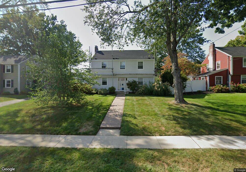
21 Lincoln Ave West Hartford, CT 06117
Estimated Value: $588,137 - $638,000
3
Beds
3
Baths
1,939
Sq Ft
$311/Sq Ft
Est. Value
About This Home
This home is located at 21 Lincoln Ave, West Hartford, CT 06117 and is currently estimated at $603,534, approximately $311 per square foot. 21 Lincoln Ave is a home located in Hartford County with nearby schools including Morley School, King Philip Middle School, and Hall High School.
Ownership History
Date
Name
Owned For
Owner Type
Purchase Details
Closed on
Nov 16, 1988
Sold by
Wilson Viva B
Bought by
Rollins T L
Current Estimated Value
Create a Home Valuation Report for This Property
The Home Valuation Report is an in-depth analysis detailing your home's value as well as a comparison with similar homes in the area
Home Values in the Area
Average Home Value in this Area
Purchase History
| Date | Buyer | Sale Price | Title Company |
|---|---|---|---|
| Rollins T L | $282,000 | -- |
Source: Public Records
Mortgage History
| Date | Status | Borrower | Loan Amount |
|---|---|---|---|
| Open | Rollins T L | $144,000 | |
| Closed | Rollins T L | $218,000 |
Source: Public Records
Tax History Compared to Growth
Tax History
| Year | Tax Paid | Tax Assessment Tax Assessment Total Assessment is a certain percentage of the fair market value that is determined by local assessors to be the total taxable value of land and additions on the property. | Land | Improvement |
|---|---|---|---|---|
| 2025 | $11,438 | $255,430 | $114,030 | $141,400 |
| 2024 | $10,817 | $255,430 | $114,030 | $141,400 |
| 2023 | $10,452 | $255,430 | $114,030 | $141,400 |
| 2022 | $10,391 | $255,430 | $114,030 | $141,400 |
| 2021 | $10,054 | $237,020 | $114,030 | $122,990 |
| 2020 | $9,744 | $233,100 | $116,130 | $116,970 |
| 2019 | $9,744 | $233,100 | $116,130 | $116,970 |
| 2018 | $9,557 | $233,100 | $116,130 | $116,970 |
| 2017 | $9,566 | $233,100 | $116,130 | $116,970 |
| 2016 | $9,298 | $235,340 | $110,040 | $125,300 |
| 2015 | $9,016 | $235,340 | $110,040 | $125,300 |
| 2014 | $8,795 | $235,340 | $110,040 | $125,300 |
Source: Public Records
Map
Nearby Homes
- 62 Blue Ridge Ln
- 1294 Trout Brook Dr
- 129 Middlebrook Rd
- 1272 Trout Brook Dr
- 47 Flagg Rd
- 1268 Trout Brook Dr
- 11 Lawler Rd
- 30 Farmstead Ln
- 2581 Albany Ave
- 132 N Main St
- 139 Mohawk Dr
- 50 Magnolia Hill
- 1196 Trout Brook Dr
- 3 Pilgrim Rd
- 11 Rye Ridge Pkwy
- 56 Fox Chase Ln
- 3 Trumbull Ln
- 1110 Trout Brook Dr
- 148 King Philip Dr
- 183 Loomis Dr Unit 109
- 17 Lincoln Ave
- 25 Lincoln Ave
- 9 Westmoreland Dr
- 4 Sunny Slope Dr
- 8 Sunny Slope Dr
- 22 Lincoln Ave
- 24 Lincoln Ave
- 20 Lincoln Ave
- 10 Sunny Slope Dr
- 11 Westmoreland Dr
- 4 Westmoreland Dr
- 28 Lincoln Ave
- 8 Westmoreland Dr
- 3 Sunny Slope Dr
- 10 Westmoreland Dr
- 30 Lincoln Ave
- 14 Sunny Slope Dr
- 33 Lincoln Ave
- 12 Westmoreland Dr
- 7 Sunny Slope Dr