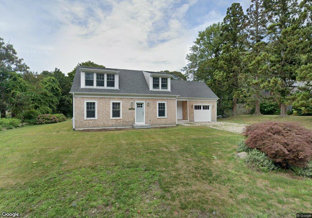
21 Little Island Rd Falmouth, MA 02540
West Falmouth NeighborhoodEstimated Value: $1,526,000 - $1,923,000
3
Beds
3
Baths
3,272
Sq Ft
$537/Sq Ft
Est. Value
About This Home
This home is located at 21 Little Island Rd, Falmouth, MA 02540 and is currently estimated at $1,755,631, approximately $536 per square foot. 21 Little Island Rd is a home located in Barnstable County with nearby schools including North Falmouth Elementary School, Morse Pond School, and Lawrence School.
Ownership History
Date
Name
Owned For
Owner Type
Purchase Details
Closed on
Mar 28, 2017
Sold by
Ginley Kathleen M and Ginley James P
Bought by
James P Ginley Rt and Ginley
Current Estimated Value
Purchase Details
Closed on
Jan 25, 1995
Sold by
Ginley James R and Ginley Kathleen M
Bought by
Dean Coop Bk
Purchase Details
Closed on
Dec 29, 1994
Sold by
Doyle John V and Doyle Sheila E
Bought by
Ginley James P and Ginley Kathleen M
Purchase Details
Closed on
May 29, 1987
Sold by
Loukas Ronald S
Bought by
Doyle John V
Create a Home Valuation Report for This Property
The Home Valuation Report is an in-depth analysis detailing your home's value as well as a comparison with similar homes in the area
Home Values in the Area
Average Home Value in this Area
Purchase History
| Date | Buyer | Sale Price | Title Company |
|---|---|---|---|
| James P Ginley Rt | -- | -- | |
| James P Ginley Rt | -- | -- | |
| Dean Coop Bk | $180,000 | -- | |
| Dean Coop Bk | $180,000 | -- | |
| Ginley James P | $225,000 | -- | |
| Ginley James P | $225,000 | -- | |
| Doyle John V | $275,000 | -- |
Source: Public Records
Mortgage History
| Date | Status | Borrower | Loan Amount |
|---|---|---|---|
| Previous Owner | Doyle John V | $283,000 | |
| Previous Owner | Doyle John V | $198,800 |
Source: Public Records
Tax History Compared to Growth
Tax History
| Year | Tax Paid | Tax Assessment Tax Assessment Total Assessment is a certain percentage of the fair market value that is determined by local assessors to be the total taxable value of land and additions on the property. | Land | Improvement |
|---|---|---|---|---|
| 2025 | $9,835 | $1,675,400 | $517,600 | $1,157,800 |
| 2024 | $9,762 | $1,554,400 | $494,700 | $1,059,700 |
| 2023 | $4,762 | $688,200 | $369,900 | $318,300 |
| 2022 | $5,066 | $629,300 | $369,400 | $259,900 |
| 2021 | $4,940 | $581,200 | $353,300 | $227,900 |
| 2020 | $4,717 | $549,100 | $321,200 | $227,900 |
| 2019 | $4,654 | $543,700 | $321,200 | $222,500 |
| 2018 | $4,569 | $531,300 | $321,200 | $210,100 |
| 2017 | $4,472 | $524,300 | $321,200 | $203,100 |
| 2016 | $4,388 | $524,300 | $321,200 | $203,100 |
| 2015 | $4,294 | $524,300 | $321,200 | $203,100 |
| 2014 | $4,268 | $523,700 | $321,300 | $202,400 |
Source: Public Records
Map
Nearby Homes
- 102 Nashawena St
- 22 Acorn Dr
- 7 Pilgrim Path
- 38 Nemasket Rd
- 37 Nemsaket Rd
- 37 Nemasket Rd
- 4 Ambleside Dr
- 106 Ambleside Dr
- 850 W Falmouth Hwy Unit 11
- 0 Chapoquoit Rd
- 113 Blacksmith Shop Rd
- 908 W Falmouth Hwy
- 345 Quaker Rd
- 37 Katelyn Hills Dr
- 0 Quaker Rd Unit 22504204
- 0 Quaker Rd Unit 73423088
- 121 Streeter Hill Rd
- 121 Streeter Hill Rd
- 61 Mckenna Ridge Dr
- 34 Mckenna Ridge Rd
- 17 Little Island Rd
- 27 Little Island Rd
- 20 Quaker Rd
- 24 Quaker Rd
- 24 Little Island Rd
- 11 Little Island Rd
- 33 Little Island Rd
- 30 Little Island Rd
- 28 Quaker Rd
- 12 Little Island Rd
- 3 Quaker Rd
- 2 Quaker Rd
- 36 Little Island Rd
- 18 Little Island Rd
- 19 Quaker Rd
- 10 Wright St
- 4 Shapquit Bars Rd
- 25 Quaker Rd
- 19 Wright St
- 31 Quaker Rd