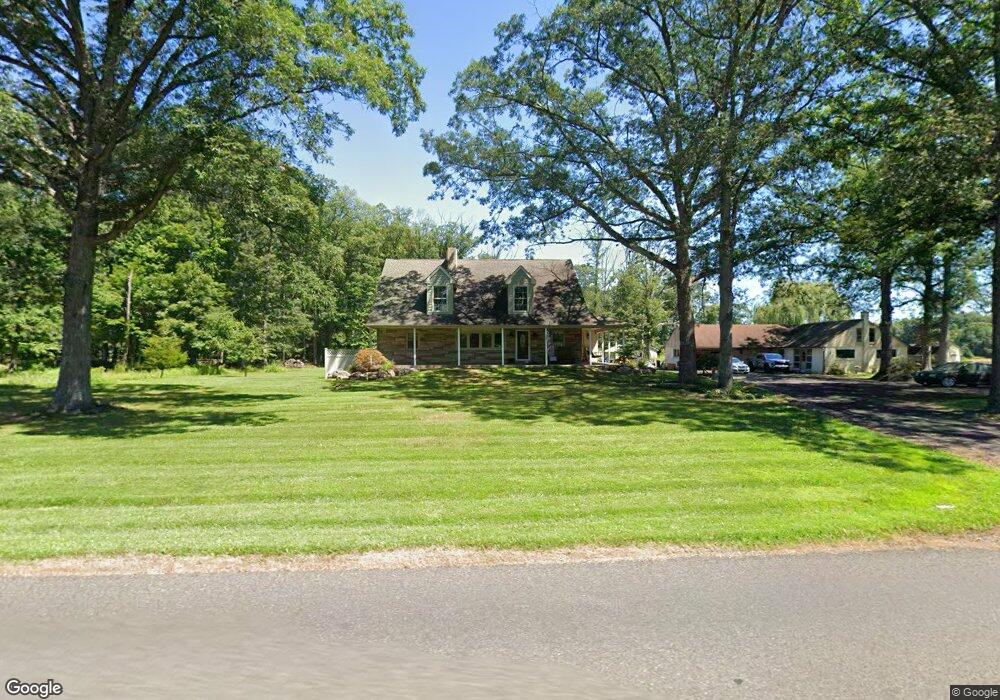
21 Log Cabin Rd Perkasie, PA 18944
Estimated Value: $587,000 - $723,000
3
Beds
1
Bath
2,002
Sq Ft
$321/Sq Ft
Est. Value
About This Home
This home is located at 21 Log Cabin Rd, Perkasie, PA 18944 and is currently estimated at $643,583, approximately $321 per square foot. 21 Log Cabin Rd is a home located in Bucks County with nearby schools including Pennridge High School and Plumstead Christian School.
Ownership History
Date
Name
Owned For
Owner Type
Purchase Details
Closed on
Jul 19, 2017
Sold by
Johnson Earl Homer
Bought by
Johnson Brandon
Current Estimated Value
Home Financials for this Owner
Home Financials are based on the most recent Mortgage that was taken out on this home.
Original Mortgage
$23,500
Outstanding Balance
$19,525
Interest Rate
3.89%
Mortgage Type
New Conventional
Estimated Equity
$624,058
Purchase Details
Closed on
Jun 24, 2006
Sold by
Johnson Teresa A
Bought by
Johnson Earl Homer
Purchase Details
Closed on
Jun 28, 2004
Sold by
Moyer Dorothy D
Bought by
Johnson Earl Homer and Johnson Teresa A
Home Financials for this Owner
Home Financials are based on the most recent Mortgage that was taken out on this home.
Original Mortgage
$260,000
Outstanding Balance
$130,571
Interest Rate
6.3%
Mortgage Type
Unknown
Estimated Equity
$513,012
Purchase Details
Closed on
Jan 5, 2004
Sold by
Moyer Dorothy D
Bought by
Moyer Dorothy D and Moyer Living Trust
Create a Home Valuation Report for This Property
The Home Valuation Report is an in-depth analysis detailing your home's value as well as a comparison with similar homes in the area
Home Values in the Area
Average Home Value in this Area
Purchase History
| Date | Buyer | Sale Price | Title Company |
|---|---|---|---|
| Johnson Brandon | -- | None Available | |
| Johnson Earl Homer | $50,000 | None Available | |
| Johnson Earl Homer | $325,000 | -- | |
| Moyer Dorothy D | -- | -- |
Source: Public Records
Mortgage History
| Date | Status | Borrower | Loan Amount |
|---|---|---|---|
| Open | Johnson Brandon | $23,500 | |
| Open | Johnson Earl Homer | $260,000 |
Source: Public Records
Tax History Compared to Growth
Tax History
| Year | Tax Paid | Tax Assessment Tax Assessment Total Assessment is a certain percentage of the fair market value that is determined by local assessors to be the total taxable value of land and additions on the property. | Land | Improvement |
|---|---|---|---|---|
| 2025 | $5,991 | $35,200 | $8,480 | $26,720 |
| 2024 | $5,991 | $35,200 | $8,480 | $26,720 |
| 2023 | $5,921 | $35,200 | $8,480 | $26,720 |
| 2022 | $5,921 | $35,200 | $8,480 | $26,720 |
| 2021 | $5,921 | $35,200 | $8,480 | $26,720 |
| 2020 | $5,921 | $35,200 | $8,480 | $26,720 |
| 2019 | $5,886 | $35,200 | $8,480 | $26,720 |
| 2018 | $5,886 | $35,200 | $8,480 | $26,720 |
| 2017 | $5,842 | $35,200 | $8,480 | $26,720 |
| 2016 | $5,842 | $35,200 | $8,480 | $26,720 |
| 2015 | -- | $35,200 | $8,480 | $26,720 |
| 2014 | -- | $35,200 | $8,480 | $26,720 |
Source: Public Records
Map
Nearby Homes
- 4000 Miriam Dr
- 1222 Hockley Dr
- 1214 Hockley Dr
- 204 Pennland Farm Dr
- 4811 Lincoln Aly
- 319 Pennington Way
- Lot 10 Schadle Rd
- 316 Schadle Rd
- 5068 Kratz Carriage Rd
- 3789 Stump Rd
- 17 Ruhl Dr
- 81 Williams Dr
- 5403 Stump Rd
- 4936 Curly Hill Rd
- 238 Allem Ln Unit 238
- 291 Elephant Rd
- 178 Elephant Rd Unit C26
- 178 Elephant Rd Unit A6
- 137 S Main St
- 169 Marlyn Ln
- 18 Log Cabin Rd
- 26 Log Cabin Rd
- 9 Log Cabin Rd
- 4599 Applebutter Rd
- 10 Log Cabin Rd
- 4558 Applebutter Rd
- 4558 Applebutter Rd
- 0 Log Cabin Rd
- 00 Log Cabin Rd
- 62 Log Cabin Rd
- 4479 Applebutter Rd
- 4661 Applebutter Rd
- 4671 Applebutter Rd
- 4636 Applebutter Rd
- 4660 Applebutter Rd
- 4719 Applebutter Rd
- 72 Log Cabin Rd
- 4728 Applebutter Rd
- 87 Log Cabin Rd
- 253 Scott Rd