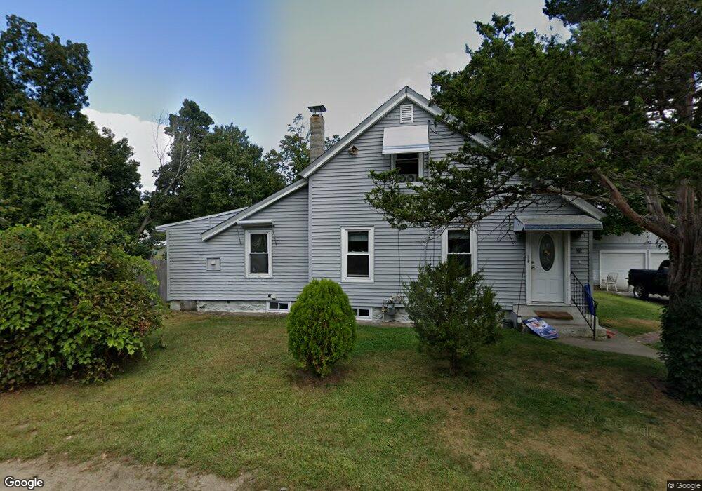
21 Lois St Methuen, MA 01844
The West End NeighborhoodEstimated Value: $425,000 - $502,000
2
Beds
1
Bath
1,152
Sq Ft
$399/Sq Ft
Est. Value
About This Home
This home is located at 21 Lois St, Methuen, MA 01844 and is currently estimated at $459,571, approximately $398 per square foot. 21 Lois St is a home located in Essex County with nearby schools including Marsh Grammar School, South Point Elementary School, and Methuen High School.
Ownership History
Date
Name
Owned For
Owner Type
Purchase Details
Closed on
Dec 3, 2024
Sold by
Dilendick Stefanie A
Bought by
Baldwin Justin
Current Estimated Value
Home Financials for this Owner
Home Financials are based on the most recent Mortgage that was taken out on this home.
Original Mortgage
$399,640
Outstanding Balance
$395,587
Interest Rate
6.54%
Mortgage Type
New Conventional
Estimated Equity
$63,984
Purchase Details
Closed on
Nov 4, 2015
Sold by
Dilendick Stephen
Bought by
Dilendick
Purchase Details
Closed on
Feb 7, 2003
Sold by
Dilendick Germaine
Bought by
Dilendick Stephen
Create a Home Valuation Report for This Property
The Home Valuation Report is an in-depth analysis detailing your home's value as well as a comparison with similar homes in the area
Home Values in the Area
Average Home Value in this Area
Purchase History
| Date | Buyer | Sale Price | Title Company |
|---|---|---|---|
| Baldwin Justin | $412,000 | None Available | |
| Baldwin Justin | $412,000 | None Available | |
| Dilendick | -- | -- | |
| Dilendick | -- | -- | |
| Dilendick | -- | -- | |
| Dilendick Stephen | $185,000 | -- | |
| Dilendick Stephen | $185,000 | -- |
Source: Public Records
Mortgage History
| Date | Status | Borrower | Loan Amount |
|---|---|---|---|
| Open | Baldwin Justin | $399,640 | |
| Closed | Baldwin Justin | $399,640 | |
| Previous Owner | Dilendick Stephen | $104,000 |
Source: Public Records
Tax History Compared to Growth
Tax History
| Year | Tax Paid | Tax Assessment Tax Assessment Total Assessment is a certain percentage of the fair market value that is determined by local assessors to be the total taxable value of land and additions on the property. | Land | Improvement |
|---|---|---|---|---|
| 2025 | $4,408 | $416,600 | $211,900 | $204,700 |
| 2024 | $4,322 | $398,000 | $193,300 | $204,700 |
| 2023 | $4,056 | $346,700 | $171,800 | $174,900 |
| 2022 | $3,825 | $293,100 | $143,200 | $149,900 |
| 2021 | $3,639 | $275,900 | $136,000 | $139,900 |
| 2020 | $3,654 | $271,900 | $136,000 | $135,900 |
| 2019 | $3,485 | $245,600 | $121,700 | $123,900 |
| 2018 | $3,421 | $239,700 | $121,700 | $118,000 |
| 2017 | $3,336 | $227,700 | $121,700 | $106,000 |
| 2016 | $3,118 | $210,500 | $114,500 | $96,000 |
| 2015 | $3,000 | $205,500 | $114,500 | $91,000 |
Source: Public Records
Map
Nearby Homes
- 14 Youngfarm Rd
- 492 Lowell St
- 14 Tyler St
- 38 Butternut Ln
- 11 Vineyard Ln Unit 11
- 362 Lowell St
- 2 Sugar Hill Cir
- 86 Butternut Ln
- 90 Butternut Ln
- 65 Clayton Ave
- 35 Memorial Dr
- 945 Riverside Dr Unit 2A
- 134 Haverhill St
- 2 Glen Forest Ln
- 1 Tilbury Rd
- 32 Glen Ave
- 57 Strathmore Rd
- 37 Maplewood Ave
- 14-16 Cypress Ave
- 17-19 Maplewood Ave