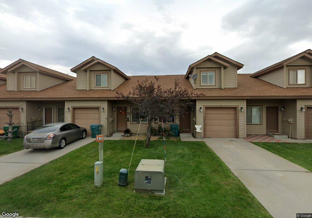
21 Mangum Cir Unit 2 Donnelly, ID 83615
Estimated Value: $367,000 - $391,000
3
Beds
1
Bath
1,389
Sq Ft
$273/Sq Ft
Est. Value
About This Home
This home is located at 21 Mangum Cir Unit 2, Donnelly, ID 83615 and is currently estimated at $378,666, approximately $272 per square foot. 21 Mangum Cir Unit 2 is a home located in Valley County with nearby schools including Donnelly Elementary School and McCall-Donnelly High School.
Ownership History
Date
Name
Owned For
Owner Type
Purchase Details
Closed on
Jul 16, 2018
Sold by
Hoffman Eric L and Hoffman Karen L
Bought by
Heyer Michael W
Current Estimated Value
Home Financials for this Owner
Home Financials are based on the most recent Mortgage that was taken out on this home.
Original Mortgage
$141,988
Outstanding Balance
$123,054
Interest Rate
4.5%
Mortgage Type
VA
Estimated Equity
$255,612
Purchase Details
Closed on
Aug 25, 2010
Sold by
Tway Monica R
Bought by
Federal National Mortgage Association
Purchase Details
Closed on
Nov 19, 2007
Sold by
Timberline Development Llc
Bought by
Tway Monica R
Home Financials for this Owner
Home Financials are based on the most recent Mortgage that was taken out on this home.
Original Mortgage
$166,250
Interest Rate
6.38%
Mortgage Type
New Conventional
Create a Home Valuation Report for This Property
The Home Valuation Report is an in-depth analysis detailing your home's value as well as a comparison with similar homes in the area
Home Values in the Area
Average Home Value in this Area
Purchase History
| Date | Buyer | Sale Price | Title Company |
|---|---|---|---|
| Heyer Michael W | -- | American Title | |
| Federal National Mortgage Association | $149,299 | -- | |
| Tway Monica R | -- | -- |
Source: Public Records
Mortgage History
| Date | Status | Borrower | Loan Amount |
|---|---|---|---|
| Open | Heyer Michael W | $141,988 | |
| Previous Owner | Tway Monica R | $166,250 |
Source: Public Records
Tax History Compared to Growth
Tax History
| Year | Tax Paid | Tax Assessment Tax Assessment Total Assessment is a certain percentage of the fair market value that is determined by local assessors to be the total taxable value of land and additions on the property. | Land | Improvement |
|---|---|---|---|---|
| 2025 | $713 | $391,112 | $23,899 | $367,213 |
| 2023 | $713 | $448,597 | $24,658 | $423,939 |
| 2022 | $879 | $400,515 | $24,658 | $375,857 |
| 2021 | $609 | $229,910 | $18,968 | $210,942 |
| 2020 | $574 | $179,115 | $21,154 | $157,961 |
| 2019 | $487 | $135,549 | $20,147 | $115,402 |
| 2018 | $822 | $121,916 | $17,212 | $104,704 |
| 2017 | $872 | $118,501 | $20,597 | $97,904 |
| 2016 | $813 | $108,275 | $19,000 | $89,275 |
| 2015 | $714 | $89,368 | $0 | $0 |
| 2013 | -- | $86,925 | $0 | $0 |
Source: Public Records
Map
Nearby Homes
- 24 Mangum Cir Unit 1
- 24 Mangum Dr Unit # 1 Unit 1
- 20 #5 W Mangum Cir Unit 5
- 20 Mangum Cir Unit 8
- 35 1 Mangum Cir
- 32 Mangum Cir Unit 3
- 32 Mangum Cir
- 35 Mangum Cir Unit 1
- 34 Mangum Cir Unit 8
- Lot 4 Hideout Dr Unit 4
- Lot 6 Hideout Dr Unit 6
- 1816 Schultz
- 1816 Schultz Unit 15
- 13111 Cameron Dr
- 22 Charters Dr
- 16 Buckskin Dr
- 13116 Crane Shores Dr
- 13116 Crane Shore Dr
- 13130 Crane Shore Dr
- TBD Herons Nest Ct
- 21 Mangum Cir Unit 1
- 21 Mangum Cir Unit 3
- 21 Mangum Cir Unit 4
- 21 Mangum Cir Unit 5
- 21 Mangum Cir Unit 6
- 21 Mangum Cir Unit 7
- 21 Mangum Cir Unit 8
- 21 Mangum Cir
- 21 Mangum Cir
- 21 Mangum Cir Unit 5
- 30 #7 Mangum Cir Unit 7
- 32#6 Mangum Cir Unit 6
- 42 #3 Mangum Cir
- 41 #7 Mangum Cir
- 26 #4 Magnum Cir
- Mangum Circle Mangum Cir Unit 41/7
- 21 (#1) Mangum Cir
- 21 (#2) Mangum Cir
- 21 #2 Mangum Cir
- 41 Mangum Cir