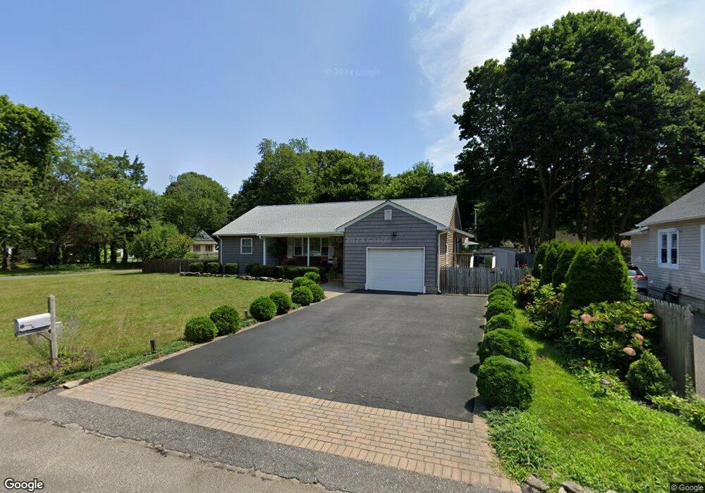
21 Market St Port Jefferson Station, NY 11776
Estimated Value: $537,000 - $602,000
2
Beds
1
Bath
1,356
Sq Ft
$424/Sq Ft
Est. Value
About This Home
This home is located at 21 Market St, Port Jefferson Station, NY 11776 and is currently estimated at $574,527, approximately $423 per square foot. 21 Market St is a home located in Suffolk County with nearby schools including John F Kennedy Middle School and Comsewogue High School.
Ownership History
Date
Name
Owned For
Owner Type
Purchase Details
Closed on
Dec 1, 2009
Sold by
Kudlik Denise F and Kudlik Richard S
Bought by
Giordano Anthony and Giordano Tetyana
Current Estimated Value
Home Financials for this Owner
Home Financials are based on the most recent Mortgage that was taken out on this home.
Original Mortgage
$100,000
Interest Rate
5%
Mortgage Type
Purchase Money Mortgage
Purchase Details
Closed on
May 23, 1994
Sold by
Abramowski Stanley A
Bought by
Kudlik Richard S and Kudlik Denise F
Create a Home Valuation Report for This Property
The Home Valuation Report is an in-depth analysis detailing your home's value as well as a comparison with similar homes in the area
Home Values in the Area
Average Home Value in this Area
Purchase History
| Date | Buyer | Sale Price | Title Company |
|---|---|---|---|
| Giordano Anthony | $250,000 | -- | |
| Kudlik Richard S | $109,000 | Security Title & Guaranty Co |
Source: Public Records
Mortgage History
| Date | Status | Borrower | Loan Amount |
|---|---|---|---|
| Previous Owner | Giordano Anthony | $100,000 |
Source: Public Records
Tax History Compared to Growth
Tax History
| Year | Tax Paid | Tax Assessment Tax Assessment Total Assessment is a certain percentage of the fair market value that is determined by local assessors to be the total taxable value of land and additions on the property. | Land | Improvement |
|---|---|---|---|---|
| 2024 | $10,087 | $2,600 | $200 | $2,400 |
| 2023 | $10,087 | $2,600 | $200 | $2,400 |
| 2022 | $8,871 | $2,600 | $200 | $2,400 |
| 2021 | $8,871 | $2,600 | $200 | $2,400 |
| 2020 | $9,103 | $2,600 | $200 | $2,400 |
| 2019 | $9,103 | $0 | $0 | $0 |
| 2018 | $8,658 | $2,600 | $200 | $2,400 |
| 2017 | $8,658 | $2,600 | $200 | $2,400 |
| 2016 | $8,586 | $2,600 | $200 | $2,400 |
| 2015 | -- | $2,600 | $200 | $2,400 |
| 2014 | -- | $2,600 | $200 | $2,400 |
Source: Public Records
Map
Nearby Homes
- 19 Davis Ave
- 26 William St
- 700 Hallock Ave
- 54 Oakland Ave
- 43 Poplar St
- 33 Oakland Ave
- 201 Hallock Ave
- 35 Junard Blvd
- 1 Terryville Rd
- 2 Terryville Rd
- 50 Hillcrest Ave
- 7 Hill Dr
- 23 Edgewood Ave
- 21 Maple Ave
- 10 Sea Court Ln
- 6 Edgewood Ave
- 4 Patty Ann Ct
- 55 Clifton Place
- 26 Wilson St
- 182 Crystal Brook Hollow Rd