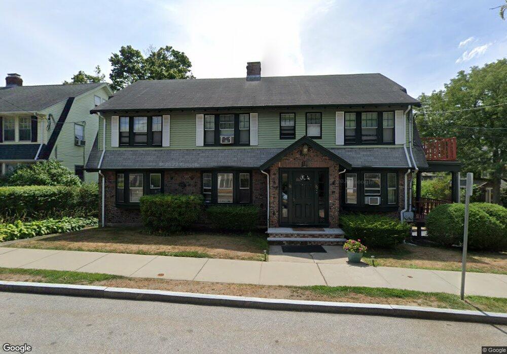
21 Middlesex Rd Watertown, MA 02472
West Watertown NeighborhoodEstimated Value: $992,000 - $1,433,673
4
Beds
2
Baths
3,240
Sq Ft
$393/Sq Ft
Est. Value
About This Home
This home is located at 21 Middlesex Rd, Watertown, MA 02472 and is currently estimated at $1,273,668, approximately $393 per square foot. 21 Middlesex Rd is a home located in Middlesex County with nearby schools including The Kendall School, St. Stephen's Armenian Elementary School, and Beacon High School.
Ownership History
Date
Name
Owned For
Owner Type
Purchase Details
Closed on
Dec 8, 2006
Sold by
Tyngsboro Landing Llc
Bought by
Shenkin Glen
Current Estimated Value
Purchase Details
Closed on
May 6, 2003
Sold by
Yacubian Blanche
Bought by
Yacubian Blanche and Tr Yacubian Ft S
Create a Home Valuation Report for This Property
The Home Valuation Report is an in-depth analysis detailing your home's value as well as a comparison with similar homes in the area
Home Values in the Area
Average Home Value in this Area
Purchase History
| Date | Buyer | Sale Price | Title Company |
|---|---|---|---|
| Shenkin Glen | $329,900 | -- | |
| Shenkin Glen | $329,900 | -- | |
| Shenkin Glen | $329,900 | -- | |
| Yacubian Blanche | -- | -- | |
| Yacubian Blanche | -- | -- |
Source: Public Records
Mortgage History
| Date | Status | Borrower | Loan Amount |
|---|---|---|---|
| Previous Owner | Yacubian Blanche | $40,000 |
Source: Public Records
Tax History Compared to Growth
Tax History
| Year | Tax Paid | Tax Assessment Tax Assessment Total Assessment is a certain percentage of the fair market value that is determined by local assessors to be the total taxable value of land and additions on the property. | Land | Improvement |
|---|---|---|---|---|
| 2025 | $12,744 | $1,091,100 | $521,000 | $570,100 |
| 2024 | $11,611 | $992,400 | $507,100 | $485,300 |
| 2023 | $12,981 | $955,900 | $485,000 | $470,900 |
| 2022 | $11,722 | $884,700 | $440,900 | $443,800 |
| 2021 | $10,658 | $870,000 | $426,200 | $443,800 |
| 2020 | $10,331 | $851,000 | $411,500 | $439,500 |
| 2019 | $9,129 | $708,800 | $411,500 | $297,300 |
| 2018 | $8,878 | $659,100 | $382,100 | $277,000 |
| 2017 | $8,492 | $611,400 | $334,400 | $277,000 |
| 2016 | $8,112 | $593,000 | $316,000 | $277,000 |
| 2015 | $8,361 | $556,300 | $279,300 | $277,000 |
| 2014 | $8,047 | $537,900 | $260,900 | $277,000 |
Source: Public Records
Map
Nearby Homes
- 118 Spring St Unit 118
- 25 Barnard Ave
- 11 Broadway Unit 11
- 68 Barnard Ave
- 21 Fayette St Unit 1
- 93 Spring St Unit 29
- 61-63 Church St
- 152 Bellevue Rd
- 71 Whites Ave Unit 71
- 110 Fayette St
- 55 Phillips St
- 199 Palfrey St
- 60 Everett Ave
- 5 Mason Rd
- 214 Palfrey St
- 91 Standish Rd
- 32 Whites Ave Unit E442
- 32 Whites Ave Unit D41
- 32 Whites Ave Unit D33
- 32 Whites Ave Unit E221
- 11 Middlesex Rd
- 11 Middlesex Rd Unit 2
- 11 Middlesex Rd Unit 1
- 33 Middlesex Rd
- 16 Middlesex Rd Unit 18
- 28 Middlesex Rd
- 3 Middlesex Rd
- 22 Middlesex Rd
- 22 Middlesex Rd Unit 22
- 16-18 Middlesex Rd Unit 2
- 34 Middlesex Rd
- 36 Middlesex Rd Unit 2
- 36 Middlesex Rd
- 36 Middlesex Rd Unit 1
- 24 Middlesex Rd Unit 26
- 10 Middlesex Rd
- 86 Common St
- 46 Middlesex Rd
- 6 Middlesex Rd Unit N/A
- 4-6 Middlesex Rd