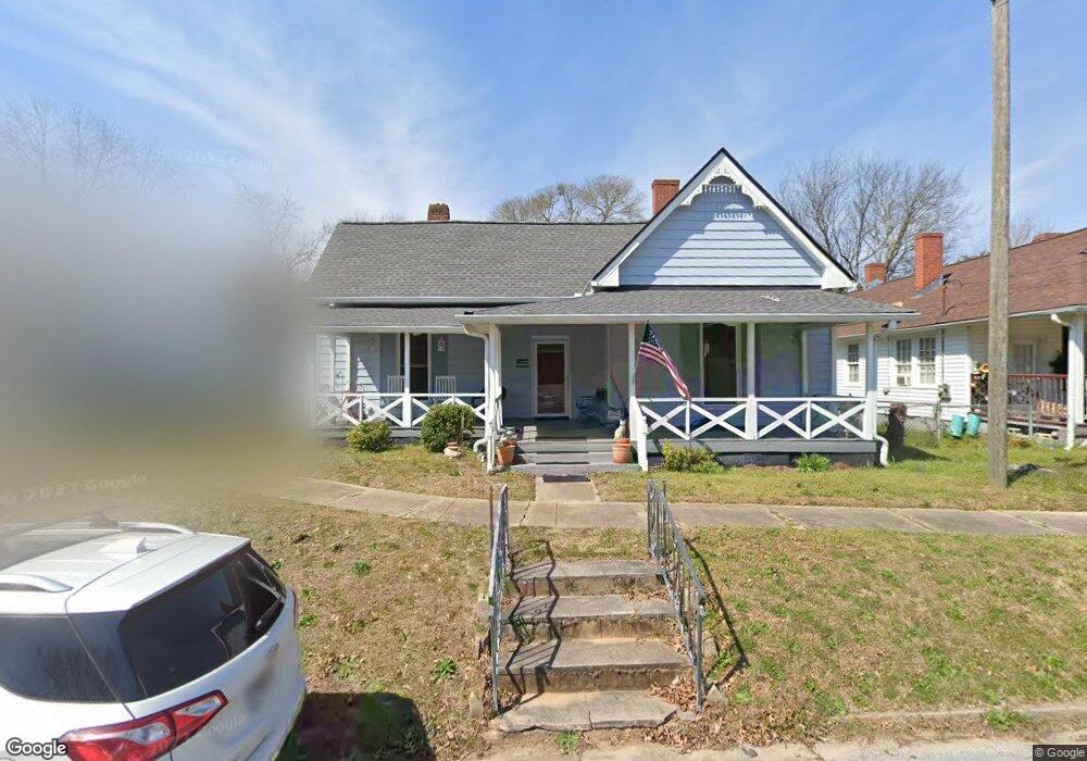
21 N Broad St Porterdale, GA 30014
Estimated Value: $171,868 - $224,000
--
Bed
1
Bath
1,856
Sq Ft
$101/Sq Ft
Est. Value
About This Home
This home is located at 21 N Broad St, Porterdale, GA 30014 and is currently estimated at $187,217, approximately $100 per square foot. 21 N Broad St is a home located in Newton County with nearby schools including Middle Ridge Elementary School, Clements Middle School, and Newton High School.
Ownership History
Date
Name
Owned For
Owner Type
Purchase Details
Closed on
Nov 12, 2012
Sold by
Cullen Brian C
Bought by
Rue Jeanne Brown
Current Estimated Value
Purchase Details
Closed on
Jul 25, 2005
Sold by
Citifinancial Svcs Inc
Bought by
Cullen Brian C and Cullen Jeanne S
Home Financials for this Owner
Home Financials are based on the most recent Mortgage that was taken out on this home.
Original Mortgage
$77,000
Interest Rate
6.19%
Mortgage Type
New Conventional
Purchase Details
Closed on
Apr 5, 2005
Sold by
Lunsford Karen S
Bought by
Citifinancial Svc Inc
Create a Home Valuation Report for This Property
The Home Valuation Report is an in-depth analysis detailing your home's value as well as a comparison with similar homes in the area
Home Values in the Area
Average Home Value in this Area
Purchase History
| Date | Buyer | Sale Price | Title Company |
|---|---|---|---|
| Rue Jeanne Brown | $62,000 | -- | |
| Cullen Brian C | $63,000 | -- | |
| Citifinancial Svc Inc | $57,900 | -- |
Source: Public Records
Mortgage History
| Date | Status | Borrower | Loan Amount |
|---|---|---|---|
| Previous Owner | Cullen Brian C | $77,000 |
Source: Public Records
Tax History Compared to Growth
Tax History
| Year | Tax Paid | Tax Assessment Tax Assessment Total Assessment is a certain percentage of the fair market value that is determined by local assessors to be the total taxable value of land and additions on the property. | Land | Improvement |
|---|---|---|---|---|
| 2024 | $1,314 | $63,880 | $10,000 | $53,880 |
| 2023 | $1,414 | $56,920 | $5,600 | $51,320 |
| 2022 | $1,044 | $47,920 | $5,600 | $42,320 |
| 2021 | $841 | $42,000 | $5,600 | $36,400 |
| 2020 | $26 | $29,120 | $5,600 | $23,520 |
| 2019 | $25 | $27,960 | $5,600 | $22,360 |
| 2018 | $11 | $25,560 | $5,600 | $19,960 |
| 2017 | $17 | $18,560 | $3,200 | $15,360 |
| 2016 | $17 | $18,560 | $3,200 | $15,360 |
| 2015 | $15 | $17,520 | $3,200 | $14,320 |
| 2014 | $6 | $19,800 | $0 | $0 |
Source: Public Records
Map
Nearby Homes