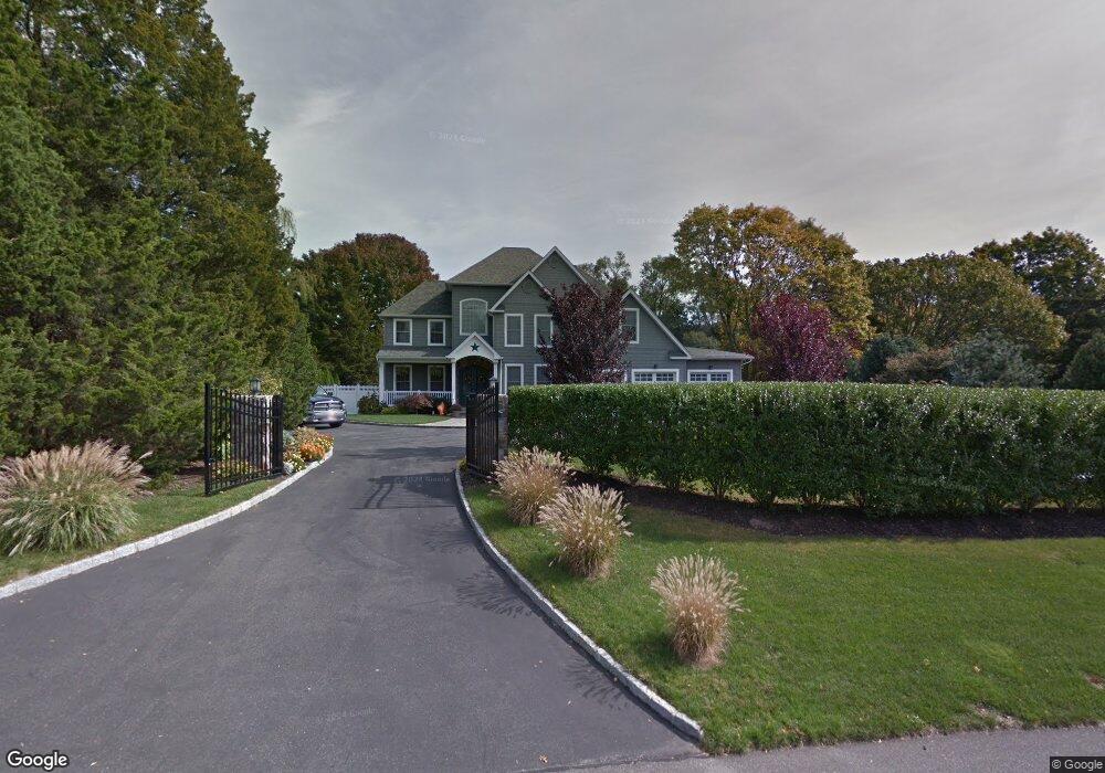
21 Normandy Dr Northport, NY 11768
Estimated Value: $885,000 - $1,124,000
--
Bed
--
Bath
--
Sq Ft
0.5
Acres
About This Home
This home is located at 21 Normandy Dr, Northport, NY 11768 and is currently estimated at $1,025,970. 21 Normandy Dr is a home located in Suffolk County with nearby schools including Northport Senior High School, The School House, and Trinity Regional School-East Northport Campus.
Ownership History
Date
Name
Owned For
Owner Type
Purchase Details
Closed on
Oct 15, 2009
Sold by
Belt Kevin and Belt Cathleen
Bought by
Annese Ronald and Annese Elizabeth
Current Estimated Value
Home Financials for this Owner
Home Financials are based on the most recent Mortgage that was taken out on this home.
Original Mortgage
$565,000
Outstanding Balance
$368,559
Interest Rate
5.06%
Mortgage Type
Purchase Money Mortgage
Estimated Equity
$657,411
Purchase Details
Closed on
Jan 29, 2007
Sold by
Rey Robert M
Bought by
Belt Kevin Cathleen
Create a Home Valuation Report for This Property
The Home Valuation Report is an in-depth analysis detailing your home's value as well as a comparison with similar homes in the area
Home Values in the Area
Average Home Value in this Area
Purchase History
| Date | Buyer | Sale Price | Title Company |
|---|---|---|---|
| Annese Ronald | $965,000 | -- | |
| Belt Kevin Cathleen | $400,000 | Cathleen D Allen |
Source: Public Records
Mortgage History
| Date | Status | Borrower | Loan Amount |
|---|---|---|---|
| Open | Annese Ronald | $565,000 |
Source: Public Records
Tax History Compared to Growth
Tax History
| Year | Tax Paid | Tax Assessment Tax Assessment Total Assessment is a certain percentage of the fair market value that is determined by local assessors to be the total taxable value of land and additions on the property. | Land | Improvement |
|---|---|---|---|---|
| 2024 | $18,660 | $5,500 | $225 | $5,275 |
| 2023 | $9,330 | $5,500 | $225 | $5,275 |
| 2022 | $17,603 | $5,500 | $225 | $5,275 |
| 2021 | $17,090 | $5,500 | $225 | $5,275 |
| 2020 | $16,840 | $5,500 | $225 | $5,275 |
| 2019 | $33,680 | $0 | $0 | $0 |
| 2018 | $16,965 | $5,850 | $225 | $5,625 |
| 2017 | $16,965 | $5,850 | $225 | $5,625 |
| 2016 | $18,629 | $6,550 | $225 | $6,325 |
| 2015 | -- | $6,550 | $225 | $6,325 |
| 2014 | -- | $6,550 | $225 | $6,325 |
Source: Public Records
Map
Nearby Homes
- 27 Brittany Ct
- 22 Middleville Rd
- 30 Middleville Rd
- 32 Middleville Rd Unit 2
- 107 Soper Ave
- 65 Circle Dr
- 7 Sun Valley Ct
- 33 Alsace Place
- 26 Gilbert St
- 44 Grant St
- 30 Fox Hollow Ridings Rd
- 15 Dune Ct
- 167 Vernon Valley Rd
- 96 Soundview Ave
- 96 Bellecrest Ave
- 292 Laurel Rd
- 18 Norton Dr
- 301 Laurel Rd
- 120 Burt Ave
- 267 Laurel Rd