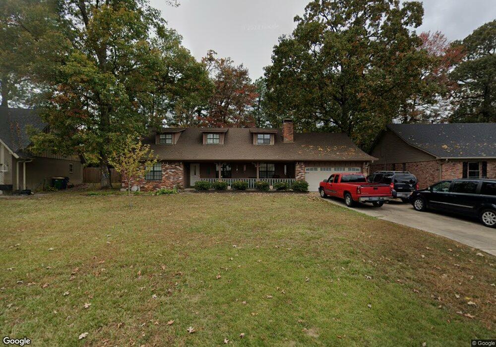
21 Oak Tree Cir North Little Rock, AR 72116
Lakewood NeighborhoodEstimated Value: $284,007 - $346,000
--
Bed
3
Baths
2,696
Sq Ft
$118/Sq Ft
Est. Value
About This Home
This home is located at 21 Oak Tree Cir, North Little Rock, AR 72116 and is currently estimated at $318,002, approximately $117 per square foot. 21 Oak Tree Cir is a home located in Pulaski County with nearby schools including Crestwood Elementary School, North Little Rock Middle School 6th Grade Campus, and North Little Rock High School.
Ownership History
Date
Name
Owned For
Owner Type
Purchase Details
Closed on
Apr 20, 2016
Sold by
Francis Ursula Maria and Henderson Laura E
Bought by
Francis Ursula Maria and Henderson Laura E
Current Estimated Value
Home Financials for this Owner
Home Financials are based on the most recent Mortgage that was taken out on this home.
Original Mortgage
$129,799
Outstanding Balance
$80,507
Interest Rate
3.73%
Mortgage Type
New Conventional
Estimated Equity
$237,496
Purchase Details
Closed on
Jul 2, 2004
Sold by
Heard Vicki Lea
Bought by
Francis Ursula Marie and Henderson Laura E
Home Financials for this Owner
Home Financials are based on the most recent Mortgage that was taken out on this home.
Original Mortgage
$158,650
Interest Rate
6.31%
Mortgage Type
Purchase Money Mortgage
Create a Home Valuation Report for This Property
The Home Valuation Report is an in-depth analysis detailing your home's value as well as a comparison with similar homes in the area
Home Values in the Area
Average Home Value in this Area
Purchase History
| Date | Buyer | Sale Price | Title Company |
|---|---|---|---|
| Francis Ursula Maria | -- | Attorney | |
| Francis Ursula Marie | $167,000 | American Abstract & Title Co |
Source: Public Records
Mortgage History
| Date | Status | Borrower | Loan Amount |
|---|---|---|---|
| Open | Francis Ursula Maria | $129,799 | |
| Closed | Francis Ursula Marie | $158,650 |
Source: Public Records
Tax History Compared to Growth
Tax History
| Year | Tax Paid | Tax Assessment Tax Assessment Total Assessment is a certain percentage of the fair market value that is determined by local assessors to be the total taxable value of land and additions on the property. | Land | Improvement |
|---|---|---|---|---|
| 2025 | $3,348 | $51,806 | $9,200 | $42,606 |
| 2024 | $3,069 | $51,806 | $9,200 | $42,606 |
| 2023 | $3,069 | $51,806 | $9,200 | $42,606 |
| 2022 | $2,929 | $51,806 | $9,200 | $42,606 |
| 2021 | $2,790 | $41,760 | $12,200 | $29,560 |
| 2020 | $2,415 | $41,760 | $12,200 | $29,560 |
| 2019 | $2,415 | $41,760 | $12,200 | $29,560 |
| 2018 | $2,440 | $41,760 | $12,200 | $29,560 |
| 2017 | $2,440 | $41,760 | $12,200 | $29,560 |
| 2016 | $2,324 | $40,030 | $6,000 | $34,030 |
| 2015 | $2,674 | $40,030 | $6,000 | $34,030 |
| 2014 | $2,674 | $40,030 | $6,000 | $34,030 |
Source: Public Records
Map
Nearby Homes
- 4524 Dawson Dr
- 4501 Dawson Dr
- 5009 Burrow Dr
- 5101 Burrow Dr
- 4204 Fox Hill Rd
- 5201 Fairway Dr
- 5317 Fairway Ave
- 4105 Dunkeld Dr
- 4100 Monticello Dr
- 10 Campden Hill Rd
- 3405 Bunker Hill Dr
- 250 Smokey Ln Unit 12
- 1003 Silver Creek Dr
- 3404 Bunker Hill Dr
- 5000 Fairway Ave
- 6600 Watercrest Loop
- 6616 Watercrest Loop
- 6633 Watercrest Loop
- 6608 Watercrest Loop
- 6601 Watercrest Loop
- 23 Oak Tree Cir
- 0 Oak Tree Cir Unit 15018165
- 0 Oak Tree Cir Unit 15025396
- 0 Oak Tree Cir Unit 20034695
- 0 Oak Tree Cir Unit 16033437
- 0 Oak Tree Cir Unit 17028928
- 0 Oak Tree Cir Unit 17033381
- 19 Oak Tree Cir
- 18 Oak Tree Cir
- 17 Oak Tree Cir
- 25 Oak Tree Cir
- 32 Oak Tree Cir
- 16 Oak Tree Cir
- 15 Oak Tree Cir
- 4532 Dawson Dr
- 14 Oak Tree Cir
- 36 Oak Tree Cir
- 27 Oak Tree Cir
- 4528 Dawson Dr
- 13 Oak Tree Cir