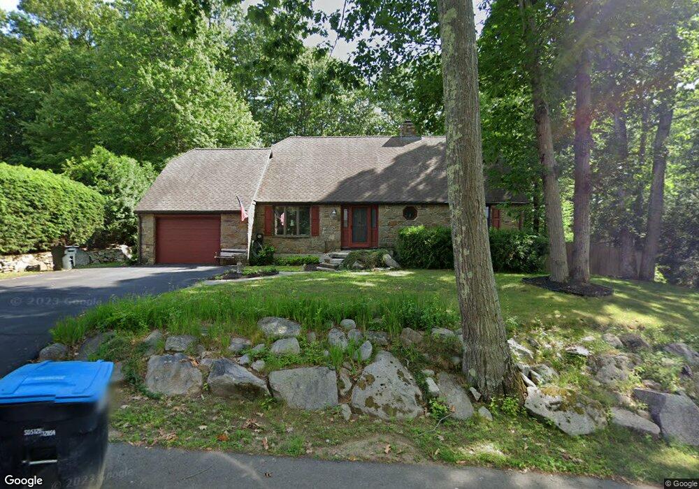
21 Old Cart Rd Auburn, MA 01501
Stoneville NeighborhoodEstimated Value: $601,000 - $753,000
4
Beds
4
Baths
2,513
Sq Ft
$263/Sq Ft
Est. Value
About This Home
This home is located at 21 Old Cart Rd, Auburn, MA 01501 and is currently estimated at $661,051, approximately $263 per square foot. 21 Old Cart Rd is a home located in Worcester County with nearby schools including Auburn Senior High School and Shrewsbury Montessori School - Auburn Campus.
Ownership History
Date
Name
Owned For
Owner Type
Purchase Details
Closed on
Sep 20, 2005
Sold by
Russell Judith M
Bought by
Russell John F
Current Estimated Value
Home Financials for this Owner
Home Financials are based on the most recent Mortgage that was taken out on this home.
Original Mortgage
$180,000
Interest Rate
5.84%
Mortgage Type
Purchase Money Mortgage
Purchase Details
Closed on
Nov 8, 1996
Sold by
Johnson Francis J and Johnson Jean C
Bought by
Russell Judith M
Create a Home Valuation Report for This Property
The Home Valuation Report is an in-depth analysis detailing your home's value as well as a comparison with similar homes in the area
Home Values in the Area
Average Home Value in this Area
Purchase History
| Date | Buyer | Sale Price | Title Company |
|---|---|---|---|
| Russell John F | $320,000 | -- | |
| Russell Judith M | $128,000 | -- |
Source: Public Records
Mortgage History
| Date | Status | Borrower | Loan Amount |
|---|---|---|---|
| Open | Russell Judith M | $144,000 | |
| Closed | Russell Judith M | $161,000 | |
| Closed | Russell John F | $180,000 |
Source: Public Records
Tax History Compared to Growth
Tax History
| Year | Tax Paid | Tax Assessment Tax Assessment Total Assessment is a certain percentage of the fair market value that is determined by local assessors to be the total taxable value of land and additions on the property. | Land | Improvement |
|---|---|---|---|---|
| 2025 | $78 | $545,000 | $125,700 | $419,300 |
| 2024 | $8,029 | $537,800 | $119,400 | $418,400 |
| 2023 | $7,924 | $499,000 | $108,500 | $390,500 |
| 2022 | $7,323 | $435,400 | $108,500 | $326,900 |
| 2021 | $7,151 | $394,200 | $95,700 | $298,500 |
| 2020 | $6,881 | $382,700 | $95,700 | $287,000 |
| 2019 | $6,552 | $355,700 | $94,800 | $260,900 |
| 2018 | $6,412 | $347,700 | $88,600 | $259,100 |
| 2017 | $6,060 | $330,400 | $80,300 | $250,100 |
| 2016 | $5,886 | $325,400 | $84,500 | $240,900 |
| 2015 | $5,323 | $308,400 | $84,500 | $223,900 |
| 2014 | $5,189 | $300,100 | $80,400 | $219,700 |
Source: Public Records
Map
Nearby Homes
- 23 Old Cart Rd
- 19 Old Cart Rd
- 20 Old Cart Rd
- 22 Old Cart Rd
- 18 Old Cart Rd
- 24 Old Cart Rd
- 28 Old Cart Rd
- 16 Old Cart Rd
- 25 Old Cart Rd
- 30 Old Cart Rd
- 15 Old Cart Rd
- 32 Briarcliff Dr
- 32 Old Cart Rd
- 14 Old Cart Rd
- 34 Old Cart Rd
- 13 Old Cart Rd
- 33 Old Cart Rd
- 34 Briarcliff Dr
- 35 Old Cart Rd
- 12 Old Cart Rd