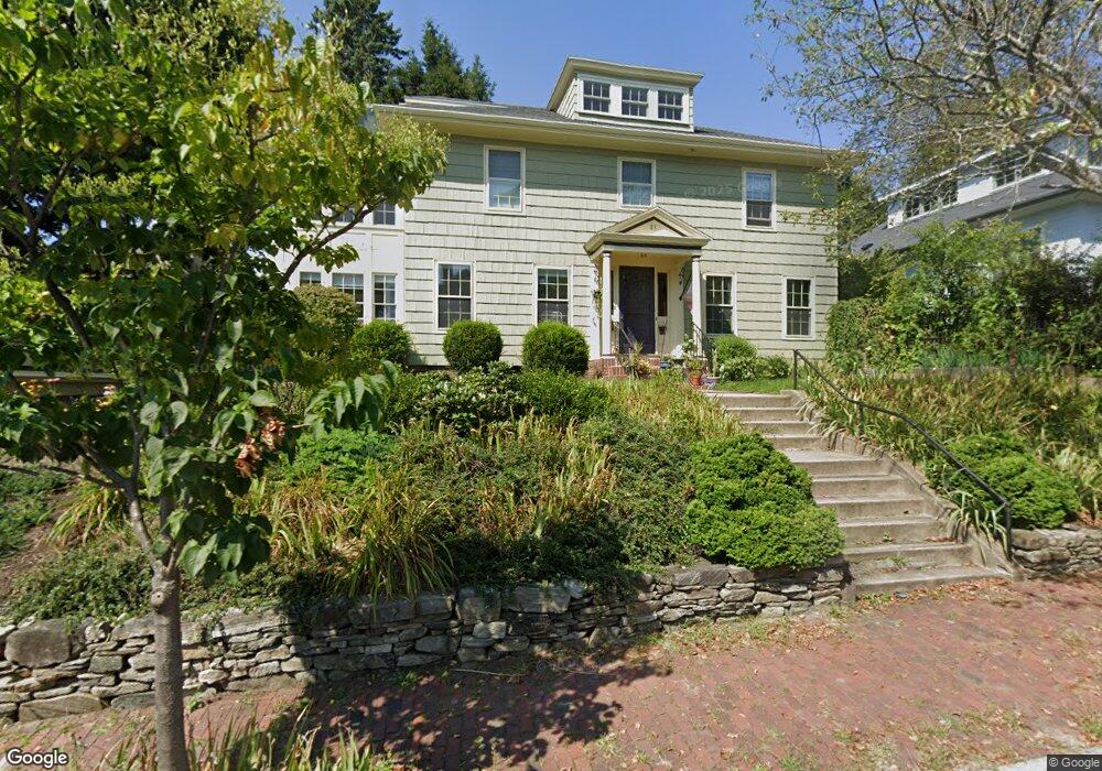
21 Orchard St Portland, ME 04102
West End NeighborhoodEstimated Value: $1,567,679 - $1,799,000
4
Beds
4
Baths
2,734
Sq Ft
$612/Sq Ft
Est. Value
About This Home
This home is located at 21 Orchard St, Portland, ME 04102 and is currently estimated at $1,673,170, approximately $611 per square foot. 21 Orchard St is a home located in Cumberland County with nearby schools including Howard C. Reiche Community School, King Middle School, and Baxter Academy for Tech & Sciences.
Ownership History
Date
Name
Owned For
Owner Type
Purchase Details
Closed on
Apr 1, 2010
Sold by
Hollander Peter E and Hollander Linda
Bought by
Fanburg Jonathan T and Gartner Stephanie D
Current Estimated Value
Home Financials for this Owner
Home Financials are based on the most recent Mortgage that was taken out on this home.
Original Mortgage
$340,000
Outstanding Balance
$225,777
Interest Rate
4.94%
Mortgage Type
Purchase Money Mortgage
Estimated Equity
$1,447,393
Create a Home Valuation Report for This Property
The Home Valuation Report is an in-depth analysis detailing your home's value as well as a comparison with similar homes in the area
Home Values in the Area
Average Home Value in this Area
Purchase History
| Date | Buyer | Sale Price | Title Company |
|---|---|---|---|
| Fanburg Jonathan T | -- | -- |
Source: Public Records
Mortgage History
| Date | Status | Borrower | Loan Amount |
|---|---|---|---|
| Open | Fanburg Jonathan T | $340,000 |
Source: Public Records
Tax History Compared to Growth
Tax History
| Year | Tax Paid | Tax Assessment Tax Assessment Total Assessment is a certain percentage of the fair market value that is determined by local assessors to be the total taxable value of land and additions on the property. | Land | Improvement |
|---|---|---|---|---|
| 2024 | $15,930 | $1,061,300 | $371,500 | $689,800 |
| 2023 | $15,293 | $1,061,300 | $371,500 | $689,800 |
| 2022 | $14,444 | $1,061,300 | $371,500 | $689,800 |
| 2021 | $12,091 | $930,800 | $371,500 | $559,300 |
| 2020 | $12,543 | $538,100 | $248,800 | $289,300 |
| 2019 | $12,543 | $538,100 | $248,800 | $289,300 |
| 2018 | $12,096 | $538,100 | $248,800 | $289,300 |
| 2017 | $11,650 | $538,100 | $248,800 | $289,300 |
| 2016 | $11,359 | $538,100 | $248,800 | $289,300 |
| 2015 | $11,101 | $538,100 | $248,800 | $289,300 |
| 2014 | $10,762 | $538,100 | $248,800 | $289,300 |
Source: Public Records
Map
Nearby Homes
- 26 Thomas St Unit 2
- 26 Thomas St Unit 7
- 278 Spring St
- 129 Pine St Unit 2
- 12 May St
- 151 Pine St Unit 4
- 93 Pine St
- 34 West St Unit 3
- 20 West St Unit 3
- 19 West St
- 64 Pine St Unit 303
- 64 Pine St Unit 201
- 64 Pine St Unit 301
- 64 Pine St Unit 401
- 64 Pine St Unit 403
- 64 Pine St Unit 203
- 209 Vaughan St Unit 7
- 53 Carleton St Unit 1
- 53 Carleton St Unit 3
- 53 Carleton St Unit 4