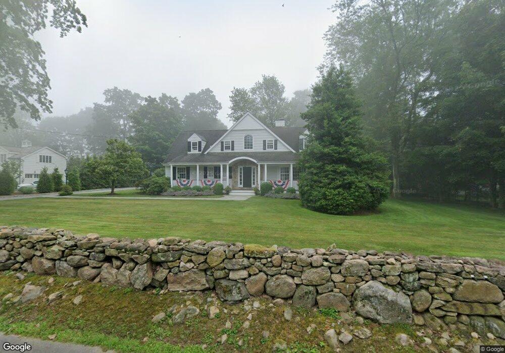
21 Overbrook Ln Darien, CT 06820
Estimated Value: $2,245,000 - $3,241,000
4
Beds
4
Baths
4,026
Sq Ft
$720/Sq Ft
Est. Value
About This Home
This home is located at 21 Overbrook Ln, Darien, CT 06820 and is currently estimated at $2,898,065, approximately $719 per square foot. 21 Overbrook Ln is a home located in Fairfield County with nearby schools including Royle Elementary School, Middlesex Middle School, and Darien High School.
Ownership History
Date
Name
Owned For
Owner Type
Purchase Details
Closed on
Sep 19, 2003
Sold by
White William M and White Donna S
Bought by
Spengler Timothy J and Spengler Megan D
Current Estimated Value
Purchase Details
Closed on
Mar 7, 2002
Sold by
Bonan Charles
Bought by
White William M and White Donna S
Purchase Details
Closed on
Nov 30, 2000
Sold by
Gorman Donald and Gorman Valerie L
Bought by
Bonan Charles
Create a Home Valuation Report for This Property
The Home Valuation Report is an in-depth analysis detailing your home's value as well as a comparison with similar homes in the area
Home Values in the Area
Average Home Value in this Area
Purchase History
| Date | Buyer | Sale Price | Title Company |
|---|---|---|---|
| Spengler Timothy J | $1,450,000 | -- | |
| White William M | $1,210,000 | -- | |
| Bonan Charles | $1,050,000 | -- |
Source: Public Records
Mortgage History
| Date | Status | Borrower | Loan Amount |
|---|---|---|---|
| Open | Bonan Charles | $891,000 | |
| Closed | Bonan Charles | $200,000 |
Source: Public Records
Tax History
| Year | Tax Paid | Tax Assessment Tax Assessment Total Assessment is a certain percentage of the fair market value that is determined by local assessors to be the total taxable value of land and additions on the property. | Land | Improvement |
|---|---|---|---|---|
| 2025 | $25,345 | $1,637,300 | $776,930 | $860,370 |
| 2024 | $24,052 | $1,637,300 | $776,930 | $860,370 |
| 2023 | $22,365 | $1,270,010 | $554,960 | $715,050 |
| 2022 | $21,882 | $1,270,010 | $554,960 | $715,050 |
| 2021 | $13,305 | $1,270,010 | $554,960 | $715,050 |
| 2020 | $20,777 | $1,270,010 | $554,960 | $715,050 |
| 2019 | $20,917 | $1,270,010 | $554,960 | $715,050 |
| 2018 | $1,115 | $1,289,820 | $645,190 | $644,630 |
| 2017 | $20,843 | $1,289,820 | $645,190 | $644,630 |
| 2016 | $20,340 | $1,289,820 | $645,190 | $644,630 |
| 2015 | $19,799 | $1,289,820 | $645,190 | $644,630 |
| 2014 | $19,360 | $1,289,820 | $645,190 | $644,630 |
Source: Public Records
Map
Nearby Homes
- 7 Buttonwood Ln
- 25 Lakeside Ave
- 9 Point o Woods Rd S
- 10 Stony Brook Rd
- 29 Richmond Dr
- 12 Dellwood Rd
- 19 Circle Rd
- 26 Holly Ln
- 2 Settlers Trail Unit 2
- 561 Middlesex Rd
- 171 Raymond St
- 97 Richards Ave Unit B10
- 5 Shields Ln
- 304 Brookside Rd
- 105 Richards Ave Unit 1407
- 49 Salisbury Rd
- 3 Revere Rd
- 44 Andrews Dr
- 15 Marianne Rd
- 2 Red Rose Cir
- 19 Overbrook Ln
- 152 Mansfield Ave
- 25 Overbrook Ln
- 148 Mansfield Ave
- 144 Mansfield Ave
- 17 Overbrook Ln
- 22 Overbrook Ln
- 24 Overbrook Ln
- 161 Mansfield Ave
- 134 Mansfield Ave
- 50 Sunset Rd
- 157 Mansfield Ave
- 20 Overbrook Ln
- 138 Mansfield Ave
- 3 Knollwood Ln
- 18 Overbrook Ln
- 44 Sunset Rd
- 11 Overbrook Ln
- 6 Knollwood Ln
- 16 Overbrook Ln
Your Personal Tour Guide
Ask me questions while you tour the home.