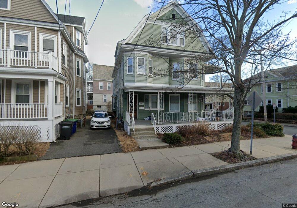
21 Packard Ave Somerville, MA 02144
Davis Square NeighborhoodEstimated Value: $1,406,000 - $1,860,684
7
Beds
2
Baths
3,143
Sq Ft
$498/Sq Ft
Est. Value
About This Home
This home is located at 21 Packard Ave, Somerville, MA 02144 and is currently estimated at $1,564,671, approximately $497 per square foot. 21 Packard Ave is a home located in Middlesex County with nearby schools including Somerville High School, Benjamin Banneker Charter Public School, and St. Clement Elementary School.
Ownership History
Date
Name
Owned For
Owner Type
Purchase Details
Closed on
Sep 5, 2024
Sold by
Mcdonagh Thomas M
Bought by
Ionamac Properties Llc
Current Estimated Value
Purchase Details
Closed on
Mar 30, 2007
Sold by
Shallah Joyce E
Bought by
Mcdonagh Thomas M
Home Financials for this Owner
Home Financials are based on the most recent Mortgage that was taken out on this home.
Original Mortgage
$472,500
Interest Rate
6.33%
Mortgage Type
Purchase Money Mortgage
Create a Home Valuation Report for This Property
The Home Valuation Report is an in-depth analysis detailing your home's value as well as a comparison with similar homes in the area
Home Values in the Area
Average Home Value in this Area
Purchase History
| Date | Buyer | Sale Price | Title Company |
|---|---|---|---|
| Ionamac Properties Llc | -- | None Available | |
| Ionamac Properties Llc | -- | None Available | |
| Mcdonagh Thomas M | $635,000 | -- | |
| Mcdonagh Thomas M | $635,000 | -- |
Source: Public Records
Mortgage History
| Date | Status | Borrower | Loan Amount |
|---|---|---|---|
| Previous Owner | Mcdonagh Thomas M | $460,000 | |
| Previous Owner | Mcdonagh Thomas M | $472,500 | |
| Previous Owner | Mcdonagh Thomas M | $30,000 | |
| Previous Owner | Mcdonagh Thomas M | $100,000 |
Source: Public Records
Tax History
| Year | Tax Paid | Tax Assessment Tax Assessment Total Assessment is a certain percentage of the fair market value that is determined by local assessors to be the total taxable value of land and additions on the property. | Land | Improvement |
|---|---|---|---|---|
| 2025 | $16,452 | $1,508,000 | $707,100 | $800,900 |
| 2024 | $15,714 | $1,493,700 | $707,100 | $786,600 |
| 2023 | $14,888 | $1,439,800 | $707,100 | $732,700 |
| 2022 | $14,023 | $1,377,500 | $673,400 | $704,100 |
| 2021 | $13,586 | $1,333,300 | $668,500 | $664,800 |
| 2020 | $13,060 | $1,294,400 | $668,900 | $625,500 |
| 2019 | $12,320 | $1,145,000 | $608,900 | $536,100 |
| 2018 | $11,270 | $996,500 | $553,600 | $442,900 |
| 2017 | $11,061 | $947,800 | $522,300 | $425,500 |
| 2016 | $10,699 | $853,900 | $466,400 | $387,500 |
| 2015 | $10,270 | $814,400 | $430,700 | $383,700 |
Source: Public Records
Map
Nearby Homes
- 42 Packard Ave Unit 42
- 55 Packard Ave Unit 1
- 69 Electric Ave Unit 3
- 106 Electric Ave Unit 3
- 1004 Broadway Unit 3
- 1188 Broadway Unit 403
- 30 Clarendon Ave
- 183 Powder House Blvd
- 202 Powder House Blvd Unit 1
- 202 Powder House Blvd Unit 2
- 34 Elmwood St Unit 2
- 14 Farragut Ave Unit 1
- 12 Upland Rd
- 233 Powder House Blvd
- 6 Hamilton Rd Unit 6
- 111 Pearson Rd
- 83 Conwell Ave Unit 1
- 3 Tannery Brook Row Unit 11
- 25 Upland Rd
- 11 Tannery Brook Row Unit 3
- 23 Packard Ave
- 51 Whitman St
- 17 Packard Ave Unit 1
- 17 Packard Ave
- 15 Packard Ave Unit 2
- 15 Packard Ave Unit 15
- 27 Packard Ave
- 27 Packard Ave Unit 2
- 47 Whitman St Unit 2
- 47 Whitman St Unit 1
- 47 Whitman St
- 52 Whitman St
- 9 Packard Ave
- 9 Packard Ave Unit 1
- 50 Whitman St
- 29 Packard Ave Unit 1
- 29 Packard Ave Unit 2
- 52 Electric Ave
- 52 Electric Ave Unit 2
- 20 Packard Ave
Your Personal Tour Guide
Ask me questions while you tour the home.