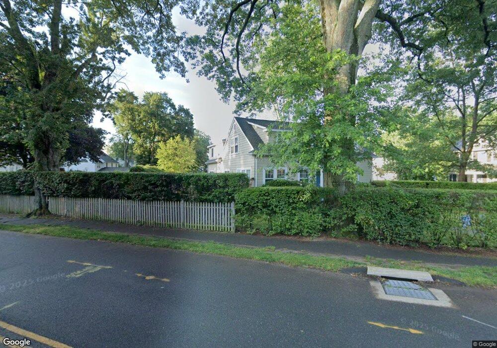
21 Park Ln Darien, CT 06820
Estimated Value: $1,621,000 - $2,130,770
4
Beds
3
Baths
2,822
Sq Ft
$642/Sq Ft
Est. Value
About This Home
This home is located at 21 Park Ln, Darien, CT 06820 and is currently estimated at $1,812,443, approximately $642 per square foot. 21 Park Ln is a home located in Fairfield County with nearby schools including Holmes Elementary School, Middlesex Middle School, and Darien High School.
Ownership History
Date
Name
Owned For
Owner Type
Purchase Details
Closed on
Jan 23, 2007
Sold by
Given Erik W and Given Sloane T
Bought by
Olsen Mark and Olsen Courtney A
Current Estimated Value
Home Financials for this Owner
Home Financials are based on the most recent Mortgage that was taken out on this home.
Original Mortgage
$632,000
Interest Rate
6.14%
Purchase Details
Closed on
Feb 5, 1999
Sold by
Heck Charles B and Heck Joyce R
Bought by
Ellis Ian P and Ellis Pippa J
Create a Home Valuation Report for This Property
The Home Valuation Report is an in-depth analysis detailing your home's value as well as a comparison with similar homes in the area
Home Values in the Area
Average Home Value in this Area
Purchase History
We collect this data history from publicly available records. To have your information removed, we recommend requesting removal directly through your county’s website.
| Date | Buyer | Sale Price | Title Company |
|---|---|---|---|
| Olsen Mark | $790,000 | -- | |
| Ellis Ian P | $410,000 | -- |
Source: Public Records
Mortgage History
We collect this data history from publicly available records. To have your information removed, we recommend requesting removal directly through your county’s website.
| Date | Status | Borrower | Loan Amount |
|---|---|---|---|
| Open | Ellis Ian P | $600,000 | |
| Closed | Ellis Ian P | $615,000 | |
| Closed | Ellis Ian P | $632,000 |
Source: Public Records
Tax History
| Year | Tax Paid | Tax Assessment Tax Assessment Total Assessment is a certain percentage of the fair market value that is determined by local assessors to be the total taxable value of land and additions on the property. | Land | Improvement |
|---|---|---|---|---|
| 2025 | $15,582 | $1,006,600 | $670,250 | $336,350 |
| 2024 | $14,787 | $1,006,600 | $670,250 | $336,350 |
| 2023 | $12,861 | $730,310 | $446,880 | $283,430 |
| 2022 | $12,583 | $730,310 | $446,880 | $283,430 |
| 2021 | $6,279 | $730,310 | $446,880 | $283,430 |
| 2020 | $6,391 | $730,310 | $446,880 | $283,430 |
| 2019 | $12,028 | $730,310 | $446,880 | $283,430 |
| 2018 | $9,070 | $564,060 | $449,470 | $114,590 |
| 2017 | $6,331 | $564,060 | $449,470 | $114,590 |
| 2016 | $8,895 | $564,060 | $449,470 | $114,590 |
| 2015 | $8,658 | $564,060 | $449,470 | $114,590 |
| 2014 | $8,467 | $564,060 | $449,470 | $114,590 |
Source: Public Records
Map
Nearby Homes
- 6 Park Ln
- 150 Holmes Ave
- 3 Abbey Rd
- 76 Maple Tree Ave Unit 5
- 34 Intervale Rd
- 5 Middlesex Rd
- 30 Maple Tree Ave Unit B
- 39 Maple Tree Ave Unit 26
- 39 Maple Tree Ave Unit 60
- 39 Maple Tree Ave Unit 40
- 39 Maple Tree Ave Unit 1
- 39 Maple Tree Ave Unit 15
- 18 Phillips Ln
- 19 Chester Rd
- 35 Hazel St
- 30 Lenox Ave
- 43 Phillips Ln
- 34 Crescent St Unit 2D
- 333 West Ave Unit 6
- 455 Hope St Unit 3E
Your Personal Tour Guide
Ask me questions while you tour the home.