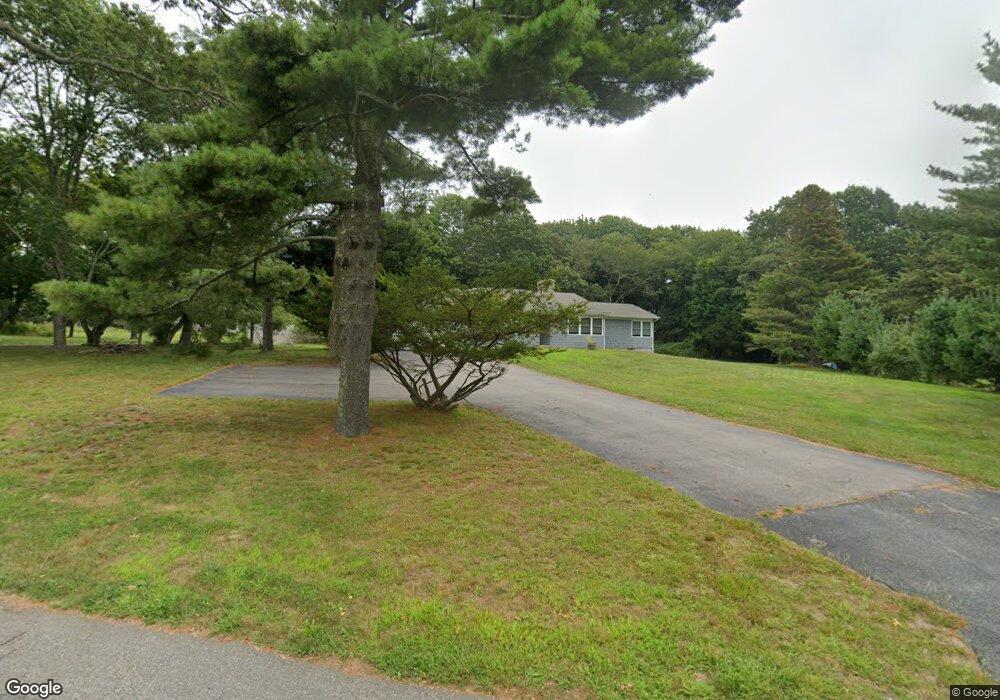
21 Peckham Ave Wakefield, RI 02879
Estimated Value: $512,000 - $743,000
3
Beds
3
Baths
1,473
Sq Ft
$406/Sq Ft
Est. Value
About This Home
This home is located at 21 Peckham Ave, Wakefield, RI 02879 and is currently estimated at $597,963, approximately $405 per square foot. 21 Peckham Ave is a home located in Washington County with nearby schools including South Kingstown High School, Monsignor Matthew Clarke Catholic Regional School, and Bradley School-South.
Ownership History
Date
Name
Owned For
Owner Type
Purchase Details
Closed on
Nov 30, 2018
Sold by
Crook Rita M
Bought by
Crook Matthew C and Crook Leonora A
Current Estimated Value
Purchase Details
Closed on
Apr 2, 2013
Sold by
Crook Nelson C
Bought by
Crook Nelson C and Crook Rita M
Purchase Details
Closed on
Feb 13, 1987
Bought by
Crook Nelson C and Crook Rita M
Create a Home Valuation Report for This Property
The Home Valuation Report is an in-depth analysis detailing your home's value as well as a comparison with similar homes in the area
Home Values in the Area
Average Home Value in this Area
Purchase History
| Date | Buyer | Sale Price | Title Company |
|---|---|---|---|
| Crook Matthew C | $275,000 | -- | |
| Crook Nelson C | -- | -- | |
| Crook Nelson C | -- | -- |
Source: Public Records
Mortgage History
| Date | Status | Borrower | Loan Amount |
|---|---|---|---|
| Previous Owner | Crook Nelson C | $25,000 | |
| Previous Owner | Crook Nelson C | $70,000 | |
| Previous Owner | Crook Nelson C | $75,900 |
Source: Public Records
Tax History
| Year | Tax Paid | Tax Assessment Tax Assessment Total Assessment is a certain percentage of the fair market value that is determined by local assessors to be the total taxable value of land and additions on the property. | Land | Improvement |
|---|---|---|---|---|
| 2025 | $3,702 | $414,100 | $193,600 | $220,500 |
| 2024 | $3,644 | $329,800 | $148,800 | $181,000 |
| 2023 | $3,644 | $329,800 | $148,800 | $181,000 |
| 2022 | $3,611 | $329,800 | $148,800 | $181,000 |
| 2021 | $3,838 | $265,600 | $129,200 | $136,400 |
| 2020 | $3,838 | $265,600 | $129,200 | $136,400 |
| 2019 | $3,838 | $265,600 | $129,200 | $136,400 |
| 2018 | $3,769 | $240,400 | $120,200 | $120,200 |
| 2017 | $3,681 | $240,400 | $120,200 | $120,200 |
| 2016 | $3,628 | $240,400 | $120,200 | $120,200 |
| 2015 | $3,703 | $238,600 | $117,500 | $121,100 |
| 2014 | $3,694 | $238,600 | $117,500 | $121,100 |
Source: Public Records
Map
Nearby Homes
- 143 Summit Ave
- 45 Cherry Ln Unit C
- 39 Hazard Ave
- 50 Shadow Farm Way
- 13 Prospect Ave
- 20 Cleveland St
- 15 Jessica Ln
- 37 Columbia St
- 137 Kingstown Rd
- 131 Columbia St
- 56 Wanda St
- 54 Othmar St
- 66 Christopher St
- 216 S Pier Rd
- 40 Northup St
- 48 Stone Bridge Dr
- 301 Church St Unit 103
- 10 Pier Market Place Unit 10
- 0 Blossom Way Unit 1402677
- 140 S Pier Rd
- 5 Peckham Ave
- 0 Narragansett Ave
- 31 Peckham Ave
- 0 Peckham Ave
- 29 Peckham Ave
- 180 Narragansett Ave E
- 169 Narragansett Ave E
- 143 Narragansett Ave E
- 196 Narragansett Ave E
- 120 Narragansett Ave W
- 33 Peckham Ave
- 121 Narragansett Ave W
- 11 Border Dr
- 20 River Heights Dr
- 0 River Heights Dr
- 23 Border Dr
- 37 Border Dr
- 110 Narragansett Ave W
- 63 Border Dr
- 104 Narragansett Ave W
Your Personal Tour Guide
Ask me questions while you tour the home.