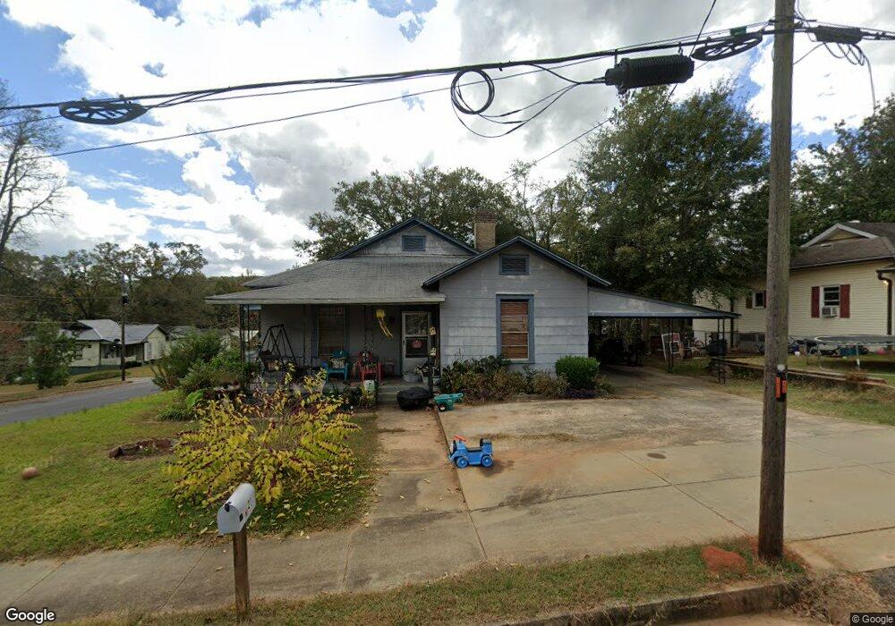
21 Perry St Manchester, GA 31816
Estimated Value: $102,000 - $147,000
3
Beds
2
Baths
1,974
Sq Ft
$62/Sq Ft
Est. Value
About This Home
This home is located at 21 Perry St, Manchester, GA 31816 and is currently estimated at $122,390, approximately $62 per square foot. 21 Perry St is a home located in Meriwether County with nearby schools including Mountain View Elementary School, Manchester Middle School, and Manchester High School.
Ownership History
Date
Name
Owned For
Owner Type
Purchase Details
Closed on
Sep 27, 2013
Sold by
Barlow Donna G
Bought by
Garrett Robin
Current Estimated Value
Home Financials for this Owner
Home Financials are based on the most recent Mortgage that was taken out on this home.
Original Mortgage
$48,979
Outstanding Balance
$36,847
Interest Rate
4.53%
Mortgage Type
New Conventional
Estimated Equity
$85,543
Purchase Details
Closed on
Nov 18, 2002
Sold by
Gilson Annette M
Bought by
Barlow Donna Y Etal
Purchase Details
Closed on
Jan 1, 1947
Bought by
Gilson Roy B and Gilson Annet
Create a Home Valuation Report for This Property
The Home Valuation Report is an in-depth analysis detailing your home's value as well as a comparison with similar homes in the area
Home Values in the Area
Average Home Value in this Area
Purchase History
| Date | Buyer | Sale Price | Title Company |
|---|---|---|---|
| Garrett Robin | $48,000 | -- | |
| Barlow Donna Y Etal | -- | -- | |
| Gilson Annette M | -- | -- | |
| Gilson Roy B | -- | -- |
Source: Public Records
Mortgage History
| Date | Status | Borrower | Loan Amount |
|---|---|---|---|
| Open | Garrett Robin | $48,979 |
Source: Public Records
Tax History Compared to Growth
Tax History
| Year | Tax Paid | Tax Assessment Tax Assessment Total Assessment is a certain percentage of the fair market value that is determined by local assessors to be the total taxable value of land and additions on the property. | Land | Improvement |
|---|---|---|---|---|
| 2024 | $513 | $15,640 | $1,960 | $13,680 |
| 2023 | $522 | $15,640 | $1,960 | $13,680 |
| 2022 | $522 | $15,640 | $1,960 | $13,680 |
| 2021 | $436 | $15,640 | $1,960 | $13,680 |
| 2020 | $440 | $15,640 | $1,960 | $13,680 |
| 2019 | $441 | $15,640 | $1,960 | $13,680 |
| 2018 | $509 | $15,640 | $1,960 | $13,680 |
| 2017 | $516 | $15,640 | $1,960 | $13,680 |
| 2016 | $515 | $15,640 | $1,960 | $13,680 |
| 2015 | $516 | $15,640 | $1,960 | $13,680 |
| 2014 | $633 | $23,480 | $1,960 | $21,520 |
| 2013 | -- | $23,480 | $1,960 | $21,520 |
Source: Public Records
Map
Nearby Homes
- 94 Cato St
- 16 North St
- 21 North St
- 77 Cordwood St
- 12 Truitt St
- 322 Chalybeate St
- 900 Mountain Ridge Dr Unit 4.89 ACRES
- 13.27 ACRES Roosevelt Hwy
- 603 Atlantic St
- 304 4th St
- 380 Elm St
- 408 Broad St
- 802 Jd Parham Dr
- 3.26 ACRES Mountain Ridge Dr
- 919 L S Glencamp Way
- 522 4th St
- 305 Holy Hill Place
- 200 Hunt Cir
- 514 Farris Blvd
- 617 Mayes Way