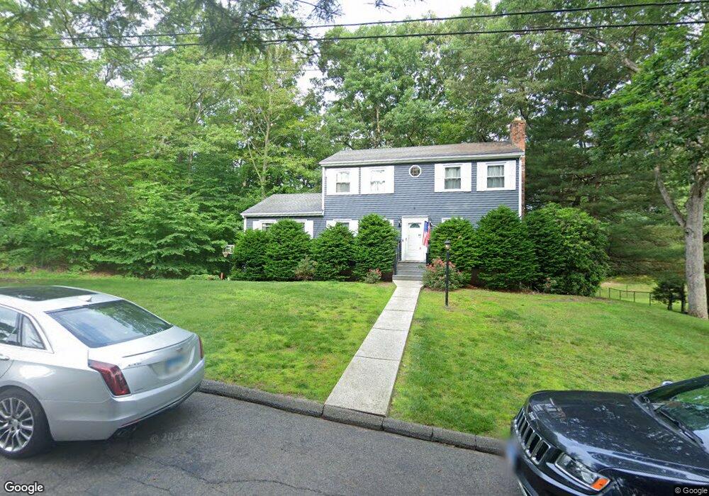
21 Pheasant Dr Seymour, CT 06483
Estimated Value: $457,622 - $516,000
4
Beds
4
Baths
2,026
Sq Ft
$235/Sq Ft
Est. Value
About This Home
This home is located at 21 Pheasant Dr, Seymour, CT 06483 and is currently estimated at $476,406, approximately $235 per square foot. 21 Pheasant Dr is a home located in New Haven County with nearby schools including Seymour Middle School, Seymour High School, and Assumption School.
Ownership History
Date
Name
Owned For
Owner Type
Purchase Details
Closed on
Jul 21, 1998
Sold by
Oconnell Donald J and Oconnell Susan
Bought by
Whitehead Geraldine B
Current Estimated Value
Create a Home Valuation Report for This Property
The Home Valuation Report is an in-depth analysis detailing your home's value as well as a comparison with similar homes in the area
Home Values in the Area
Average Home Value in this Area
Purchase History
| Date | Buyer | Sale Price | Title Company |
|---|---|---|---|
| Whitehead Geraldine B | $195,000 | -- | |
| Whitehead Geraldine B | $195,000 | -- |
Source: Public Records
Mortgage History
| Date | Status | Borrower | Loan Amount |
|---|---|---|---|
| Open | Whitehead Geraldine B | $208,860 | |
| Closed | Whitehead Geraldine B | $224,000 | |
| Closed | Whitehead Geraldine B | $125,250 |
Source: Public Records
Tax History
| Year | Tax Paid | Tax Assessment Tax Assessment Total Assessment is a certain percentage of the fair market value that is determined by local assessors to be the total taxable value of land and additions on the property. | Land | Improvement |
|---|---|---|---|---|
| 2025 | $7,226 | $260,680 | $53,410 | $207,270 |
| 2024 | $6,981 | $189,490 | $44,800 | $144,690 |
| 2023 | $6,818 | $189,490 | $44,800 | $144,690 |
| 2022 | $6,744 | $189,490 | $44,800 | $144,690 |
| 2021 | $6,577 | $189,490 | $44,800 | $144,690 |
| 2020 | $6,255 | $173,740 | $52,710 | $121,030 |
| 2019 | $6,255 | $173,740 | $52,710 | $121,030 |
| 2018 | $6,255 | $173,740 | $52,710 | $121,030 |
| 2017 | $6,255 | $173,740 | $52,710 | $121,030 |
| 2016 | $6,255 | $173,740 | $52,710 | $121,030 |
| 2015 | $6,346 | $183,470 | $57,750 | $125,720 |
| 2014 | $6,245 | $183,470 | $57,750 | $125,720 |
Source: Public Records
Map
Nearby Homes
- 24 Byron Ave
- 129 Old Ansonia Rd
- 208 Bungay Rd
- 44 Morningside Dr
- 44 Woodlawn Ave
- 7 Old Town Rd
- 387 S Main St
- 257 N State St
- 222 1/2 N State St
- 10 Ells St
- 38 Winter St
- 22 Woodbridge Ave
- 33 Steep Hill Rd
- 29 Moss Ave Unit 23
- 278 S Main St
- 28 Elmwood Dr
- 174 1/2 Prospect St
- 50 Bissell Place
- 169 Derby Ave
- 32 La Rovera Terrace
Your Personal Tour Guide
Ask me questions while you tour the home.