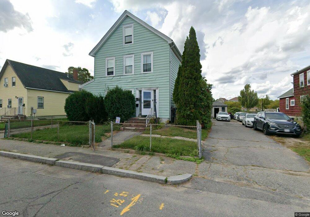
21 Porter St Taunton, MA 02780
Estimated Value: $406,000 - $646,000
5
Beds
3
Baths
2,525
Sq Ft
$219/Sq Ft
Est. Value
About This Home
This home is located at 21 Porter St, Taunton, MA 02780 and is currently estimated at $553,629, approximately $219 per square foot. 21 Porter St is a home located in Bristol County with nearby schools including H. H. Galligan School, Taunton High School, and John F. Parker Middle School.
Ownership History
Date
Name
Owned For
Owner Type
Purchase Details
Closed on
Feb 1, 2002
Sold by
Department Of Housing & Urban Dev
Bought by
Blanchard Jason and Blanchard Joshua
Current Estimated Value
Home Financials for this Owner
Home Financials are based on the most recent Mortgage that was taken out on this home.
Original Mortgage
$165,003
Outstanding Balance
$68,661
Interest Rate
7.15%
Mortgage Type
Purchase Money Mortgage
Estimated Equity
$484,968
Purchase Details
Closed on
May 31, 2001
Sold by
Suberu Ismaila
Bought by
Wells Fargo Home Mtg
Purchase Details
Closed on
Apr 30, 1996
Sold by
Silva Manuel A and Dasilva Natividad J
Bought by
Suberu Ismaila
Home Financials for this Owner
Home Financials are based on the most recent Mortgage that was taken out on this home.
Original Mortgage
$122,751
Interest Rate
7.81%
Mortgage Type
Purchase Money Mortgage
Create a Home Valuation Report for This Property
The Home Valuation Report is an in-depth analysis detailing your home's value as well as a comparison with similar homes in the area
Home Values in the Area
Average Home Value in this Area
Purchase History
| Date | Buyer | Sale Price | Title Company |
|---|---|---|---|
| Blanchard Jason | $165,000 | -- | |
| Wells Fargo Home Mtg | $139,127 | -- | |
| Suberu Ismaila | $123,700 | -- |
Source: Public Records
Mortgage History
| Date | Status | Borrower | Loan Amount |
|---|---|---|---|
| Open | Suberu Ismaila | $165,003 | |
| Previous Owner | Suberu Ismaila | $122,751 | |
| Previous Owner | Suberu Ismaila | $122,484 |
Source: Public Records
Tax History Compared to Growth
Tax History
| Year | Tax Paid | Tax Assessment Tax Assessment Total Assessment is a certain percentage of the fair market value that is determined by local assessors to be the total taxable value of land and additions on the property. | Land | Improvement |
|---|---|---|---|---|
| 2025 | $5,480 | $500,900 | $101,800 | $399,100 |
| 2024 | $5,000 | $446,800 | $101,800 | $345,000 |
| 2023 | $4,648 | $385,700 | $101,800 | $283,900 |
| 2022 | $4,179 | $317,100 | $84,900 | $232,200 |
| 2021 | $4,051 | $285,300 | $77,200 | $208,100 |
| 2020 | $3,936 | $264,900 | $77,200 | $187,700 |
| 2019 | $3,563 | $226,100 | $77,200 | $148,900 |
| 2018 | $3,414 | $217,200 | $77,600 | $139,600 |
| 2017 | $3,147 | $200,300 | $73,600 | $126,700 |
| 2016 | $3,018 | $192,500 | $71,400 | $121,100 |
| 2015 | $2,715 | $180,900 | $71,100 | $109,800 |
| 2014 | $2,628 | $179,900 | $70,100 | $109,800 |
Source: Public Records
Map
Nearby Homes
- 19 Mason St
- 46 Harrison St Unit 4
- 278 Cohannet St
- 98 Winthrop St
- 39 Myrtle St
- 48 Oak St
- 16 Clinton St
- 72 Barnum St
- 132 Winthrop St
- 16 Kilton St
- 48 Taunton Green
- 22 Everett St
- 26 Kilmer Ave
- 0, M64 L51 Knapp St
- 0 M64 L39 Knapp St
- 0, M64 L49 Knapp St
- 0, M64 L50 Knapp St
- 5 Dean Ave
- 51 Shores St
- 215 High St Unit 21
- 19 Porter St
- 23 Porter St
- 25 Porter St
- 25 Porter St Unit 2
- 17 Porter St
- 25 1/2 Porter St Unit 3
- 25 1/2 Porter St Unit 1
- 27 Porter St
- 12 Porter St
- 12 Porter St Unit A-C
- 21 Mason St
- 23 Mason St
- 29 Porter St
- 20 Porter St
- 7 Mason St Unit 2
- 7 Mason St Unit 1R
- 193 Cohannet St
- 199 Cohannet St
- 167 Cohannet St
- 20 Mason St