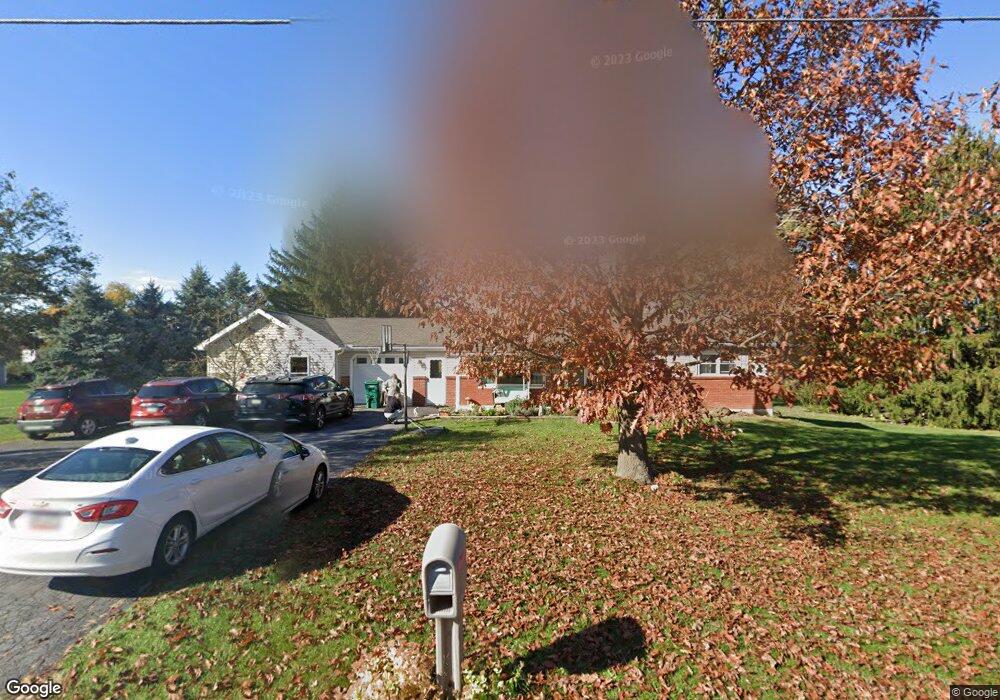
21 Ridge Dr Carlisle, PA 17015
Estimated Value: $311,000 - $416,000
3
Beds
2
Baths
2,148
Sq Ft
$167/Sq Ft
Est. Value
About This Home
This home is located at 21 Ridge Dr, Carlisle, PA 17015 and is currently estimated at $358,261, approximately $166 per square foot. 21 Ridge Dr is a home located in Cumberland County with nearby schools including Middlesex Elementary School, Eagle View Middle School, and Cumberland Valley High School.
Ownership History
Date
Name
Owned For
Owner Type
Purchase Details
Closed on
Jun 17, 2016
Sold by
Deitch Ralph L and Deitch Linda K
Bought by
Brown Brian Michael and Brown Chevonne T
Current Estimated Value
Home Financials for this Owner
Home Financials are based on the most recent Mortgage that was taken out on this home.
Original Mortgage
$166,920
Outstanding Balance
$131,977
Interest Rate
3.37%
Mortgage Type
FHA
Estimated Equity
$226,284
Purchase Details
Closed on
Jun 12, 2012
Sold by
Knouse Michael
Bought by
Deitch Ralph L
Home Financials for this Owner
Home Financials are based on the most recent Mortgage that was taken out on this home.
Original Mortgage
$155,000
Interest Rate
3.84%
Mortgage Type
Construction
Purchase Details
Closed on
Oct 22, 1999
Sold by
Walter Harold E
Bought by
Knouse Michael D
Home Financials for this Owner
Home Financials are based on the most recent Mortgage that was taken out on this home.
Original Mortgage
$94,400
Interest Rate
7.83%
Create a Home Valuation Report for This Property
The Home Valuation Report is an in-depth analysis detailing your home's value as well as a comparison with similar homes in the area
Home Values in the Area
Average Home Value in this Area
Purchase History
| Date | Buyer | Sale Price | Title Company |
|---|---|---|---|
| Brown Brian Michael | $170,000 | Attorney | |
| Deitch Ralph L | $155,000 | -- | |
| Knouse Michael D | $118,000 | -- |
Source: Public Records
Mortgage History
| Date | Status | Borrower | Loan Amount |
|---|---|---|---|
| Open | Brown Brian Michael | $166,920 | |
| Previous Owner | Deitch Ralph L | $155,000 | |
| Previous Owner | Knouse Michael D | $94,400 |
Source: Public Records
Tax History Compared to Growth
Tax History
| Year | Tax Paid | Tax Assessment Tax Assessment Total Assessment is a certain percentage of the fair market value that is determined by local assessors to be the total taxable value of land and additions on the property. | Land | Improvement |
|---|---|---|---|---|
| 2025 | $3,614 | $206,900 | $54,000 | $152,900 |
| 2024 | $3,452 | $206,900 | $54,000 | $152,900 |
| 2023 | $3,276 | $206,900 | $54,000 | $152,900 |
| 2022 | $3,098 | $206,900 | $54,000 | $152,900 |
| 2021 | $3,035 | $206,900 | $54,000 | $152,900 |
| 2020 | $2,981 | $206,900 | $54,000 | $152,900 |
| 2019 | $2,935 | $206,900 | $54,000 | $152,900 |
| 2018 | $2,358 | $171,800 | $54,000 | $117,800 |
| 2017 | $2,263 | $171,800 | $54,000 | $117,800 |
| 2016 | -- | $171,800 | $54,000 | $117,800 |
| 2015 | -- | $171,800 | $54,000 | $117,800 |
| 2014 | -- | $171,800 | $54,000 | $117,800 |
Source: Public Records
Map
Nearby Homes
- 320 S Middlesex Rd
- 23 Tiffany Dr
- 105 Hickory Rd
- 13 Eastwood Dr
- 265 Old Stonehouse Rd N
- 111 N Old Stonehouse Rd
- 19 Silo St
- 18 Snap Dragon Rd
- 21 Snap Dragon Rd
- 15 Snap Dragon Rd
- 9 Snap Dragon Rd
- 7 Snap Dragon Rd
- 3 Granary Rd
- 5 Granary Rd
- 7 Granary Rd
- 9 Granary Rd
- 7 Sage St
- 10 Charolais St
- 12 Charolais St
- 14 Charolais St