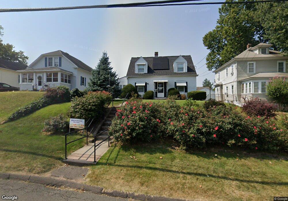
21 Ridge Rd Middletown, CT 06457
Estimated Value: $316,000 - $349,597
2
Beds
4
Baths
1,238
Sq Ft
$269/Sq Ft
Est. Value
About This Home
This home is located at 21 Ridge Rd, Middletown, CT 06457 and is currently estimated at $333,149, approximately $269 per square foot. 21 Ridge Rd is a home located in Middlesex County with nearby schools including Farm Hill School and St John Paul II School.
Ownership History
Date
Name
Owned For
Owner Type
Purchase Details
Closed on
Jan 29, 2015
Sold by
Magnano Jeff W and Magnano Lisa A
Bought by
Magnano Jeff W and Magnano Lisa A
Current Estimated Value
Purchase Details
Closed on
May 14, 2004
Sold by
Es Crowell Frederick W and Raczka Theodore V
Bought by
Magnano Jeff W and Magnano Lisa A
Home Financials for this Owner
Home Financials are based on the most recent Mortgage that was taken out on this home.
Original Mortgage
$135,200
Interest Rate
4.37%
Create a Home Valuation Report for This Property
The Home Valuation Report is an in-depth analysis detailing your home's value as well as a comparison with similar homes in the area
Home Values in the Area
Average Home Value in this Area
Purchase History
| Date | Buyer | Sale Price | Title Company |
|---|---|---|---|
| Magnano Jeff W | -- | -- | |
| Magnano Jeff W | $169,000 | -- |
Source: Public Records
Mortgage History
| Date | Status | Borrower | Loan Amount |
|---|---|---|---|
| Previous Owner | Magnano Jeff W | $70,000 | |
| Previous Owner | Magnano Jeff W | $135,200 | |
| Previous Owner | Magnano Jeff W | $33,800 |
Source: Public Records
Tax History Compared to Growth
Tax History
| Year | Tax Paid | Tax Assessment Tax Assessment Total Assessment is a certain percentage of the fair market value that is determined by local assessors to be the total taxable value of land and additions on the property. | Land | Improvement |
|---|---|---|---|---|
| 2025 | $6,893 | $186,230 | $60,970 | $125,260 |
| 2024 | $6,595 | $186,230 | $60,970 | $125,260 |
| 2023 | $6,259 | $186,230 | $60,970 | $125,260 |
| 2022 | $5,332 | $129,250 | $38,510 | $90,740 |
| 2021 | $5,309 | $129,250 | $38,510 | $90,740 |
| 2020 | $5,300 | $129,250 | $38,510 | $90,740 |
| 2019 | $5,325 | $129,250 | $38,510 | $90,740 |
| 2018 | $5,142 | $129,250 | $38,510 | $90,740 |
| 2017 | $4,361 | $112,740 | $39,410 | $73,330 |
| 2016 | $4,273 | $112,740 | $39,410 | $73,330 |
| 2015 | $3,848 | $103,820 | $36,280 | $67,540 |
| 2014 | $3,845 | $103,820 | $36,280 | $67,540 |
Source: Public Records
Map
Nearby Homes
- 37 Front St
- 154 Front St
- 42 Saybrook Rd
- 10 Wall St
- 10 Silver St
- 1 Russell St Unit 15
- 1 Russell St Unit 11
- 73 Durant St
- 58 Durant Terrace
- 66 Durant Terrace
- 102 Main Street Extension
- 40 Maple Place
- 4 Hillside Ct
- 50 Garfield Ave
- 30 Denison Rd
- 43 Silver St
- 47 Silver St
- 56 Bidwell Terrace
- 23 Hotchkiss St
- 128 Highland Ave