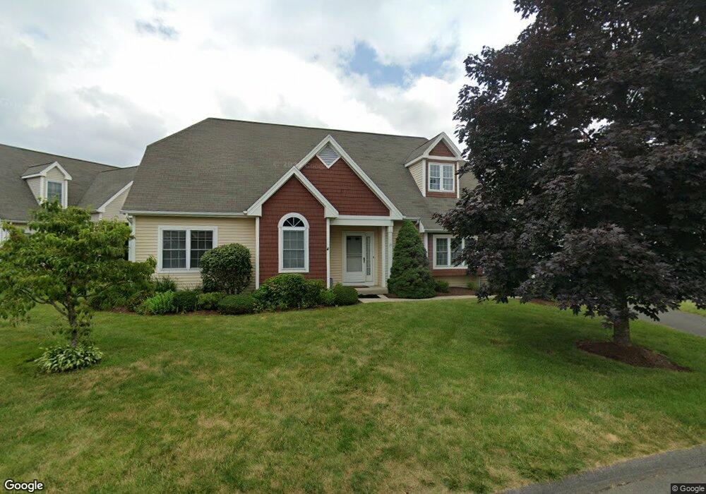
21 S Pond Rd Bloomfield, CT 06002
Estimated Value: $449,000 - $535,585
3
Beds
3
Baths
2,396
Sq Ft
$198/Sq Ft
Est. Value
About This Home
This home is located at 21 S Pond Rd, Bloomfield, CT 06002 and is currently estimated at $473,896, approximately $197 per square foot. 21 S Pond Rd is a home located in Hartford County with nearby schools including Laurel School, Carmen Arace Intermediate School, and Metacomet School.
Ownership History
Date
Name
Owned For
Owner Type
Purchase Details
Closed on
Dec 9, 2016
Sold by
Gerroll Children T and Gerroll
Bought by
Abdullah Siddiq
Current Estimated Value
Home Financials for this Owner
Home Financials are based on the most recent Mortgage that was taken out on this home.
Original Mortgage
$216,000
Outstanding Balance
$176,137
Interest Rate
3.47%
Mortgage Type
New Conventional
Estimated Equity
$297,759
Purchase Details
Closed on
Jan 25, 2016
Sold by
Gerrol Shirley
Bought by
Gerrol Childrens T and Gerrol
Purchase Details
Closed on
Aug 6, 2007
Sold by
Marble Donna
Bought by
Gerrol Melvin and Gerrol Shirley
Create a Home Valuation Report for This Property
The Home Valuation Report is an in-depth analysis detailing your home's value as well as a comparison with similar homes in the area
Home Values in the Area
Average Home Value in this Area
Purchase History
| Date | Buyer | Sale Price | Title Company |
|---|---|---|---|
| Abdullah Siddiq | $270,000 | -- | |
| Abdullah Siddiq | $270,000 | -- | |
| Gerrol Childrens T | -- | -- | |
| Gerrol Childrens T | -- | -- | |
| Gerrol Melvin | $365,000 | -- | |
| Gerrol Melvin | $365,000 | -- |
Source: Public Records
Mortgage History
| Date | Status | Borrower | Loan Amount |
|---|---|---|---|
| Open | Gerrol Melvin | $216,000 | |
| Closed | Gerrol Melvin | $216,000 | |
| Previous Owner | Gerrol Melvin | $250,000 |
Source: Public Records
Tax History
| Year | Tax Paid | Tax Assessment Tax Assessment Total Assessment is a certain percentage of the fair market value that is determined by local assessors to be the total taxable value of land and additions on the property. | Land | Improvement |
|---|---|---|---|---|
| 2025 | $11,440 | $305,060 | $0 | $305,060 |
| 2024 | $7,894 | $201,180 | $0 | $201,180 |
| 2023 | $7,751 | $201,180 | $0 | $201,180 |
| 2022 | $7,249 | $201,180 | $0 | $201,180 |
| 2021 | $7,409 | $201,180 | $0 | $201,180 |
| 2020 | $7,295 | $201,180 | $0 | $201,180 |
| 2019 | $7,778 | $201,180 | $0 | $201,180 |
| 2018 | $8,891 | $230,230 | $0 | $230,230 |
| 2017 | $8,878 | $230,230 | $0 | $230,230 |
| 2016 | $8,668 | $230,230 | $0 | $230,230 |
| 2015 | $8,507 | $230,230 | $0 | $230,230 |
| 2014 | $8,153 | $228,130 | $0 | $228,130 |
Source: Public Records
Map
Nearby Homes
- 162 Thistle Pond Dr
- 81 Silo Way Unit 81
- 26 Burnwood Dr
- 6 Spy Glass Cir
- 63 Duncaster Rd
- 545 Simsbury Rd
- 79 Prospect St
- 12 Filley St
- 99 Oliver Way Unit 99
- 1347 Hall Blvd
- 234 Woodland Ave
- 5 Caramoor Park Unit 5
- 406 Tunxis Ave
- 34 Cary Ln Unit 34
- 322 Tunxis Ave
- 17 Harwich Ln Unit 17
- 49 Tyler St
- 3 Cobtail Way
- 256 Park Ave
- 159 School St
- 9 S Pond Rd
- 13 S Pond Rd
- 11 S Pond Rd
- 7 S Pond Rd
- 5 S Pond Rd
- 3 S Pond Rd
- 21 S Pond Rd Unit 21
- 5 S Pond Rd Unit 5
- 9 S Pond Rd Unit 9
- 23 S Pond Rd
- 23 S Pond Rd Unit 23
- 25 S Pond Rd
- 27 S Pond Rd
- 27 S Pond Rd Unit 27
- 2 Early Dawn Cir
- 29 S Pond Rd
- 18 18 South Pond Rd
- 4 Early Dawn Cir
- 8 S Pond Rd
- 28 S Pond Rd
Your Personal Tour Guide
Ask me questions while you tour the home.