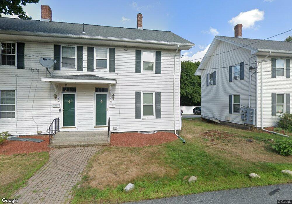
21 Sampson St South Grafton, MA 01560
Estimated Value: $254,000 - $314,698
3
Beds
1
Bath
868
Sq Ft
$339/Sq Ft
Est. Value
About This Home
This home is located at 21 Sampson St, South Grafton, MA 01560 and is currently estimated at $293,925, approximately $338 per square foot. 21 Sampson St is a home located in Worcester County with nearby schools including Grafton High School and Silver Spruce Montessori School.
Ownership History
Date
Name
Owned For
Owner Type
Purchase Details
Closed on
Jul 27, 2006
Sold by
Grafton Prop Llc
Bought by
Douaire Brian F
Current Estimated Value
Home Financials for this Owner
Home Financials are based on the most recent Mortgage that was taken out on this home.
Original Mortgage
$170,900
Outstanding Balance
$102,103
Interest Rate
6.67%
Mortgage Type
Purchase Money Mortgage
Estimated Equity
$191,822
Create a Home Valuation Report for This Property
The Home Valuation Report is an in-depth analysis detailing your home's value as well as a comparison with similar homes in the area
Home Values in the Area
Average Home Value in this Area
Purchase History
| Date | Buyer | Sale Price | Title Company |
|---|---|---|---|
| Douaire Brian F | $179,900 | -- |
Source: Public Records
Mortgage History
| Date | Status | Borrower | Loan Amount |
|---|---|---|---|
| Open | Douaire Brian F | $170,900 |
Source: Public Records
Tax History Compared to Growth
Tax History
| Year | Tax Paid | Tax Assessment Tax Assessment Total Assessment is a certain percentage of the fair market value that is determined by local assessors to be the total taxable value of land and additions on the property. | Land | Improvement |
|---|---|---|---|---|
| 2025 | $3,205 | $229,900 | $100 | $229,800 |
| 2024 | $3,131 | $218,800 | $0 | $218,800 |
| 2023 | $2,997 | $190,800 | $0 | $190,800 |
| 2022 | $2,728 | $161,600 | $0 | $161,600 |
| 2021 | $2,759 | $160,600 | $0 | $160,600 |
| 2020 | $2,490 | $150,900 | $0 | $150,900 |
| 2019 | $1,899 | $114,000 | $0 | $114,000 |
| 2018 | $2,333 | $140,600 | $0 | $140,600 |
| 2017 | $2,303 | $140,400 | $0 | $140,400 |
| 2016 | $2,261 | $135,000 | $0 | $135,000 |
| 2015 | $2,155 | $130,600 | $0 | $130,600 |
| 2014 | $1,993 | $130,600 | $0 | $130,600 |
Source: Public Records
Map
Nearby Homes
- 29 Sampson St Unit 29
- 44 Fisherville Terrace
- 55 Fisherville Terrace
- 58 Fisherville Terrace
- 109 Main St
- 110 Main St
- 7 Pine Hill Rd
- 191 Hartness Rd
- 185 Main St
- 90 Leland Hill Rd
- 151 Providence Rd Unit 24
- 50 Highland View Dr
- 150 Sprague St
- 19 Wildflower Dr
- 5 Wildflower Dr
- 29 Highland View Dr
- 13 Pullard Rd Unit 38
- 395 Providence Rd Unit 4
- 29 Pullard Rd
- 51 Londonderry Rd Unit 51
- 19 Sampson St
- 17 Sampson St
- 15 Sampson St
- 11 Sampson St
- 17 Sampson St Unit 17
- 13 Sampson St
- 12 Sampson St
- 14 Sampson St
- 16 Sampson St
- 18 Sampson St
- 27 Sampson St
- 29 Sampson St
- 1 Sampson St
- 33 Sampson St
- 31 Sampson St
- 23 Sampson St
- 23 Sampson St Unit 23
- 33 Sampson St Unit 33
- 25 Sampson St
- 25 Sampson St Unit 25