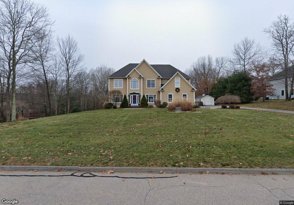
21 Saw Mill Way Amston, CT 06231
Estimated Value: $650,743 - $765,000
4
Beds
4
Baths
3,149
Sq Ft
$229/Sq Ft
Est. Value
About This Home
This home is located at 21 Saw Mill Way, Amston, CT 06231 and is currently estimated at $720,186, approximately $228 per square foot. 21 Saw Mill Way is a home located in Tolland County with nearby schools including Gilead Hill School, Hebron Elementary School, and RHAM Middle School.
Ownership History
Date
Name
Owned For
Owner Type
Purchase Details
Closed on
Dec 28, 2011
Sold by
Thomas Hal S and Thomas Debra A
Bought by
Guerriero Michael J and Guerriero Selina L
Current Estimated Value
Home Financials for this Owner
Home Financials are based on the most recent Mortgage that was taken out on this home.
Original Mortgage
$416,500
Outstanding Balance
$285,813
Interest Rate
4%
Estimated Equity
$434,373
Purchase Details
Closed on
Sep 10, 2007
Sold by
Mason Built Llc
Bought by
Thomas Hal and Thomas Debra
Home Financials for this Owner
Home Financials are based on the most recent Mortgage that was taken out on this home.
Original Mortgage
$340,000
Interest Rate
6.74%
Create a Home Valuation Report for This Property
The Home Valuation Report is an in-depth analysis detailing your home's value as well as a comparison with similar homes in the area
Home Values in the Area
Average Home Value in this Area
Purchase History
| Date | Buyer | Sale Price | Title Company |
|---|---|---|---|
| Guerriero Michael J | $490,000 | -- | |
| Thomas Hal | $489,900 | -- |
Source: Public Records
Mortgage History
| Date | Status | Borrower | Loan Amount |
|---|---|---|---|
| Open | Thomas Hal | $416,500 | |
| Previous Owner | Thomas Hal | $338,400 | |
| Previous Owner | Thomas Hal | $340,000 | |
| Previous Owner | Thomas Hal | $50,000 |
Source: Public Records
Tax History Compared to Growth
Tax History
| Year | Tax Paid | Tax Assessment Tax Assessment Total Assessment is a certain percentage of the fair market value that is determined by local assessors to be the total taxable value of land and additions on the property. | Land | Improvement |
|---|---|---|---|---|
| 2025 | $11,855 | $321,720 | $56,000 | $265,720 |
| 2024 | $11,099 | $321,720 | $56,000 | $265,720 |
| 2023 | $10,678 | $321,720 | $56,000 | $265,720 |
| 2022 | $10,199 | $321,720 | $56,000 | $265,720 |
| 2021 | $10,080 | $277,460 | $56,000 | $221,460 |
| 2020 | $10,080 | $277,460 | $56,000 | $221,460 |
| 2019 | $10,280 | $277,460 | $56,000 | $221,460 |
| 2018 | $10,388 | $277,460 | $56,000 | $221,460 |
| 2017 | $10,266 | $277,460 | $56,000 | $221,460 |
| 2016 | $10,166 | $285,250 | $87,500 | $197,750 |
| 2015 | $10,269 | $285,250 | $87,500 | $197,750 |
| 2014 | $10,198 | $285,250 | $87,500 | $197,750 |
Source: Public Records
Map
Nearby Homes
- 30 Pepperbush Dr
- 18 Spring Hill Rd
- 2 Lots on Deepwood Dr
- 0 Deepwood Dr
- 185 Deepwood Dr
- 24 Wood Acres Rd
- 282 Deepwood Dr
- 20 Mohegan Ln
- 30 Island Beach Rd
- 0 Park Rd Unit 24130670
- 25 Woodland Dr
- 76 Park Rd
- 37 Andrews St
- 34 Spafford Dr
- 0 Wildwood Dr
- 6 Deepwood Dr
- 40 Cannon Dr
- 0 Kellys Corner
- 236 Stollman Rd
- 101 Levita Rd
- 17 Saw Mill Way
- 17 Saw Mill Way
- 27 Saw Mill Way
- 27 Saw Mill Way
- 30 Saw Mill Way
- 33 Saw Mill Way
- 30 Saw Mill Way
- 24 Saw Mill Way
- 20 Saw Mill Way
- 9 Sawmill Way
- 14 Saw Mill Way
- 34 Saw Mill Way
- 9 Saw Mill Way
- 39 Saw Mill Way
- 39 Sawmill Way
- 8 Saw Mill Way
- 26 Saw Mill Way
- 40 Saw Mill Way
- 720 Church St
- 41 Saw Mill Way