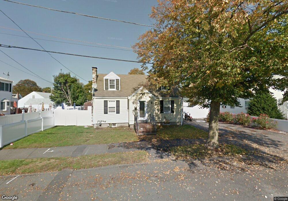
21 Starrett Rd Lynn, MA 01905
Austin Square NeighborhoodEstimated Value: $609,000 - $642,000
3
Beds
2
Baths
1,590
Sq Ft
$393/Sq Ft
Est. Value
About This Home
This home is located at 21 Starrett Rd, Lynn, MA 01905 and is currently estimated at $625,405, approximately $393 per square foot. 21 Starrett Rd is a home located in Essex County with nearby schools including Julia F. Callahan Elementary School, William R. Fallon School, and Breed Middle School.
Ownership History
Date
Name
Owned For
Owner Type
Purchase Details
Closed on
Apr 29, 2005
Sold by
Miller Christine M and Miller Kenneth A
Bought by
Stewart Robert and Stewart Grace
Current Estimated Value
Home Financials for this Owner
Home Financials are based on the most recent Mortgage that was taken out on this home.
Original Mortgage
$200,000
Interest Rate
5.95%
Mortgage Type
Purchase Money Mortgage
Create a Home Valuation Report for This Property
The Home Valuation Report is an in-depth analysis detailing your home's value as well as a comparison with similar homes in the area
Home Values in the Area
Average Home Value in this Area
Purchase History
| Date | Buyer | Sale Price | Title Company |
|---|---|---|---|
| Stewart Robert | $341,000 | -- | |
| Stewart Robert | $341,000 | -- |
Source: Public Records
Mortgage History
| Date | Status | Borrower | Loan Amount |
|---|---|---|---|
| Open | Stewart Robert | $256,075 | |
| Closed | Stewart Robert | $256,000 | |
| Closed | Stewart Robert | $252,000 | |
| Closed | Stewart Robert | $200,000 |
Source: Public Records
Tax History
| Year | Tax Paid | Tax Assessment Tax Assessment Total Assessment is a certain percentage of the fair market value that is determined by local assessors to be the total taxable value of land and additions on the property. | Land | Improvement |
|---|---|---|---|---|
| 2025 | $6,355 | $613,400 | $234,900 | $378,500 |
| 2024 | $5,863 | $556,800 | $206,400 | $350,400 |
| 2023 | $5,841 | $523,900 | $213,200 | $310,700 |
| 2022 | $5,557 | $447,100 | $157,800 | $289,300 |
| 2021 | $5,178 | $397,400 | $145,100 | $252,300 |
| 2020 | $5,076 | $378,800 | $139,700 | $239,100 |
| 2019 | $5,148 | $360,000 | $131,500 | $228,500 |
| 2018 | $5,221 | $344,600 | $145,100 | $199,500 |
| 2017 | $4,683 | $300,200 | $120,600 | $179,600 |
| 2016 | $4,576 | $282,800 | $112,900 | $169,900 |
| 2015 | $4,419 | $263,800 | $112,000 | $151,800 |
Source: Public Records
Map
Nearby Homes
- 189 Holyoke St
- 187 Hamilton St
- 4 Oneil Way
- 32 Birch Brook Landing Unit 23
- 32 Birch Brook Landing Unit 25
- 32 Birch Brook Landing Unit 22
- 32 Birch Brook Rd Unit 13
- 32 Birch Brook Rd Unit 27
- 32 Birch Brook Rd Unit 16
- 32 Birch Brook Rd Unit 1
- 32 Birch Brook Rd Unit 14
- 32 Birch Brook Rd Unit 28
- 27 Garfield Ave
- 79 Laurel St
- 44 Ballard St
- 11 Margin St Unit 7
- 43 W Sigourney St
- 590 Boston St Unit 303
- 268 Walnut St
- 46 Wilfred St
- 29 Glen Ct Unit 29
- 21 Glen Ct Unit 21
- 21 Glen Ct
- 33 Glen Ct Unit 33
- 44 Oakland Ave Unit B
- 44 Oakland Ave Unit A
- 44 Oakland Ave Unit 44
- 19 Homesite St
- 20 Homesite St
- 17 Glen Ct
- 40 Oakland Ave Unit B
- 40 Oakland Ave Unit A
- 18 Homesite St
- 42 Oakland Ave Unit B
- 42 Oakland Ave Unit A
- 42 Oakland Ave Unit 42B
- 15 Homesite St
- 11 Glen Ct Unit 11
- 22 Glen Ct Unit 22
- 34 Glen Ct
Your Personal Tour Guide
Ask me questions while you tour the home.