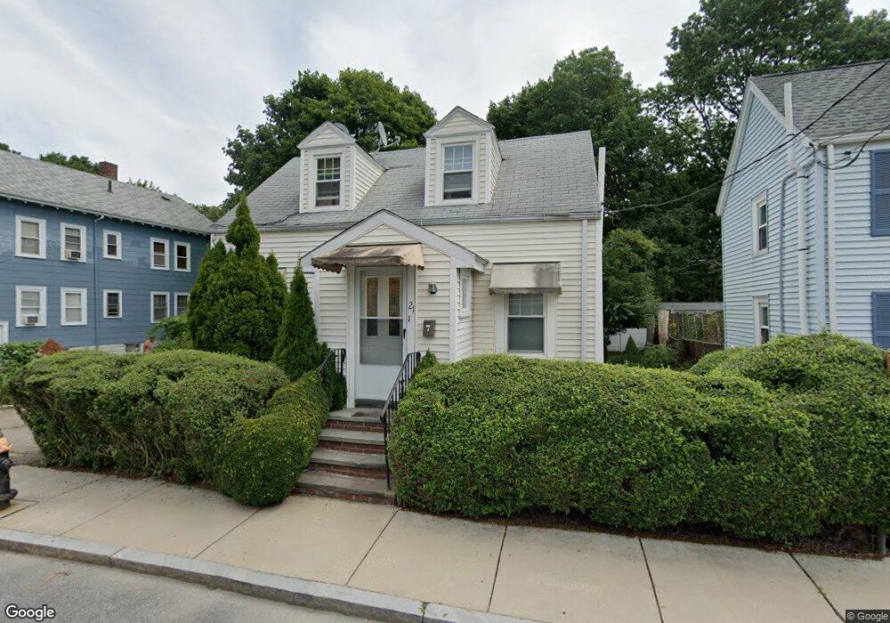
21 Sturbridge St Mattapan, MA 02126
West Codman Hill-West Lowe NeighborhoodEstimated Value: $575,000 - $616,398
2
Beds
2
Baths
1,096
Sq Ft
$544/Sq Ft
Est. Value
About This Home
This home is located at 21 Sturbridge St, Mattapan, MA 02126 and is currently estimated at $596,600, approximately $544 per square foot. 21 Sturbridge St is a home located in Suffolk County with nearby schools including Conservatory Lab Upper School, Saint John Paul II Catholic Academy, and Epiphany School.
Ownership History
Date
Name
Owned For
Owner Type
Purchase Details
Closed on
Aug 31, 1999
Sold by
Flynn Eugene L
Bought by
Cameron Carl A
Current Estimated Value
Purchase Details
Closed on
Feb 23, 1999
Sold by
Dyson Brian and Us Trust
Bought by
Somerset Sb
Purchase Details
Closed on
Apr 1, 1994
Sold by
Somrock Corp
Bought by
Stokes Theresa A and Dyson Brian
Purchase Details
Closed on
May 17, 1993
Sold by
Sturbridge St T
Bought by
Somrock Corp
Create a Home Valuation Report for This Property
The Home Valuation Report is an in-depth analysis detailing your home's value as well as a comparison with similar homes in the area
Home Values in the Area
Average Home Value in this Area
Purchase History
| Date | Buyer | Sale Price | Title Company |
|---|---|---|---|
| Cameron Carl A | $139,000 | -- | |
| Somerset Sb | $71,000 | -- | |
| Stokes Theresa A | $122,000 | -- | |
| Somrock Corp | $95,000 | -- |
Source: Public Records
Mortgage History
| Date | Status | Borrower | Loan Amount |
|---|---|---|---|
| Open | Somrock Corp | $63,000 |
Source: Public Records
Tax History
| Year | Tax Paid | Tax Assessment Tax Assessment Total Assessment is a certain percentage of the fair market value that is determined by local assessors to be the total taxable value of land and additions on the property. | Land | Improvement |
|---|---|---|---|---|
| 2025 | $6,369 | $550,000 | $167,000 | $383,000 |
| 2024 | $5,637 | $517,200 | $172,800 | $344,400 |
| 2023 | $5,342 | $497,400 | $166,200 | $331,200 |
| 2022 | $5,010 | $460,500 | $153,900 | $306,600 |
| 2021 | $4,797 | $449,600 | $153,900 | $295,700 |
| 2020 | $4,443 | $420,700 | $153,300 | $267,400 |
| 2019 | $4,106 | $389,600 | $118,100 | $271,500 |
| 2018 | $3,889 | $371,100 | $118,100 | $253,000 |
| 2017 | $3,708 | $350,100 | $118,100 | $232,000 |
| 2016 | $3,565 | $324,100 | $118,100 | $206,000 |
| 2015 | $3,535 | $291,900 | $108,800 | $183,100 |
| 2014 | $3,429 | $272,600 | $108,800 | $163,800 |
Source: Public Records
Map
Nearby Homes
- 21 Tanglewood Rd Unit 1
- 67 Idaho St
- 19 Standard St Unit 2
- 19 Standard St Unit 1
- 1241-1255 Adams St Unit F213
- 1241-1255 Adams St Unit B302
- 35 Standard St
- 1245 Adams St Unit B503
- 10 Brookside Park
- 14 Avondale St
- 30 Pleasant Hill Ave Unit 32
- 23 Maryknoll St
- 88 Wharf St Unit 105
- 14 Valley Rd
- 56 Fairmount St Unit 2
- 988 Morton St
- 57 Fairmount St Unit A
- 44 Allen Cir
- 2089 Dorchester Ave Unit 1
- 20 Fairmount St
- 19 Sturbridge St
- 27 Sturbridge St Unit 29
- 16 Monson St
- 69R River St
- 20 Sturbridge St Unit 24
- 19 Monson St
- 24 Sturbridge St
- 23 Monson St
- 23 Monson St Unit 2
- 18 Sturbridge St
- 30 Sturbridge St
- 17 Monson St
- 14 Sturbridge St
- 39 Sturbridge St
- 23 Caddy Rd Unit 25
- 32 Sturbridge St
- 14 Monson St
- 14 Monson St Unit L
- 59 River St Unit 63
- 67 River St Unit 2
Your Personal Tour Guide
Ask me questions while you tour the home.