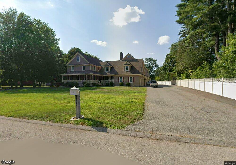
21 Twin Brook Ln Taunton, MA 02780
Oakland NeighborhoodEstimated Value: $966,000 - $1,067,051
4
Beds
3
Baths
3,848
Sq Ft
$264/Sq Ft
Est. Value
About This Home
This home is located at 21 Twin Brook Ln, Taunton, MA 02780 and is currently estimated at $1,015,263, approximately $263 per square foot. 21 Twin Brook Ln is a home located in Bristol County with nearby schools including Benjamin Friedman Middle School, Joseph C. Chamberlain Elementary School, and Taunton High School.
Ownership History
Date
Name
Owned For
Owner Type
Purchase Details
Closed on
Aug 31, 2004
Sold by
Leonard Chrystal E and Leonard Edward D
Bought by
Leonard Edward D
Current Estimated Value
Home Financials for this Owner
Home Financials are based on the most recent Mortgage that was taken out on this home.
Original Mortgage
$540,000
Outstanding Balance
$270,025
Interest Rate
6.02%
Mortgage Type
Purchase Money Mortgage
Estimated Equity
$745,238
Purchase Details
Closed on
Jul 1, 2003
Sold by
Mann David B and Mann Cynthia
Bought by
Leonard Edward D and Leonard Crystal E
Home Financials for this Owner
Home Financials are based on the most recent Mortgage that was taken out on this home.
Original Mortgage
$380,000
Interest Rate
5.53%
Mortgage Type
Purchase Money Mortgage
Purchase Details
Closed on
Mar 20, 1998
Sold by
Niki Rt and Krikis Maria
Bought by
Mann David B and Mann Cynthia A
Home Financials for this Owner
Home Financials are based on the most recent Mortgage that was taken out on this home.
Original Mortgage
$56,000
Interest Rate
6.92%
Mortgage Type
Purchase Money Mortgage
Create a Home Valuation Report for This Property
The Home Valuation Report is an in-depth analysis detailing your home's value as well as a comparison with similar homes in the area
Home Values in the Area
Average Home Value in this Area
Purchase History
| Date | Buyer | Sale Price | Title Company |
|---|---|---|---|
| Leonard Edward D | -- | -- | |
| Leonard Edward D | $482,000 | -- | |
| Mann David B | $70,000 | -- |
Source: Public Records
Mortgage History
| Date | Status | Borrower | Loan Amount |
|---|---|---|---|
| Open | Leonard Edward D | $540,000 | |
| Previous Owner | Leonard Edward D | $380,000 | |
| Previous Owner | Mann David B | $87,800 | |
| Previous Owner | Mann David B | $229,700 | |
| Previous Owner | Mann David B | $56,000 |
Source: Public Records
Tax History Compared to Growth
Tax History
| Year | Tax Paid | Tax Assessment Tax Assessment Total Assessment is a certain percentage of the fair market value that is determined by local assessors to be the total taxable value of land and additions on the property. | Land | Improvement |
|---|---|---|---|---|
| 2025 | $11,565 | $1,057,100 | $146,300 | $910,800 |
| 2024 | $10,044 | $897,600 | $146,300 | $751,300 |
| 2023 | $10,059 | $834,800 | $152,900 | $681,900 |
| 2022 | $9,549 | $724,500 | $118,800 | $605,700 |
| 2021 | $9,258 | $652,000 | $108,100 | $543,900 |
| 2020 | $8,941 | $601,700 | $108,100 | $493,600 |
| 2019 | $9,302 | $590,200 | $113,500 | $476,700 |
| 2018 | $9,303 | $591,800 | $114,500 | $477,300 |
| 2017 | $8,937 | $568,900 | $109,200 | $459,700 |
| 2016 | $8,245 | $525,800 | $106,000 | $419,800 |
| 2015 | $7,883 | $525,200 | $106,000 | $419,200 |
| 2014 | $6,816 | $466,500 | $106,000 | $360,500 |
Source: Public Records
Map
Nearby Homes
- 2 Upland Rd
- 22 Southway
- 0 Norton Ave Unit 73445127
- 17 Davis St
- 193 Fremont St
- 16 Hunter St Unit A
- 79 Fremont St
- 8 N Walker St
- 169 Powderhorn Dr
- 20 Grand Ave
- 214 Eldridge St
- 137 Tremont St
- 383 Tremont St
- 110 Eldridge St Unit B
- Lot 6 Tremont St
- 750 Whittenton St Unit 523
- 563 Whittenton St
- 108 Tremont St
- 99 Tremont St
- 0 Whittenton St
- 0 Lot 5 Twinbrook Ln Unit 50488226
- 43 Twin Brook Ln
- 260 Norton Ave
- 270 Norton Ave
- 10 Twin Brook Ln
- 34 Twin Brook Ln
- 280 Norton Ave
- 57 Twin Brook Ln
- 275 Norton Ave
- 255 Norton Ave
- 265 Norton Ave
- 230 Norton Ave
- 245 Norton Ave
- 285 Norton Ave
- 71 Twin Brook Ln
- 64 Twin Brook Ln
- 3 Upland Rd
- 1 Northway
- 228 Norton Ave
- 225 Norton Ave