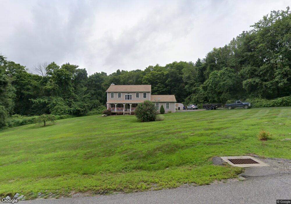
21 Ulasik Rd Canterbury, CT 06331
Estimated Value: $420,000 - $481,000
3
Beds
3
Baths
1,896
Sq Ft
$242/Sq Ft
Est. Value
About This Home
This home is located at 21 Ulasik Rd, Canterbury, CT 06331 and is currently estimated at $459,128, approximately $242 per square foot. 21 Ulasik Rd is a home located in Windham County with nearby schools including Canterbury Elementary School and Dr. Helen Baldwin Middle School.
Ownership History
Date
Name
Owned For
Owner Type
Purchase Details
Closed on
Jun 13, 2005
Sold by
Pollack Shane J and Pollack Samantha E
Bought by
Boisvert Nichole E and Boisvert Robert R
Current Estimated Value
Home Financials for this Owner
Home Financials are based on the most recent Mortgage that was taken out on this home.
Original Mortgage
$222,600
Interest Rate
5.79%
Purchase Details
Closed on
Nov 23, 2004
Sold by
Pollock Janice T
Bought by
Pollock Shane J and Pollock Samantha E
Create a Home Valuation Report for This Property
The Home Valuation Report is an in-depth analysis detailing your home's value as well as a comparison with similar homes in the area
Home Values in the Area
Average Home Value in this Area
Purchase History
| Date | Buyer | Sale Price | Title Company |
|---|---|---|---|
| Boisvert Nichole E | $318,000 | -- | |
| Boisvert Nichole E | $318,000 | -- | |
| Pollock Shane J | $48,000 | -- |
Source: Public Records
Mortgage History
| Date | Status | Borrower | Loan Amount |
|---|---|---|---|
| Open | Pollock Shane J | $240,000 | |
| Closed | Pollock Shane J | $30,000 | |
| Closed | Pollock Shane J | $222,600 |
Source: Public Records
Tax History Compared to Growth
Tax History
| Year | Tax Paid | Tax Assessment Tax Assessment Total Assessment is a certain percentage of the fair market value that is determined by local assessors to be the total taxable value of land and additions on the property. | Land | Improvement |
|---|---|---|---|---|
| 2025 | $4,529 | $270,200 | $49,400 | $220,800 |
| 2024 | $5,693 | $247,500 | $49,300 | $198,200 |
| 2023 | $4,145 | $180,200 | $37,000 | $143,200 |
| 2022 | $4,145 | $180,200 | $37,000 | $143,200 |
| 2021 | $4,274 | $180,200 | $37,000 | $143,200 |
| 2020 | $4,388 | $166,200 | $36,900 | $129,300 |
| 2019 | $4,388 | $166,200 | $36,900 | $129,300 |
| 2018 | $4,354 | $166,200 | $36,900 | $129,300 |
| 2017 | $4,072 | $166,200 | $36,900 | $129,300 |
| 2016 | $4,072 | $166,200 | $36,900 | $129,300 |
| 2015 | $4,246 | $196,100 | $60,900 | $135,200 |
| 2014 | $4,216 | $196,100 | $60,900 | $135,200 |
Source: Public Records
Map
Nearby Homes
- 202 Cemetery Rd
- 63 Gay Head Rd
- 416 Hanover Rd
- 0 Hanover Rd
- 93 Kinne Rd
- 0 Brooklyn Rd Unit 24124218
- 0 Brooklyn Rd Unit 24111912
- 361 Westminster Rd
- 7 Devotion Rd
- 165 Lisbon Rd
- 75 Lisbon Rd
- 150 Gager Hill Rd
- 19 Knollwood Dr
- 0 Bennett Pond Rd
- 245 Brooklyn Rd
- 2 Mission St
- 80 John MacK Rd
- 85 Potash Hill Rd
- 78 Salt Rock Rd
- 243 Kemp Rd