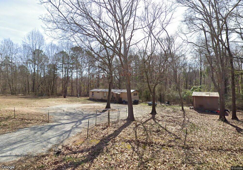
21 Upland Dr Maysville, GA 30558
Estimated Value: $83,454 - $265,000
--
Bed
--
Bath
--
Sq Ft
1.28
Acres
About This Home
This home is located at 21 Upland Dr, Maysville, GA 30558 and is currently estimated at $181,818. 21 Upland Dr is a home located in Jackson County with nearby schools including Maysville Elementary School, East Jackson Middle School, and East Jackson Comprehensive High School.
Ownership History
Date
Name
Owned For
Owner Type
Purchase Details
Closed on
Oct 20, 2014
Sold by
Ilsley Kevin
Bought by
Patrick James S
Current Estimated Value
Home Financials for this Owner
Home Financials are based on the most recent Mortgage that was taken out on this home.
Original Mortgage
$13,000
Interest Rate
4.29%
Mortgage Type
New Conventional
Purchase Details
Closed on
Mar 12, 2007
Sold by
Not Provided
Bought by
Ilsley Kevin and Ilsley Tammy W
Purchase Details
Closed on
Aug 28, 2002
Sold by
H & W Properties
Bought by
Price Ray
Purchase Details
Closed on
Jun 4, 2001
Sold by
Rae Robert J and Rae Linda
Bought by
H & W Properties
Create a Home Valuation Report for This Property
The Home Valuation Report is an in-depth analysis detailing your home's value as well as a comparison with similar homes in the area
Home Values in the Area
Average Home Value in this Area
Purchase History
| Date | Buyer | Sale Price | Title Company |
|---|---|---|---|
| Patrick James S | $15,000 | -- | |
| Ilsley Kevin | $6,500 | -- | |
| Price Ray | $36,000 | -- | |
| H & W Properties | $30,000 | -- |
Source: Public Records
Mortgage History
| Date | Status | Borrower | Loan Amount |
|---|---|---|---|
| Closed | Patrick James S | $13,000 |
Source: Public Records
Tax History Compared to Growth
Tax History
| Year | Tax Paid | Tax Assessment Tax Assessment Total Assessment is a certain percentage of the fair market value that is determined by local assessors to be the total taxable value of land and additions on the property. | Land | Improvement |
|---|---|---|---|---|
| 2024 | $345 | $13,920 | $13,600 | $320 |
| 2023 | $345 | $13,920 | $13,600 | $320 |
| 2022 | $394 | $13,920 | $13,600 | $320 |
| 2021 | $100 | $3,520 | $3,200 | $320 |
| 2020 | $110 | $3,520 | $3,200 | $320 |
| 2019 | $112 | $3,520 | $3,200 | $320 |
| 2018 | $113 | $3,520 | $3,200 | $320 |
| 2017 | $115 | $3,520 | $3,200 | $320 |
| 2016 | $116 | $3,520 | $3,200 | $320 |
| 2015 | $116 | $3,520 | $3,200 | $320 |
| 2014 | $117 | $3,520 | $3,200 | $320 |
| 2013 | -- | $2,560 | $2,240 | $320 |
Source: Public Records
Map
Nearby Homes
- 3354 Plainview Rd
- 596 Pinetree Cir
- 3565 Plainview Rd
- 1118 Marlow Rd
- 1542 Marlow Rd
- 4394 Holly Springs Rd
- 0 Holly Springs Rd Unit 10571613
- 0 Marlow Rd Unit 10587501
- 0 Marlow Rd Unit 7635185
- 195 Sims Farm Way
- 1206 Ridgewood Dr
- 4292 Deadwyler Rd
- 412 Emily Forest Way
- 323 Emily Forest Way
- 808 Eagle Heights Dr
- 718 Eagle Heights Dr
- 759 Eagle Heights Dr
- 131 Upland Dr
- 32 Upland Dr
- 55 Highland Way
- 358 Highland Way
- 0 Upland Dr Unit 7462002
- 0 Upland Dr Unit 7599818
- 0 Upland Dr Unit 7123310
- 0 Upland Dr
- 108 Upland Dr
- 578 Hale Rd
- 481 Hale Rd
- 0 Hale Rd Unit 10407077
- 0 Hale Rd Unit 974033
- 0 Hale Rd Unit 7264957
- 0 Hale Rd Unit 7156124
- 0 Hale Rd Unit 7158455
- 0 Hale Rd Unit 8622177
- 0 Hale Rd Unit 8521690
- 0 Hale Rd Unit 3289006
- 0 Hale Rd Unit 8495380