--
Bed
--
Bath
2,400
Sq Ft
2.97
Acres
About This Home
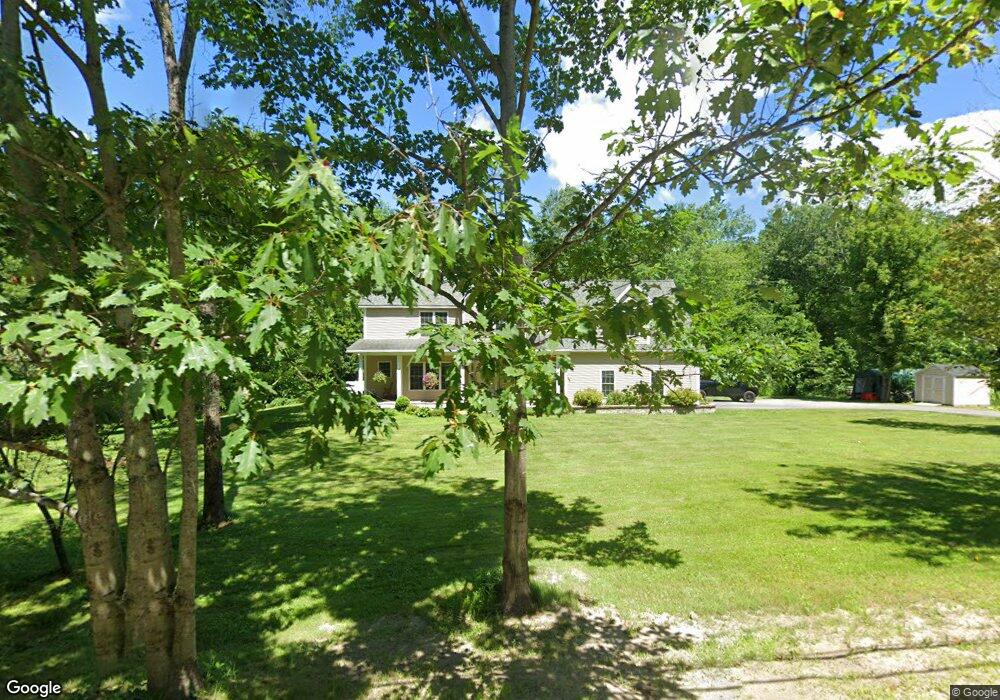
This home is located at 21 Verrill Rd, Minot, ME 04258. 21 Verrill Rd is a home located in Androscoggin County with nearby schools including Minot Consolidated School and Poland Spring Academy.
Create a Home Valuation Report for This Property
The Home Valuation Report is an in-depth analysis detailing your home's value as well as a comparison with similar homes in the area
Home Values in the Area
Average Home Value in this Area
Tax History Compared to Growth
Map
Nearby Homes
- 355 Woodman Hill Rd
- R03-007-A Pottle Hill Rd
- Lot 14C Mechanic Falls Rd
- 78 Star Dr
- 91 Elm St
- 63 Elm St
- 30 Highland Ave
- 450 Millett Rd
- 24 Clifford St
- 19 Tirrell Ave
- 33 Dunlop Ave
- 339 Harris Hill Rd
- 125 S Main St
- 26 Spring St
- 30 North St
- 62 North St
- 759 Lake St
- 107 Riverside Dr
- 1269 Woodman Hill Rd
- 351 W Auburn Rd
- 21 Verrill Rd
- 476 Woodman Hill Rd
- 22 Verrill Rd
- 486 Woodman Hill Rd
- 473 Woodman Hill Rd
- Lot #1A Verrill Rd
- Lot 1A Verrill Rd
- 0 Verrill Rd
- 0 Verrill Road Lot #1a
- 496 Woodman Hill Rd
- 487 Woodman Hill Rd
- 495 Woodman Hill Rd
- 50 Verrill Rd
- 55 Verrill Rd
- 2 Verrill Rd
- 501 Woodman Hill Rd
- 506 Woodman Hill Rd
- 59 Verrill Rd
- 36 Sandy's Way
- 36 Sandys Way