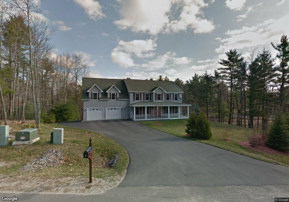
21 Vista Dr Auburn, ME 04210
Estimated Value: $496,000 - $682,056
4
Beds
5
Baths
3,388
Sq Ft
$176/Sq Ft
Est. Value
About This Home
This home is located at 21 Vista Dr, Auburn, ME 04210 and is currently estimated at $596,514, approximately $176 per square foot. 21 Vista Dr is a home located in Androscoggin County with nearby schools including Park Avenue Elementary School, Auburn Middle School, and Edward Little High School.
Ownership History
Date
Name
Owned For
Owner Type
Purchase Details
Closed on
Sep 14, 2005
Sold by
B & M Developers Inc
Bought by
Vargas Veronica and Diaz Pedro A
Current Estimated Value
Home Financials for this Owner
Home Financials are based on the most recent Mortgage that was taken out on this home.
Original Mortgage
$323,100
Outstanding Balance
$172,751
Interest Rate
5.84%
Mortgage Type
Purchase Money Mortgage
Estimated Equity
$423,763
Create a Home Valuation Report for This Property
The Home Valuation Report is an in-depth analysis detailing your home's value as well as a comparison with similar homes in the area
Home Values in the Area
Average Home Value in this Area
Purchase History
| Date | Buyer | Sale Price | Title Company |
|---|---|---|---|
| Vargas Veronica | -- | -- |
Source: Public Records
Mortgage History
| Date | Status | Borrower | Loan Amount |
|---|---|---|---|
| Open | Vargas Veronica | $323,100 |
Source: Public Records
Tax History Compared to Growth
Tax History
| Year | Tax Paid | Tax Assessment Tax Assessment Total Assessment is a certain percentage of the fair market value that is determined by local assessors to be the total taxable value of land and additions on the property. | Land | Improvement |
|---|---|---|---|---|
| 2024 | $11,089 | $498,400 | $99,600 | $398,800 |
| 2023 | $10,081 | $443,100 | $88,600 | $354,500 |
| 2022 | $10,081 | $443,100 | $88,600 | $354,500 |
| 2021 | $8,794 | $369,200 | $73,800 | $295,400 |
| 2020 | $8,887 | $374,200 | $73,800 | $300,400 |
| 2019 | $8,887 | $374,200 | $73,800 | $300,400 |
| 2018 | $8,861 | $374,200 | $73,800 | $300,400 |
| 2017 | $8,603 | $374,200 | $73,800 | $300,400 |
| 2016 | $8,426 | $377,000 | $73,800 | $303,200 |
| 2015 | $7,799 | $377,000 | $73,800 | $303,200 |
| 2013 | -- | $372,400 | $73,800 | $298,600 |
Source: Public Records
Map
Nearby Homes
- 121 Conant Ave
- 454 Court St
- 17 Western Ave
- 20 Western Ave
- 151 Allen Ave
- 69 Dawes Ave
- 325 Court St
- 17 Beacon Ave
- 356 Park Ave
- 81 Highland Ave
- 17 Sunset Ave
- 51 Grandview Ave
- 79 Tourmaline Ln Unit 31
- 14 Morse St
- 206 Fairview Ave
- 1 Freedom Farm Rd Unit 2
- 1 Freedom Farm Rd Unit 1
- 299 Minot Ave
- 5 Sheridan Ave
- 35 Union St