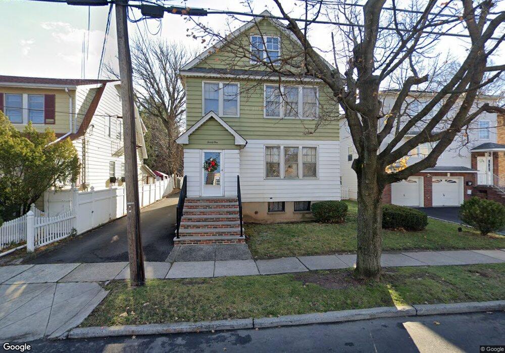
21 W 10th St Linden, NJ 07036
Estimated Value: $551,882 - $781,000
--
Bed
--
Bath
2,016
Sq Ft
$308/Sq Ft
Est. Value
About This Home
This home is located at 21 W 10th St, Linden, NJ 07036 and is currently estimated at $620,721, approximately $307 per square foot. 21 W 10th St is a home located in Union County with nearby schools including School No. 2, Myles J. McManus Middle School, and Linden High School.
Ownership History
Date
Name
Owned For
Owner Type
Purchase Details
Closed on
Aug 30, 2022
Sold by
Samsel Walter S
Bought by
Samsel Walter S and Samsel Jane M
Current Estimated Value
Purchase Details
Closed on
Aug 22, 2005
Sold by
Samsel Walter S
Bought by
Samsel Walter S and Samsel Richard L
Create a Home Valuation Report for This Property
The Home Valuation Report is an in-depth analysis detailing your home's value as well as a comparison with similar homes in the area
Home Values in the Area
Average Home Value in this Area
Purchase History
| Date | Buyer | Sale Price | Title Company |
|---|---|---|---|
| Samsel Walter S | -- | -- | |
| Samsel Walter S | -- | None Listed On Document | |
| Samsel Walter S | -- | -- |
Source: Public Records
Tax History Compared to Growth
Tax History
| Year | Tax Paid | Tax Assessment Tax Assessment Total Assessment is a certain percentage of the fair market value that is determined by local assessors to be the total taxable value of land and additions on the property. | Land | Improvement |
|---|---|---|---|---|
| 2025 | $10,597 | $150,700 | $46,000 | $104,700 |
| 2024 | $10,365 | $150,700 | $46,000 | $104,700 |
| 2023 | $10,365 | $150,700 | $46,000 | $104,700 |
| 2022 | $10,419 | $150,700 | $46,000 | $104,700 |
| 2021 | $10,472 | $150,700 | $46,000 | $104,700 |
| 2020 | $10,416 | $150,700 | $46,000 | $104,700 |
| 2019 | $10,382 | $150,700 | $46,000 | $104,700 |
| 2018 | $10,379 | $150,700 | $46,000 | $104,700 |
| 2017 | $10,154 | $150,700 | $46,000 | $104,700 |
| 2016 | $9,835 | $150,700 | $46,000 | $104,700 |
| 2015 | $9,459 | $150,700 | $46,000 | $104,700 |
| 2014 | $9,276 | $150,700 | $46,000 | $104,700 |
Source: Public Records
Map
Nearby Homes
- 111 E 10th St
- 111 E 13th St
- 1519 Winans Ave
- 317 Mitchell Ave
- 321 W 15th St Unit 1
- 14 Arlington Place
- 116 W 17th St
- 108 W 18th St
- 221 Jefferson Ave
- 1713 S Wood Ave Unit 2
- 212 W Morris Ave
- 120 S Stiles St
- 226 Pennsylvania Railroad Ave
- 104 E Elizabeth Ave
- 10 N Wood Ave Unit 312
- 10 N Wood Ave Unit 700
- 10 N Wood Ave Unit 214
- 10 N Wood Ave Unit 323
- 28 W Elizabeth Ave Unit A3
- 201 Hussa St