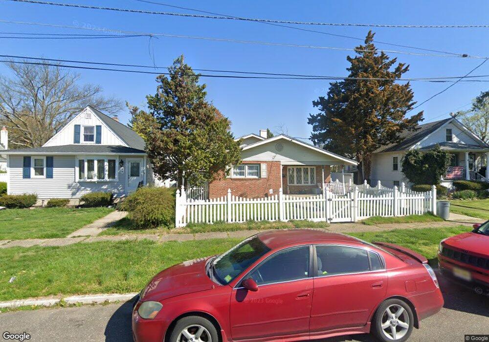
21 W Broadway Maple Shade, NJ 08052
Estimated Value: $324,000 - $382,000
4
Beds
2
Baths
1,272
Sq Ft
$273/Sq Ft
Est. Value
About This Home
This home is located at 21 W Broadway, Maple Shade, NJ 08052 and is currently estimated at $346,964, approximately $272 per square foot. 21 W Broadway is a home located in Burlington County with nearby schools including Ralph J Steinhauer Elementary School, Maude M. Wilkins Elementary School, and Howard R Yocum School.
Ownership History
Date
Name
Owned For
Owner Type
Purchase Details
Closed on
Oct 12, 2018
Sold by
Tomafsky Mark
Bought by
Tomafsky Sarah M
Current Estimated Value
Purchase Details
Closed on
Mar 19, 2008
Sold by
Tomafsky Mark and Tomafsky Sarah M
Bought by
Tomafsky Mark and Tomafsky Sarah
Home Financials for this Owner
Home Financials are based on the most recent Mortgage that was taken out on this home.
Original Mortgage
$236,241
Outstanding Balance
$147,332
Interest Rate
5.76%
Mortgage Type
FHA
Estimated Equity
$199,632
Purchase Details
Closed on
Jan 31, 2005
Sold by
Jordan Robert J and Jordan Joanna B
Bought by
Mahlenbrock Melissa
Home Financials for this Owner
Home Financials are based on the most recent Mortgage that was taken out on this home.
Original Mortgage
$184,500
Interest Rate
5.77%
Mortgage Type
VA
Create a Home Valuation Report for This Property
The Home Valuation Report is an in-depth analysis detailing your home's value as well as a comparison with similar homes in the area
Home Values in the Area
Average Home Value in this Area
Purchase History
| Date | Buyer | Sale Price | Title Company |
|---|---|---|---|
| Tomafsky Sarah M | -- | None Available | |
| Tomafsky Mark | -- | Surety Title Corporation | |
| Mahlenbrock Melissa | $205,000 | Surety Title Corp |
Source: Public Records
Mortgage History
| Date | Status | Borrower | Loan Amount |
|---|---|---|---|
| Open | Tomafsky Mark | $236,241 | |
| Closed | Mahlenbrock Melissa | $184,500 |
Source: Public Records
Tax History
| Year | Tax Paid | Tax Assessment Tax Assessment Total Assessment is a certain percentage of the fair market value that is determined by local assessors to be the total taxable value of land and additions on the property. | Land | Improvement |
|---|---|---|---|---|
| 2025 | $6,252 | $164,700 | $46,600 | $118,100 |
| 2024 | $6,071 | $164,700 | $46,600 | $118,100 |
| 2023 | $6,071 | $164,700 | $46,600 | $118,100 |
| 2022 | $5,977 | $164,700 | $46,600 | $118,100 |
| 2021 | $5,919 | $164,700 | $46,600 | $118,100 |
| 2020 | $5,936 | $164,700 | $46,600 | $118,100 |
| 2019 | $5,718 | $164,700 | $46,600 | $118,100 |
| 2018 | $5,620 | $164,700 | $46,600 | $118,100 |
| 2017 | $5,554 | $164,700 | $46,600 | $118,100 |
| 2016 | $5,471 | $164,700 | $46,600 | $118,100 |
| 2015 | $5,353 | $164,700 | $46,600 | $118,100 |
| 2014 | $5,190 | $164,700 | $46,600 | $118,100 |
Source: Public Records
Map
Nearby Homes
- 22 Theodore Ave
- 63 Mecray Ln
- 47 S Lippincott Ave
- 207 E Park Ave
- 480 W Front St
- 12 Overbrook Ave
- 2 Gainor Ave
- 2 Wyndale Ave
- 411 A3 Stiles Ave Unit A-3
- 411 C12 Stiles Ave Unit C-12
- 411 A2 Stiles Ave Unit A-2
- 9 Woodbine Ave
- 331 Collins Ln
- 27 Indian Queen Ln
- 728 Haverford Ave
- 11 Rose Ave
- 8539 Bryn Mawr Ave
- 44 S Pine Ave
- 15 S Pine Ave
- 26 Morris Ave
- 25 W Broadway
- 17 W Broadway
- 116 N Forklanding Rd
- 10 W Linwood Ave
- 33 W Broadway
- 112 N Forklanding Rd
- 108 N Forklanding Rd
- 14 W Linwood Ave
- 120 N Forklanding Rd
- 104 N Forklanding Rd
- 18 W Linwood Ave
- 122 N Forklanding Rd
- 37 W Broadway
- 124 N Forklanding Rd
- 22 W Linwood Ave
- 126 N Forklanding Rd
- 128 N Forklanding Rd
- 41 W Broadway
- 26 W Linwood Ave
- 30 W Linwood Ave
Your Personal Tour Guide
Ask me questions while you tour the home.