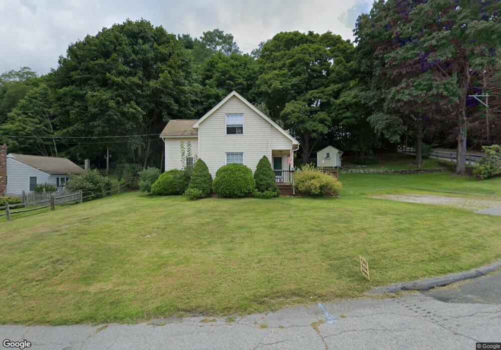
21 Walnut St Ivoryton, CT 06442
Estimated Value: $368,000 - $499,000
2
Beds
2
Baths
1,033
Sq Ft
$413/Sq Ft
Est. Value
About This Home
This home is located at 21 Walnut St, Ivoryton, CT 06442 and is currently estimated at $426,589, approximately $412 per square foot. 21 Walnut St is a home located in Middlesex County with nearby schools including Valley Regional High School.
Ownership History
Date
Name
Owned For
Owner Type
Purchase Details
Closed on
Jun 10, 2003
Sold by
Gates Michael and Davis Scott
Bought by
Carter Kathleen M and Manning William
Current Estimated Value
Purchase Details
Closed on
May 16, 1997
Sold by
Budney Dana W
Bought by
Watson Trudy B
Create a Home Valuation Report for This Property
The Home Valuation Report is an in-depth analysis detailing your home's value as well as a comparison with similar homes in the area
Home Values in the Area
Average Home Value in this Area
Purchase History
| Date | Buyer | Sale Price | Title Company |
|---|---|---|---|
| Carter Kathleen M | $205,000 | -- | |
| Carter Kathleen M | $205,000 | -- | |
| Watson Trudy B | $111,000 | -- | |
| Watson Trudy B | $111,000 | -- |
Source: Public Records
Mortgage History
| Date | Status | Borrower | Loan Amount |
|---|---|---|---|
| Open | Watson Trudy B | $200,650 | |
| Closed | Watson Trudy B | $216,000 |
Source: Public Records
Tax History
| Year | Tax Paid | Tax Assessment Tax Assessment Total Assessment is a certain percentage of the fair market value that is determined by local assessors to be the total taxable value of land and additions on the property. | Land | Improvement |
|---|---|---|---|---|
| 2025 | $3,603 | $193,400 | $58,700 | $134,700 |
| 2024 | $3,491 | $193,400 | $58,700 | $134,700 |
| 2023 | $3,230 | $143,000 | $52,100 | $90,900 |
| 2022 | $3,239 | $143,000 | $52,100 | $90,900 |
| 2021 | $3,207 | $143,000 | $52,100 | $90,900 |
| 2020 | $5,128 | $143,000 | $52,100 | $90,900 |
| 2019 | $3,096 | $143,000 | $52,100 | $90,900 |
| 2018 | $2,969 | $135,900 | $54,900 | $81,000 |
| 2017 | $2,984 | $135,900 | $54,900 | $81,000 |
| 2016 | $2,933 | $135,900 | $54,900 | $81,000 |
| 2015 | $2,865 | $135,900 | $54,900 | $81,000 |
| 2014 | $2,853 | $135,900 | $54,900 | $81,000 |
Source: Public Records
Map
Nearby Homes
- 22 Ebony Ln
- 130 Mares Hill Rd
- 41 Bushy Hill Rd
- 29 Mitchel Terrace
- 1 Verona St
- 23 Lynn Rd
- 151 Bushy Hill Rd
- 120 Warsaw St
- 108 Westbrook Rd
- 1 Lake Louise Dr
- 33 Deep River Rd
- 97 Bushy Hill Rd
- 272 Westbrook Rd
- 3 Donald Rd Extension
- 0 Glen Grove Rd
- 207 Pettipaug Rd
- 25 Union St
- 101 N Main St
- 56 S Main St
- 209 Main St
Your Personal Tour Guide
Ask me questions while you tour the home.