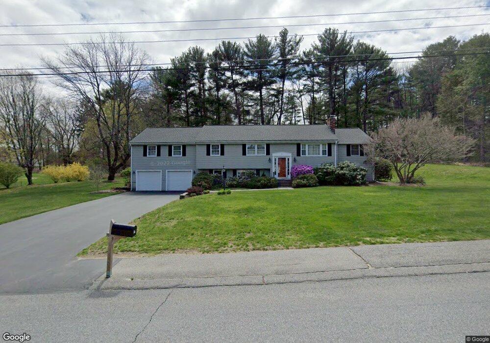
21 Warren Rd Sudbury, MA 01776
Estimated Value: $852,000 - $1,048,000
4
Beds
3
Baths
2,090
Sq Ft
$461/Sq Ft
Est. Value
About This Home
This home is located at 21 Warren Rd, Sudbury, MA 01776 and is currently estimated at $962,579, approximately $460 per square foot. 21 Warren Rd is a home located in Middlesex County with nearby schools including Israel Loring Elementary School, Ephraim Curtis Middle School, and Lincoln-Sudbury Regional High School.
Ownership History
Date
Name
Owned For
Owner Type
Purchase Details
Closed on
Mar 16, 2016
Sold by
Saia Joseph C and Saia Mary A
Bought by
Saia Rt
Current Estimated Value
Purchase Details
Closed on
Aug 26, 1981
Bought by
Saia Rt
Create a Home Valuation Report for This Property
The Home Valuation Report is an in-depth analysis detailing your home's value as well as a comparison with similar homes in the area
Home Values in the Area
Average Home Value in this Area
Purchase History
| Date | Buyer | Sale Price | Title Company |
|---|---|---|---|
| Saia Rt | -- | -- | |
| Saia Rt | -- | -- | |
| Saia Rt | $82,000 | -- |
Source: Public Records
Mortgage History
| Date | Status | Borrower | Loan Amount |
|---|---|---|---|
| Previous Owner | Saia Rt | $200,000 | |
| Previous Owner | Saia Rt | $224,000 | |
| Previous Owner | Saia Rt | $78,000 |
Source: Public Records
Tax History Compared to Growth
Tax History
| Year | Tax Paid | Tax Assessment Tax Assessment Total Assessment is a certain percentage of the fair market value that is determined by local assessors to be the total taxable value of land and additions on the property. | Land | Improvement |
|---|---|---|---|---|
| 2025 | $12,163 | $830,800 | $439,000 | $391,800 |
| 2024 | $11,773 | $805,800 | $426,200 | $379,600 |
| 2023 | $11,648 | $738,600 | $394,600 | $344,000 |
| 2022 | $10,787 | $597,600 | $362,200 | $235,400 |
| 2021 | $10,616 | $563,800 | $362,200 | $201,600 |
| 2020 | $10,402 | $563,800 | $362,200 | $201,600 |
| 2019 | $10,098 | $563,800 | $362,200 | $201,600 |
| 2018 | $9,901 | $552,200 | $386,200 | $166,000 |
| 2017 | $9,273 | $522,700 | $367,400 | $155,300 |
| 2016 | $8,928 | $501,600 | $353,400 | $148,200 |
| 2015 | $8,596 | $488,400 | $339,800 | $148,600 |
| 2014 | $8,586 | $476,200 | $329,800 | $146,400 |
Source: Public Records
Map
Nearby Homes
- 84 Hopestill Brown Rd
- 0 Wagonwheel Rd
- 63 Landham Rd
- 216 Landham Rd
- 14 Eisenhower Rd
- 91 Eaton Rd W
- 19 Nob Hill Dr
- 32 Eaton Rd W
- 27 Sloane Dr
- 30 Edith Rd
- 128 Nobscot Rd
- 1011 Boston Post Rd
- 23 Massasoit Ave
- 30 Nobscot Rd Unit 14
- 36 Concord Rd
- 14 Francine Rd
- 8 Clara Rd
- 53 Davidson Rd
- 40 Gregory Rd
- 41 James St