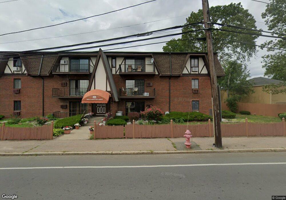
21 West St Unit A2 Randolph, MA 02368
Downtown Randolph NeighborhoodEstimated Value: $294,392 - $330,000
2
Beds
1
Bath
1,040
Sq Ft
$301/Sq Ft
Est. Value
About This Home
This home is located at 21 West St Unit A2, Randolph, MA 02368 and is currently estimated at $312,598, approximately $300 per square foot. 21 West St Unit A2 is a home located in Norfolk County with nearby schools including Randolph High School, Boston Higashi School, and Lighthouse Baptist Christian Academy.
Ownership History
Date
Name
Owned For
Owner Type
Purchase Details
Closed on
Apr 27, 2017
Sold by
Dasse Joseph G
Bought by
Dasse Joseph G and Dasse Jamesley
Current Estimated Value
Purchase Details
Closed on
Jan 5, 2009
Sold by
Keating Nancy P and Keating Richard L
Bought by
Dasse Joseph G
Home Financials for this Owner
Home Financials are based on the most recent Mortgage that was taken out on this home.
Original Mortgage
$80,000
Interest Rate
6.08%
Mortgage Type
Purchase Money Mortgage
Create a Home Valuation Report for This Property
The Home Valuation Report is an in-depth analysis detailing your home's value as well as a comparison with similar homes in the area
Home Values in the Area
Average Home Value in this Area
Purchase History
| Date | Buyer | Sale Price | Title Company |
|---|---|---|---|
| Dasse Joseph G | -- | -- | |
| Dasse Joseph G | $100,000 | -- |
Source: Public Records
Mortgage History
| Date | Status | Borrower | Loan Amount |
|---|---|---|---|
| Previous Owner | Dasse Joseph G | $80,000 |
Source: Public Records
Tax History
| Year | Tax Paid | Tax Assessment Tax Assessment Total Assessment is a certain percentage of the fair market value that is determined by local assessors to be the total taxable value of land and additions on the property. | Land | Improvement |
|---|---|---|---|---|
| 2025 | $2,782 | $239,600 | $0 | $239,600 |
| 2024 | $2,629 | $229,600 | $0 | $229,600 |
| 2023 | $2,469 | $204,400 | $0 | $204,400 |
| 2022 | $2,841 | $208,900 | $0 | $208,900 |
| 2021 | $2,762 | $186,900 | $0 | $186,900 |
| 2020 | $2,682 | $179,900 | $0 | $179,900 |
| 2019 | $2,205 | $147,200 | $0 | $147,200 |
| 2018 | $2,195 | $138,200 | $0 | $138,200 |
| 2017 | $2,079 | $128,500 | $0 | $128,500 |
| 2016 | $1,929 | $110,900 | $0 | $110,900 |
| 2015 | $1,694 | $93,600 | $0 | $93,600 |
Source: Public Records
Map
Nearby Homes
- 43 West St Unit A2
- 54 Jasper Ln
- 153 West St
- 16 Grove Square Unit 16
- 6 Eagle Rd
- 591 N Main St
- 33 Hemlock Terrace
- 159 Bittersweet Ln Unit 107
- 17 Mazzeo Dr
- 54 Highland Glen Dr
- 59 Highland Glen Dr Unit 328
- 20 Simmonds Blvd Unit 20
- 18 Simmonds Blvd Unit 18
- 8 Simmonds Blvd Unit 8
- 22 Simmonds Blvd Unit 22
- 10 Simmonds Blvd Unit 10
- 24 Simmonds Blvd Unit 24
- 6 Simmonds Blvd Unit 6
- 10 Alfred Terrace
- 34 Orchard St
- 21 West St
- 21 West St Unit C4
- 21 West St Unit C3
- 21 West St Unit C2
- 21 West St Unit C1
- 21 West St Unit B3
- 21 West St Unit B2
- 21 West St Unit B1
- 21 West St Unit A1
- 21 West St Unit B4
- 21 West St Unit 2C
- 21 West St Unit A-3,21
- 21 West St Unit 4B
- 31 West St Unit 100
- 31 West St
- 31 West St Unit 203
- 360 N Main St Unit A
- 360 N Main St
- 374 N Main St
- 34 West St
Your Personal Tour Guide
Ask me questions while you tour the home.