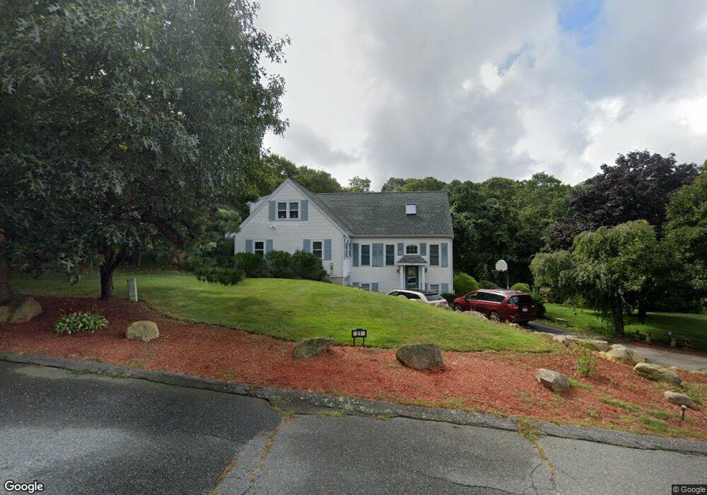
21 Westerly Dr Bourne, MA 2532
Monument Beach NeighborhoodEstimated Value: $738,000 - $819,000
4
Beds
2
Baths
2,544
Sq Ft
$306/Sq Ft
Est. Value
About This Home
This home is located at 21 Westerly Dr, Bourne, MA 2532 and is currently estimated at $778,513, approximately $306 per square foot. 21 Westerly Dr is a home located in Barnstable County with nearby schools including Bourne High School, Cadence Academy Preschool - Bourne, and St Margaret Regional School.
Ownership History
Date
Name
Owned For
Owner Type
Purchase Details
Closed on
Nov 4, 2016
Sold by
Watterson Janice A
Bought by
Curtis Dennis M and Curtis Catherine L
Current Estimated Value
Home Financials for this Owner
Home Financials are based on the most recent Mortgage that was taken out on this home.
Original Mortgage
$340,000
Outstanding Balance
$272,015
Interest Rate
3.48%
Mortgage Type
New Conventional
Estimated Equity
$506,498
Create a Home Valuation Report for This Property
The Home Valuation Report is an in-depth analysis detailing your home's value as well as a comparison with similar homes in the area
Home Values in the Area
Average Home Value in this Area
Purchase History
| Date | Buyer | Sale Price | Title Company |
|---|---|---|---|
| Curtis Dennis M | $390,000 | -- | |
| Curtis Dennis M | $390,000 | -- |
Source: Public Records
Mortgage History
| Date | Status | Borrower | Loan Amount |
|---|---|---|---|
| Open | Curtis Dennis M | $340,000 | |
| Closed | Curtis Dennis M | $340,000 |
Source: Public Records
Tax History
| Year | Tax Paid | Tax Assessment Tax Assessment Total Assessment is a certain percentage of the fair market value that is determined by local assessors to be the total taxable value of land and additions on the property. | Land | Improvement |
|---|---|---|---|---|
| 2025 | $5,208 | $666,800 | $221,600 | $445,200 |
| 2024 | $5,094 | $635,100 | $211,100 | $424,000 |
| 2023 | $4,990 | $566,400 | $186,800 | $379,600 |
| 2022 | $4,707 | $466,500 | $165,300 | $301,200 |
| 2021 | $4,574 | $424,700 | $150,500 | $274,200 |
| 2020 | $4,346 | $404,700 | $149,000 | $255,700 |
| 2019 | $4,130 | $393,000 | $149,000 | $244,000 |
| 2018 | $3,890 | $369,100 | $141,900 | $227,200 |
| 2017 | $3,477 | $337,600 | $133,600 | $204,000 |
| 2016 | $3,382 | $332,900 | $133,600 | $199,300 |
| 2015 | $3,210 | $318,800 | $119,500 | $199,300 |
Source: Public Records
Map
Nearby Homes
- 4 Harbor Hill Dr
- 20 Colony Ave
- 16 Amberwood Ct
- 12 Turnberry Rd Unit 12
- 4 Hollyhock Knoll Ct Unit 4
- 4 Hollyhock Knoll Ct Unit 4
- 203 County Rd
- 5 Sea Knoll Ct
- 13 Laurel Hill Ct
- 5 Zoli Ln
- 566 Shore Rd
- 44 Cotuit Rd
- 10 Sandy Ln
- 60 Sandwich Rd
- 3 1st St
- 709 County Rd
- 7 4th Ave
- 3 4th Ave
- 254 Barlows Landing Rd
- 3 Honora Ln Unit 3
Your Personal Tour Guide
Ask me questions while you tour the home.