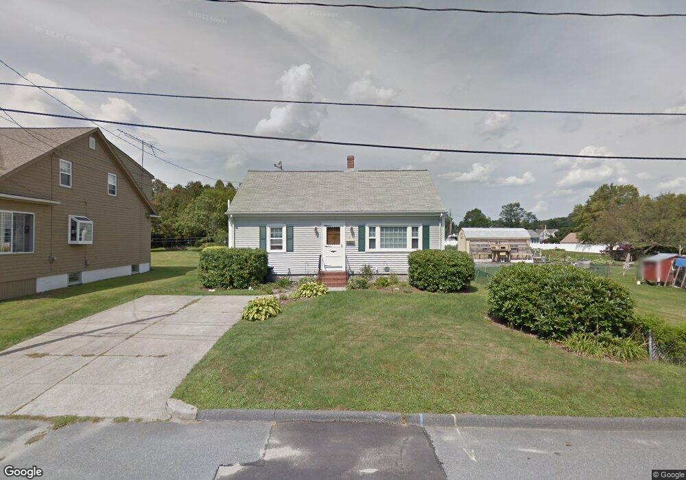
21 Westland St Acushnet, MA 02743
Coury Heights NeighborhoodEstimated Value: $449,000 - $513,000
3
Beds
2
Baths
1,491
Sq Ft
$320/Sq Ft
Est. Value
About This Home
This home is located at 21 Westland St, Acushnet, MA 02743 and is currently estimated at $476,574, approximately $319 per square foot. 21 Westland St is a home located in Bristol County with nearby schools including Acushnet Elementary School, Albert F Ford Middle School, and All Saints Catholic School.
Ownership History
Date
Name
Owned For
Owner Type
Purchase Details
Closed on
Dec 22, 2008
Sold by
Stiles Barbara Jean and Mccoy-Warren Kathleen M
Bought by
Renoir Deborah C
Current Estimated Value
Home Financials for this Owner
Home Financials are based on the most recent Mortgage that was taken out on this home.
Original Mortgage
$213,265
Interest Rate
6.27%
Mortgage Type
Purchase Money Mortgage
Create a Home Valuation Report for This Property
The Home Valuation Report is an in-depth analysis detailing your home's value as well as a comparison with similar homes in the area
Home Values in the Area
Average Home Value in this Area
Purchase History
| Date | Buyer | Sale Price | Title Company |
|---|---|---|---|
| Renoir Deborah C | $209,000 | -- |
Source: Public Records
Mortgage History
| Date | Status | Borrower | Loan Amount |
|---|---|---|---|
| Open | Renoir Deborah C | $196,000 | |
| Closed | Renoir Deborah C | $213,265 |
Source: Public Records
Tax History Compared to Growth
Tax History
| Year | Tax Paid | Tax Assessment Tax Assessment Total Assessment is a certain percentage of the fair market value that is determined by local assessors to be the total taxable value of land and additions on the property. | Land | Improvement |
|---|---|---|---|---|
| 2025 | $38 | $352,300 | $119,600 | $232,700 |
| 2024 | $3,610 | $316,400 | $113,300 | $203,100 |
| 2023 | $3,623 | $301,900 | $102,800 | $199,100 |
| 2022 | $3,586 | $270,200 | $96,500 | $173,700 |
| 2021 | $3,322 | $240,200 | $96,500 | $143,700 |
| 2020 | $3,261 | $233,900 | $90,200 | $143,700 |
| 2019 | $3,098 | $218,500 | $86,000 | $132,500 |
| 2018 | $3,004 | $208,300 | $86,000 | $122,300 |
| 2017 | $2,892 | $200,300 | $86,000 | $114,300 |
| 2016 | $2,913 | $200,500 | $86,000 | $114,500 |
| 2015 | $2,682 | $187,800 | $86,000 | $101,800 |
Source: Public Records
Map
Nearby Homes
- 6 Middlefield Place
- 9 Middlefield Place
- 65 Armsby St
- 187 Tarkiln Hill Rd
- 6 Illinois St
- 957 Glen St
- 0 Church Dutton & Chaffee Unit 73371719
- 4 Tisbury St
- 57 Crompton St
- 263 Hersom St
- 52 Pershing Ave
- 11 Saucier St
- 506 Hawes St
- 27 Jean St
- 1044 Victoria St Unit B-29
- 203 S Main St
- 868 Phillips Rd
- 400 Oliver St
- 25 Pershing Ave
- 398 Brockton St