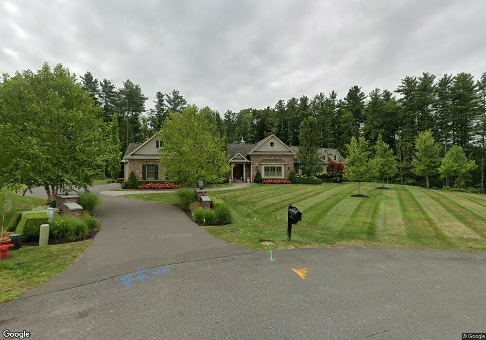
21 Westover Rd Slingerlands, NY 12159
Estimated Value: $736,000 - $1,001,000
3
Beds
3
Baths
3,922
Sq Ft
$222/Sq Ft
Est. Value
About This Home
This home is located at 21 Westover Rd, Slingerlands, NY 12159 and is currently estimated at $872,471, approximately $222 per square foot. 21 Westover Rd is a home located in Albany County with nearby schools including Voorheesville Elementary School, Voorheesville Middle School, and Clayton A Bouton High School.
Ownership History
Date
Name
Owned For
Owner Type
Purchase Details
Closed on
Jul 14, 2015
Sold by
Turney Jacqueline
Bought by
Trombly Francis H and Trombly Deborah L
Current Estimated Value
Purchase Details
Closed on
May 12, 2006
Sold by
Trombly Francis H
Bought by
Tureby William
Purchase Details
Closed on
May 18, 2005
Sold by
Rosenstein Bradley T
Bought by
Trombly Francis H
Purchase Details
Closed on
Jan 17, 2003
Sold by
Marotta Steven and Marotta Lisa
Bought by
Rosenstein Bradley T
Purchase Details
Closed on
May 4, 2001
Sold by
Homeland Dev Corp
Bought by
Marotta Steven and Marotta Lisa
Create a Home Valuation Report for This Property
The Home Valuation Report is an in-depth analysis detailing your home's value as well as a comparison with similar homes in the area
Home Values in the Area
Average Home Value in this Area
Purchase History
| Date | Buyer | Sale Price | Title Company |
|---|---|---|---|
| Trombly Francis H | $250,000 | None Available | |
| Tureby William | $290,000 | John Cahill | |
| Trombly Francis H | $250,000 | Edward Trombly | |
| Rosenstein Bradley T | $200,000 | Eugene M Sneeringer, Jr | |
| Marotta Steven | $175,000 | David Mcdermott |
Source: Public Records
Tax History
| Year | Tax Paid | Tax Assessment Tax Assessment Total Assessment is a certain percentage of the fair market value that is determined by local assessors to be the total taxable value of land and additions on the property. | Land | Improvement |
|---|---|---|---|---|
| 2024 | $19,589 | $650,000 | $83,100 | $566,900 |
| 2023 | $19,123 | $650,000 | $83,100 | $566,900 |
| 2022 | $18,801 | $650,000 | $83,100 | $566,900 |
| 2021 | $18,579 | $650,000 | $83,100 | $566,900 |
| 2020 | $18,444 | $650,000 | $83,100 | $566,900 |
| 2019 | $14,528 | $650,000 | $83,100 | $566,900 |
| 2018 | $18,283 | $650,000 | $83,100 | $566,900 |
| 2017 | $0 | $583,000 | $83,100 | $499,900 |
| 2016 | $5,775 | $207,600 | $207,600 | $0 |
| 2015 | -- | $207,600 | $207,600 | $0 |
| 2014 | -- | $207,600 | $207,600 | $0 |
Source: Public Records
Map
Nearby Homes
- 91 Daniel St
- 38 Capricorn Ln
- 26 Muterfield Ct
- L23 Maple Rd
- L15.4 Youmans Rd
- 1575 New Scotland Rd
- 3 Bradstreet Ct
- 70 Orchard Hill Rd
- 25 Canterbury Ln
- 23 Canterbury Ln
- 10 Canterbury Ln
- 263 Kings Ct
- 212 Deerfield Ct
- 150 Stonington Hill Rd
- 22 Edinburgh Ct
- L23.2 Unionville Feura Bush Rd
- L17 Crow Ridge Rd
- 64 Normanskill Rd
- 268 Waldenmaier Rd
- 40 Voorheesville Ave
Your Personal Tour Guide
Ask me questions while you tour the home.