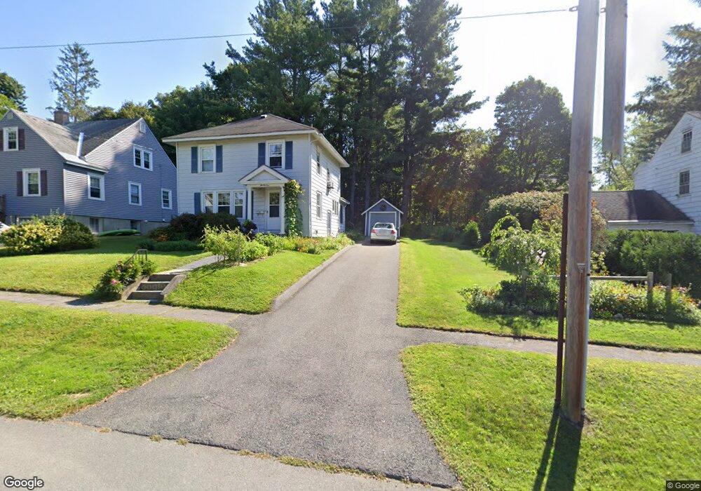
21 Whittier Ave Pittsfield, MA 01201
Estimated Value: $278,006 - $361,000
3
Beds
1
Bath
1,344
Sq Ft
$226/Sq Ft
Est. Value
About This Home
This home is located at 21 Whittier Ave, Pittsfield, MA 01201 and is currently estimated at $304,252, approximately $226 per square foot. 21 Whittier Ave is a home located in Berkshire County with nearby schools including Egremont Elementary School, Theodore Herberg Middle School, and Pittsfield High School.
Ownership History
Date
Name
Owned For
Owner Type
Purchase Details
Closed on
Aug 21, 1997
Sold by
Bossio Robert A and Bossio Karen M
Bought by
Billow John E and Billow Denise A
Current Estimated Value
Home Financials for this Owner
Home Financials are based on the most recent Mortgage that was taken out on this home.
Original Mortgage
$98,550
Interest Rate
7.42%
Mortgage Type
Purchase Money Mortgage
Purchase Details
Closed on
Feb 27, 1991
Sold by
Fulton Matthew S
Bought by
Bossio Robert A
Create a Home Valuation Report for This Property
The Home Valuation Report is an in-depth analysis detailing your home's value as well as a comparison with similar homes in the area
Home Values in the Area
Average Home Value in this Area
Purchase History
| Date | Buyer | Sale Price | Title Company |
|---|---|---|---|
| Billow John E | $109,500 | -- | |
| Billow John E | $109,500 | -- | |
| Bossio Robert A | $116,000 | -- | |
| Bossio Robert A | $116,000 | -- |
Source: Public Records
Mortgage History
| Date | Status | Borrower | Loan Amount |
|---|---|---|---|
| Open | Bossio Robert A | $124,000 | |
| Closed | Bossio Robert A | $25,000 | |
| Closed | Bossio Robert A | $98,550 |
Source: Public Records
Tax History Compared to Growth
Tax History
| Year | Tax Paid | Tax Assessment Tax Assessment Total Assessment is a certain percentage of the fair market value that is determined by local assessors to be the total taxable value of land and additions on the property. | Land | Improvement |
|---|---|---|---|---|
| 2025 | $4,031 | $224,700 | $88,900 | $135,800 |
| 2024 | $3,961 | $214,700 | $88,900 | $125,800 |
| 2023 | $3,549 | $193,700 | $79,000 | $114,700 |
| 2022 | $3,346 | $180,300 | $79,000 | $101,300 |
| 2021 | $2,966 | $154,100 | $79,000 | $75,100 |
| 2020 | $2,988 | $151,600 | $79,000 | $72,600 |
| 2019 | $2,896 | $149,100 | $79,000 | $70,100 |
| 2018 | $2,959 | $147,900 | $79,000 | $68,900 |
| 2017 | $2,854 | $145,400 | $79,000 | $66,400 |
| 2016 | $2,715 | $144,700 | $79,000 | $65,700 |
| 2015 | $2,613 | $144,700 | $79,000 | $65,700 |
Source: Public Records
Map
Nearby Homes
- 11 Sampson Pkwy
- 40 Sampson Pkwy
- 39 Lexington Pkwy
- 31 Lexington Pkwy
- 16 Revere Pkwy
- 20 Marshall Ave
- 206 Dawes Ave
- 106 Sampson Pkwy
- 66 Holmes Rd
- 49 Revilla Terrace
- 99 Cambridge Ave
- 75 Livingston Ave
- 55 Revilla Terrace
- 381 Williams St
- 51 Foote Ave
- 81 Northumberland Rd
- 38 Northumberland Rd
- 25 Putnam Ave
- 168 Elm St
- 36 Chickering St
- 17 Whittier Ave
- 31 Whittier Ave
- 210 Holmes Rd
- 204 Holmes Rd
- 11 Whittier Ave
- 37 Whittier Ave
- 216 Holmes Rd
- 200 Holmes Rd
- 22 Whittier Ave
- 26 Whittier Ave
- 14 Whittier Ave
- 222 Holmes Rd
- 41 Whittier Ave
- 196 Holmes Rd
- 36 Whittier Ave
- 10 Whittier Ave
- 3 Whittier Ave
- 47 Whittier Ave
- 192 Holmes Rd
- 230 Holmes Rd