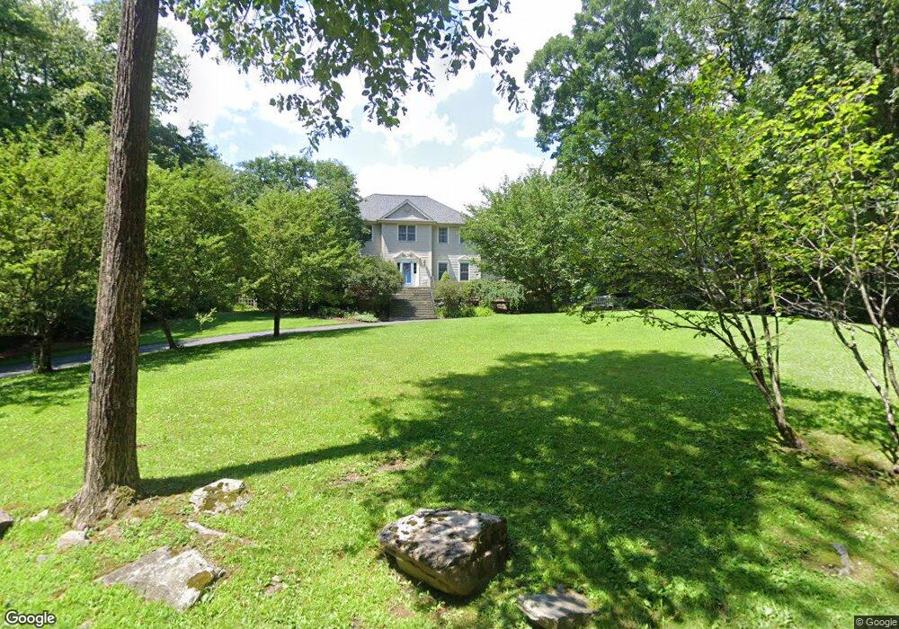
21 Whortleberry Rd Redding, CT 06896
Estimated Value: $1,106,425 - $1,420,000
4
Beds
3
Baths
3,347
Sq Ft
$376/Sq Ft
Est. Value
About This Home
This home is located at 21 Whortleberry Rd, Redding, CT 06896 and is currently estimated at $1,257,606, approximately $375 per square foot. 21 Whortleberry Rd is a home located in Fairfield County with nearby schools including Redding Elementary School, John Read Middle School, and Joel Barlow High School.
Ownership History
Date
Name
Owned For
Owner Type
Purchase Details
Closed on
May 31, 2001
Sold by
Pilson David C and Pilson Gloria J
Bought by
Esocoff Andrew S and Esocoff Katrina M
Current Estimated Value
Home Financials for this Owner
Home Financials are based on the most recent Mortgage that was taken out on this home.
Original Mortgage
$480,000
Interest Rate
7.09%
Purchase Details
Closed on
Jun 11, 1996
Sold by
Pirone Alfred D and Pirone Mary Ann
Bought by
Pilson David C and Pilson Gloria J
Home Financials for this Owner
Home Financials are based on the most recent Mortgage that was taken out on this home.
Original Mortgage
$72,000
Interest Rate
7.89%
Mortgage Type
Unknown
Create a Home Valuation Report for This Property
The Home Valuation Report is an in-depth analysis detailing your home's value as well as a comparison with similar homes in the area
Home Values in the Area
Average Home Value in this Area
Purchase History
| Date | Buyer | Sale Price | Title Company |
|---|---|---|---|
| Esocoff Andrew S | $705,000 | -- | |
| Pilson David C | $80,000 | -- |
Source: Public Records
Mortgage History
| Date | Status | Borrower | Loan Amount |
|---|---|---|---|
| Closed | Pilson David C | $480,000 | |
| Previous Owner | Pilson David C | $230,000 | |
| Previous Owner | Pilson David C | $200,000 | |
| Previous Owner | Pilson David C | $72,000 |
Source: Public Records
Tax History Compared to Growth
Tax History
| Year | Tax Paid | Tax Assessment Tax Assessment Total Assessment is a certain percentage of the fair market value that is determined by local assessors to be the total taxable value of land and additions on the property. | Land | Improvement |
|---|---|---|---|---|
| 2025 | $17,015 | $576,000 | $154,500 | $421,500 |
| 2024 | $16,543 | $576,000 | $154,500 | $421,500 |
| 2023 | $15,949 | $576,000 | $154,500 | $421,500 |
| 2022 | $15,273 | $458,100 | $159,200 | $298,900 |
| 2021 | $15,044 | $458,100 | $159,200 | $298,900 |
| 2020 | $15,044 | $458,100 | $159,200 | $298,900 |
| 2019 | $15,044 | $458,100 | $159,200 | $298,900 |
| 2018 | $14,531 | $458,100 | $159,200 | $298,900 |
| 2017 | $13,382 | $451,800 | $159,500 | $292,300 |
| 2016 | $13,211 | $451,800 | $159,500 | $292,300 |
| 2015 | $13,062 | $451,800 | $159,500 | $292,300 |
| 2014 | $13,062 | $451,800 | $159,500 | $292,300 |
Source: Public Records
Map
Nearby Homes
- 24 Costa Ln
- 145 Limekiln Rd
- 9 Chuck Wagon Ln
- 90 Old Stagecoach Rd
- 7 Guardhouse Dr
- 61 Marchant Rd
- 2 Longwood Dr
- 229 Umpawaug Rd
- 194 Lonetown Rd
- 193 Chestnut Ridge Rd
- 15 Bartram Dr
- 155 Long Ridge Rd
- 173 Chestnut Ridge Rd
- 134 Nashville Rd
- 151 Long Ridge Rd
- 35 Diamond Hill Rd
- 45 Great Pasture Rd
- 49 Starr Ln
- 12 Canaan Dr
- 81 Picketts Ridge Rd
- 34 Whortleberry Rd
- 9 Whortleberry Rd
- 23 Whortleberry Rd
- 7 Whortleberry Rd
- 25 Whortleberry Rd
- 14 Whortleberry Rd
- 5 Whortleberry Rd
- 35 Whortleberry Rd
- 6 Whortleberry Rd
- 36 Whortleberry Rd
- 36 Whortleberry Rd
- 36 Whortleberry Rd
- 37 Whortleberry Rd
- 10 Rob Rider Rd
- 39 Whortleberry Rd
- 180 Gallows Hill Rd
- 8 Rob Rider Rd
- 60 Whortleberry Rd
- 14 Rob Rider Rd
- 20 Costa Ln