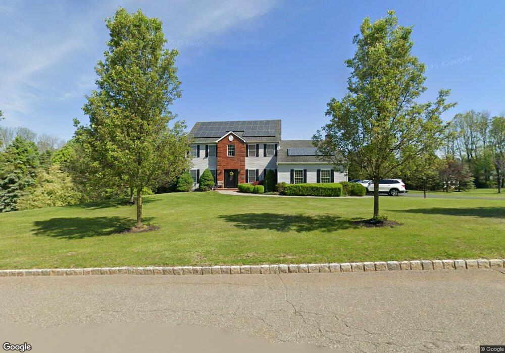
21 Wisteria Rd Lafayette, NJ 07848
Andover Township NeighborhoodEstimated Value: $707,000 - $752,000
--
Bed
--
Bath
2,584
Sq Ft
$283/Sq Ft
Est. Value
About This Home
This home is located at 21 Wisteria Rd, Lafayette, NJ 07848 and is currently estimated at $731,488, approximately $283 per square foot. 21 Wisteria Rd is a home located in Sussex County with nearby schools including Florence M. Burd School, Long Pond School, and Reverand George A. Brown School.
Ownership History
Date
Name
Owned For
Owner Type
Purchase Details
Closed on
Jun 18, 1999
Sold by
Ciminera Vincent and Ciminera Michele
Bought by
Hanifan Michael J and Hanifan Esther G
Current Estimated Value
Home Financials for this Owner
Home Financials are based on the most recent Mortgage that was taken out on this home.
Original Mortgage
$299,700
Outstanding Balance
$79,301
Interest Rate
7.09%
Estimated Equity
$652,187
Purchase Details
Closed on
May 22, 1998
Sold by
Joseph & Sons Construction Llc
Bought by
Ciminera Vincent M and Ciminera Michele
Home Financials for this Owner
Home Financials are based on the most recent Mortgage that was taken out on this home.
Original Mortgage
$297,500
Interest Rate
7.05%
Create a Home Valuation Report for This Property
The Home Valuation Report is an in-depth analysis detailing your home's value as well as a comparison with similar homes in the area
Home Values in the Area
Average Home Value in this Area
Purchase History
| Date | Buyer | Sale Price | Title Company |
|---|---|---|---|
| Hanifan Michael J | $333,000 | Chicago Title Insurance Co | |
| Ciminera Vincent M | $313,200 | First American Title Ins Co |
Source: Public Records
Mortgage History
| Date | Status | Borrower | Loan Amount |
|---|---|---|---|
| Open | Hanifan Michael J | $299,700 | |
| Previous Owner | Ciminera Vincent M | $297,500 |
Source: Public Records
Tax History Compared to Growth
Tax History
| Year | Tax Paid | Tax Assessment Tax Assessment Total Assessment is a certain percentage of the fair market value that is determined by local assessors to be the total taxable value of land and additions on the property. | Land | Improvement |
|---|---|---|---|---|
| 2025 | $14,585 | $346,200 | $99,000 | $247,200 |
| 2024 | $14,059 | $346,200 | $99,000 | $247,200 |
| 2023 | $14,059 | $346,200 | $99,000 | $247,200 |
| 2022 | $13,474 | $346,200 | $99,000 | $247,200 |
| 2021 | $13,280 | $346,200 | $99,000 | $247,200 |
| 2020 | $12,937 | $346,200 | $99,000 | $247,200 |
| 2019 | $12,636 | $346,200 | $99,000 | $247,200 |
| 2018 | $12,439 | $346,200 | $99,000 | $247,200 |
| 2017 | $12,172 | $346,200 | $99,000 | $247,200 |
| 2016 | $11,781 | $346,200 | $99,000 | $247,200 |
| 2015 | $13,789 | $387,100 | $99,000 | $288,100 |
| 2014 | $13,490 | $387,100 | $99,000 | $288,100 |
Source: Public Records
Map
Nearby Homes
- 994 Limecrest Rd
- 11 Cheyenne Rd Unit 11
- 293 Cheyenne Rd Unit 293
- 14 Kimberly Ct
- 323 Cheyenne Rd Unit 323
- 131 McPeek Rd Unit 131
- 68 Fox Hollow Rd
- 393 Mohegan Cir
- 63 Mulford Rd
- 133 Hillside Dr
- 21 Starrett Ct
- 6 Shawnee Trail
- 21 Seneca Trail
- 108 Hillside Dr
- 35 Summit Trail
- 160 Newton Sparta Rd
- 172 Alpine Trail
- 23 S Shore Trail
- 9 Golfview Terrace
- 17 Ledgewood Trl Club Lot
- 19 Wisteria Rd
- 23 Wisteria Rd
- 22 Wisteria Rd
- 20 Wisteria Rd
- 18 Wisteria Rd
- 24 Wisteria Rd
- 25 Wisteria Rd
- 26 Wisteria Rd
- 1 Michael Ct
- 28 Wisteria Rd
- 30 Wisteria Rd
- 15 Wisteria Rd
- 27 Wisteria Rd
- 3 Michael Ct
- 2 Michael Ct
- 14 Wisteria Rd
- 27 Richmond Hill Dr
- 11 Wisteria Rd
- 5 Michael Ct
- 23 Richmond Hill Dr