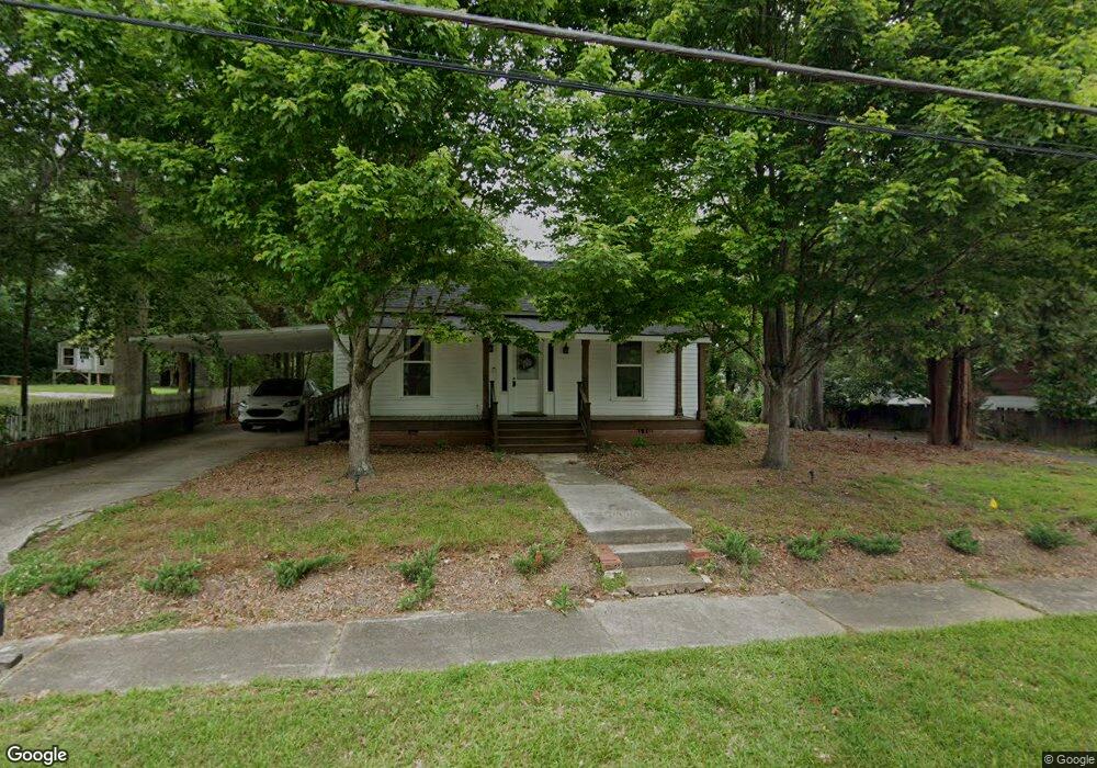
210 Adamson Ave Carrollton, GA 30117
Estimated Value: $334,000 - $415,000
2
Beds
2
Baths
1,396
Sq Ft
$272/Sq Ft
Est. Value
About This Home
This home is located at 210 Adamson Ave, Carrollton, GA 30117 and is currently estimated at $379,031, approximately $271 per square foot. 210 Adamson Ave is a home located in Carroll County with nearby schools including Carrollton Elementary School, Carrollton Upper Elementary School, and Carrollton Middle School.
Ownership History
Date
Name
Owned For
Owner Type
Purchase Details
Closed on
Jun 30, 2025
Sold by
Haney Michael Kyle
Bought by
Rooks Rachel Clarice
Current Estimated Value
Home Financials for this Owner
Home Financials are based on the most recent Mortgage that was taken out on this home.
Original Mortgage
$330,000
Outstanding Balance
$329,724
Interest Rate
6.89%
Mortgage Type
New Conventional
Estimated Equity
$49,307
Purchase Details
Closed on
Jan 26, 2024
Sold by
Haney Richard Michael
Bought by
Haney Michael Kyle
Home Financials for this Owner
Home Financials are based on the most recent Mortgage that was taken out on this home.
Original Mortgage
$330,000
Interest Rate
6.61%
Mortgage Type
New Conventional
Purchase Details
Closed on
Jun 17, 2005
Sold by
Springer Slyvia E
Bought by
Haney Development Llc
Purchase Details
Closed on
May 8, 1992
Bought by
Springer
Create a Home Valuation Report for This Property
The Home Valuation Report is an in-depth analysis detailing your home's value as well as a comparison with similar homes in the area
Home Values in the Area
Average Home Value in this Area
Purchase History
| Date | Buyer | Sale Price | Title Company |
|---|---|---|---|
| Rooks Rachel Clarice | $412,500 | -- | |
| Haney Michael Kyle | $412,500 | -- | |
| Haney Richard Michael | -- | -- | |
| Haney Development Llc | $93,000 | -- | |
| Springer | -- | -- |
Source: Public Records
Mortgage History
| Date | Status | Borrower | Loan Amount |
|---|---|---|---|
| Open | Rooks Rachel Clarice | $330,000 | |
| Previous Owner | Haney Richard Michael | $330,000 |
Source: Public Records
Tax History Compared to Growth
Tax History
| Year | Tax Paid | Tax Assessment Tax Assessment Total Assessment is a certain percentage of the fair market value that is determined by local assessors to be the total taxable value of land and additions on the property. | Land | Improvement |
|---|---|---|---|---|
| 2024 | $3,100 | $113,450 | $16,782 | $96,668 |
| 2023 | $3,100 | $59,989 | $17,253 | $42,736 |
| 2022 | $1,336 | $45,762 | $11,502 | $34,260 |
| 2021 | $1,111 | $38,053 | $8,520 | $29,533 |
| 2020 | $1,022 | $34,983 | $8,520 | $26,463 |
| 2019 | $964 | $32,682 | $8,520 | $24,162 |
| 2018 | $913 | $30,498 | $8,520 | $21,978 |
| 2017 | $918 | $30,498 | $8,520 | $21,978 |
| 2016 | $923 | $30,498 | $8,520 | $21,978 |
| 2015 | $670 | $21,686 | $4,000 | $17,687 |
| 2014 | $801 | $25,834 | $4,000 | $21,834 |
Source: Public Records
Map
Nearby Homes
- 406 Harmon Ave
- 114 Bennett Cir
- 122 Mandeville Ave
- 105 Mara St
- 322 Cedar St
- 150 Adamson Dr
- 120 Stewart St
- 423 Clifton Terrace
- 317 Bledsoe St
- 509 Adamson Ave
- 521 Adamson Ave
- 201 Stewart St
- 119 Oxford Square
- 112 Lane Dr
- 112 Lane Dr Unit LOT 68
- 202 Laney Dr
- 27 South St
- 210 Lane Dr Unit LOT 61
- 210 Lane Dr
- 212 Lane Dr Unit LOT 60
- 204 Adamson Ave
- 209 Adamson Ave
- 205 Adamson Ave
- 215 Adamson Ave
- 142 Adamson Ave
- 143 Adamson Ave
- 505 Austin Ave
- 138 Adamson Ave
- 408 Austin Ave
- 135 Adamson Ave
- 134 Adamson Ave
- 134 Adamson Ave
- 131 Adamson Ave
- 130 Adamson Ave
- 406 Austin Ave
- 139 Adamson Ave
- 127 Adamson Ave
- 126 Adamson Ave
- 402 Austin Ave
- 435 West Ave